
Potential hazards from airfall ash
Long Valley-Mono Lake Volcanic Field Area, United States, 1982
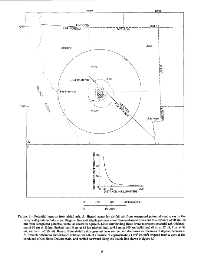
Figure 3 in: Miller, C.D., Mullineaux, D.R., Crandell, D.R. & Bailey, R.A. (1982). Potential hazards from future volcanic eruptions in the Long Valley-Mono Lake area, east-central California and southwest Nevada; a preliminary assessment. U.S. Geological Survey, Circular 877, 10 p. https://doi.org/10.3133/cir877
This map was produced by an official agency, but is NOT the most recent, most complete, or main operational map.
For the current operational hazard map, please consult the proper institutional authorities.
Click on image for full-size map. If link seems broken, try the archived version.
Miller, C.D., Mullineaux, D.R., Crandell, D.R. & Bailey, R.A. (1982). Potential hazards from future volcanic eruptions in the Long Valley-Mono Lake area, east-central California and southwest Nevada; a preliminary assessment. U.S. Geological Survey, Circular 877, 10 p. https://doi.org/10.3133/cir877Map Set
https://doi.org/10.3133/cir877
Other Maps In Set: