
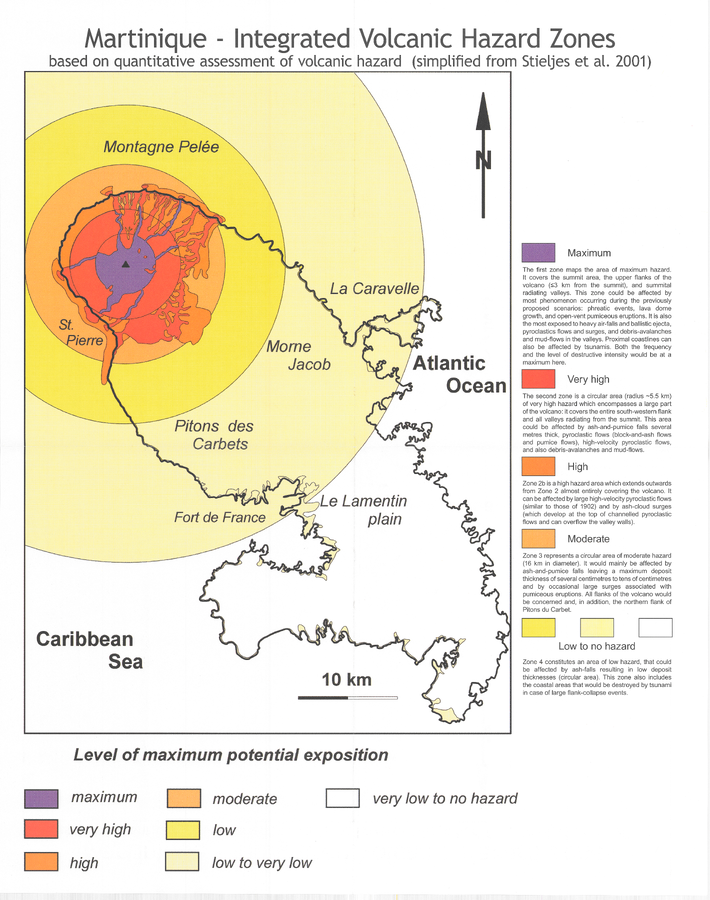
Martinique - Integrated Volcanic Hazard Zones based on quantitative assessment of volcanic hazard (simplified from Stieltjes et al. 2001)
Pelée, Martinique [France], 2005
Pocket insert in: Boudon, G., Le Friant, A., Villemant, B., & Viode, J.-P. (2005). Martinique. In: Lindsay, J.M., Shepherd, J.B., Robertson, R.E.A., & Ali, S. (Eds) Volcanic hazard atlas of the Lesser Antilles. Seismic Research Unit, The University of the West Indies, Trinidad and Tobago, W.I., p. 128-146. (Simplified from: Stieltjes et al. 2001)
This map was produced by an official agency, but is NOT the most recent, most complete, or main operational map.
For the current operational hazard map, please consult the proper institutional authorities.
Map Set
Boudon, G., Le Friant, A., Villemant, B., & Viode, J.-P. (2005). Martinique. In: Lindsay, J.M., Shepherd, J.B., Robertson, R.E.A., & Ali, S. (Eds) Volcanic hazard atlas of the Lesser Antilles. Seismic Research Unit, The University of the West Indies, Trinidad and Tobago, W.I., p. 128-146.
https://uwiseismic.com/wp-content/uploads/2021/10/Martinique.pdf
Other Maps In Set: