
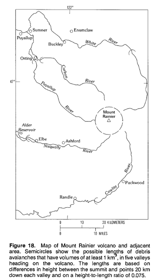
Map of Mount Rainier volcano and adjacent area.
Rainier, United States, 1989
Figure 18 in: Crandell, D.R. (1989). Gigantic debris avalanche of Pleistocene age from ancestral Mount Shasta Volcano, California, and debris-avalanche hazard zonation. U.S. Geological Survey, Bulletin 1861, 32 p. https://doi.org/10.3133/b1861
This map was produced by an official agency, but is NOT the most recent, most complete, or main operational map.
For the current operational hazard map, please consult the proper institutional authorities.
Click on image for full-size map. If link seems broken, try the archived version.
Crandell, D.R. (1989). Gigantic debris avalanche of Pleistocene age from ancestral Mount Shasta Volcano, California, and debris-avalanche hazard zonation. U.S. Geological Survey, Bulletin 1861, 32 p. https://doi.org/10.3133/b1861Map Set
https://doi.org/10.3133/b1861
Other Maps In Set: