
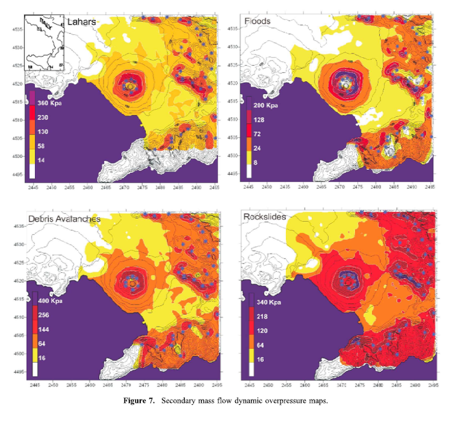
Lahars, Floods, Debris Avalanches, Rockslides
Vesuvius, Italy, 2010
Figure 7 in: Mastrolorenzo, G., & Pappalardo, L. (2010). Hazard assessment of explosive volcanism at Somma‐Vesuvius. Journal of Geophysical Research: Solid Earth, 115(B12). https://doi.org/10.1029/2009JB006871
This hazard map is the result of scientific research and was published in academic literature.
It is presented here to serve as an example of the map type or the map-making methodology. It is NOT the official, operational map. For the current operational hazard map, please consult the proper institutional authorities.
Click on image for full-size map.
Map Set
Mastrolorenzo, G., & Pappalardo, L. (2010). Hazard assessment of explosive volcanism at Somma‐Vesuvius. Journal of Geophysical Research: Solid Earth, 115(B12). https://doi.org/10.1029/2009JB006871
https://doi.org/10.1029/2009JB006871
Other Maps In Set:
- Volcanic explosivity index (VEI) 2 magmatic and phreatomagmatic fallout conditional probability of minimum tephra load leading to roof collapse (200 kg/m2). VEI 3 magmatic and phreatomagmatic fallout conditional probability of minimum load of roof collapse (200 kg/m2). VEI 3 concentrated PDC conditional probability and dynamic overpressure (Pa).
- VEI 4 Magmatic fallout scenario, VEI 4 phreatomagmatic fallout scenario, VEI 4 concentrated PDC scenario, VEI 4 dilute PDC scenario
- VEI 5 Magmatic fallout scenario, VEI 5 phreatomagmatic fallout scenario, VEI 5 concentrated PDC scenario, VEI 5 dilute PDC scenario