
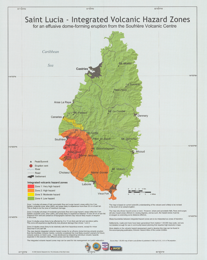
Saint Lucia - Integrated Volcanic Hazard Zones for an effusive dome-forming eruption from the Soufrière Volcanic Centre
Soufrière Volcanic Center (Qualibou), Saint Lucia, 2005
Pocket Insert in: Lindsay, J.M. (2005). Saint Lucia. In: Lindsay, J.M., Shepherd, J.B., Robertson, R.E.A., & Ali, S. (Eds) Volcanic hazard atlas of the Lesser Antilles. Seismic Research Unit, The University of the West Indies, Trinidad and Tobago, W.I., p. 219-239.
This map was produced by an official agency, but is NOT the most recent, most complete, or main operational map.
For the current operational hazard map, please consult the proper institutional authorities.
Map Set
Lindsay, J.M. (2005). Saint Lucia. In: Lindsay, J.M., Shepherd, J.B., Robertson, R.E.A., & Ali, S. (Eds) Volcanic hazard atlas of the Lesser Antilles. Seismic Research Unit, The University of the West Indies, Trinidad and Tobago, W.I., p. 219-239.
https://uwiseismic.com/wp-content/uploads/2021/10/StLucia.pdf
Other Maps In Set:
- Volcanic hazard map for Scenario 3: Dome-forming eruption from within the Soufrière Volcanic Centre
- Volcanic hazard map for Scenario 4: Explosive Plinian eruption from within the Soufrière Volcanic Centre
- Integrated volcanic hazard zones for Scenario 3: Dome-forming eruption from within the Soufrière Volcanic Centre
- Integrated volcanic hazard zones for Scenario 4: Explosive Plinian eruption from within the Soufrière Volcanic Centre