
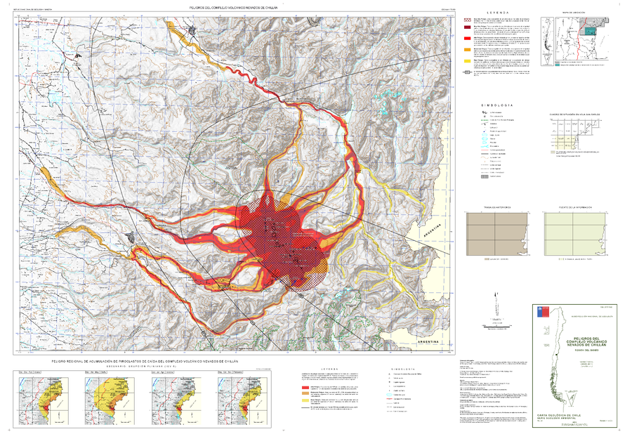
Peligros del Complejo Volcánico Nevados de Chillán
Hazards of the Nevados de Chillán Volcanic Complex
Nevados de Chillán, Chile, 2016
Orozco, G., Jara, G., & Bertin, D. (2016). Peligros del Complejo Volcánico Nevados de Chillán, Región del Biobío. Servicio Nacional de Geología y Minería (SERNAGEOMIN), Carta Geológica de Chile, Serie Geología Ambiental 28: 34p., 1 mapa escala 1:75.000. Santiago.
This map was produced by an official agency, but may not be the most recent, most complete, or main operational map.
For the current operational hazard map, please consult the proper institutional authorities.
Click on image for full-size map. If link seems broken, try the archived version.