
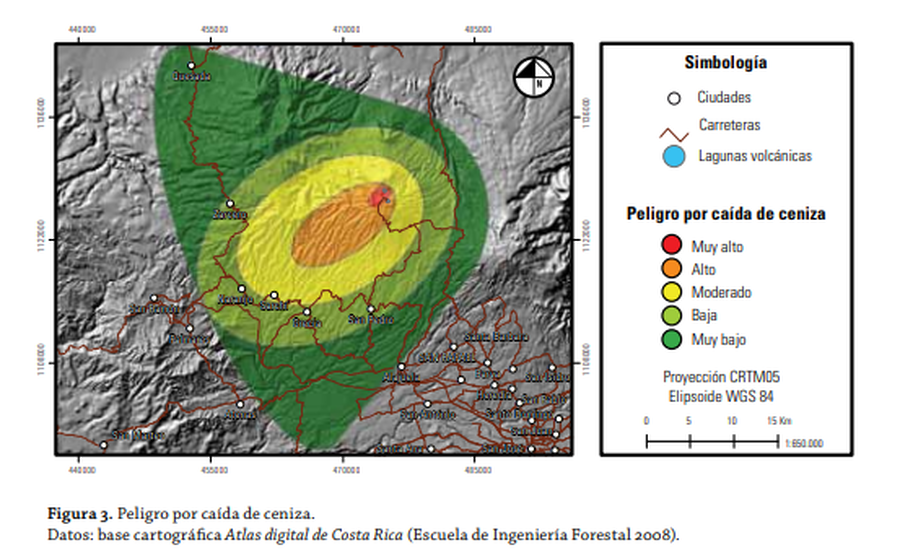
Peligro por Caída de Ceniza
Hazard from ashfall
Poás, Costa Rica, 2015
Figure 3 in: Barrantes, G. & Malavassi, E. (2015). Mapa de peligros del volcán Poás. Cuadernos de Geografica: Revista Colombiana de Geographica 24 (2), p. 157-172. https://doi.org/10.15446/rcdg.v24n2.50219
This hazard map is the result of scientific research and was published in academic literature.
It is presented here to serve as an example of the map type or the map-making methodology. It is NOT the official, operational map. For the current operational hazard map, please consult the proper institutional authorities.
Click on image for full-size map. If link seems broken, try the archived version.
Barrantes, G. & Malavassi, E. (2015). Mapa de peligros del volcán Poás. Cuadernos de Geografica: Revista Colombiana de Geographica 24 (2), p. 157-172. https://doi.org/10.15446/rcdg.v24n2.50219 Map Set
https://doi.org/10.15446/rcdg.v24n2.50219
Other Maps In Set: