
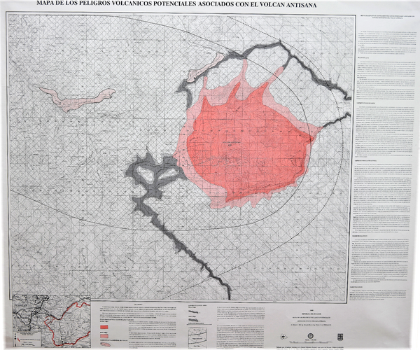
Mapa de los Peligros Volcanicos Potenciales Asociados con el Volcan Antisana
Map of Potential Volcanic Hazards Associated with the Antisana Volcano
Antisana, Ecuador, 1989
Hall, M.L., Beate, B., & von Hillebrandt, C.G. (1989). Mapa de los Peligros Volcanicos Potenciales Asociados con el Volcan Antisana. Instituto Geofisico de la Escuela Politecnica Nacional (IG-EPN), mapa escala 1:50.000. Quito.
This map was produced by an official agency, but may not be the most recent, most complete, or main operational map.
For the current operational hazard map, please consult the proper institutional authorities.
Click on thumbnail for full-size map. We do not have copyright permission to display the full-size image. If you are the copyright holder and wish to provide copyright, please contact us at admin@volcanichazardmaps.org. If link seems broken, try the archived version.