
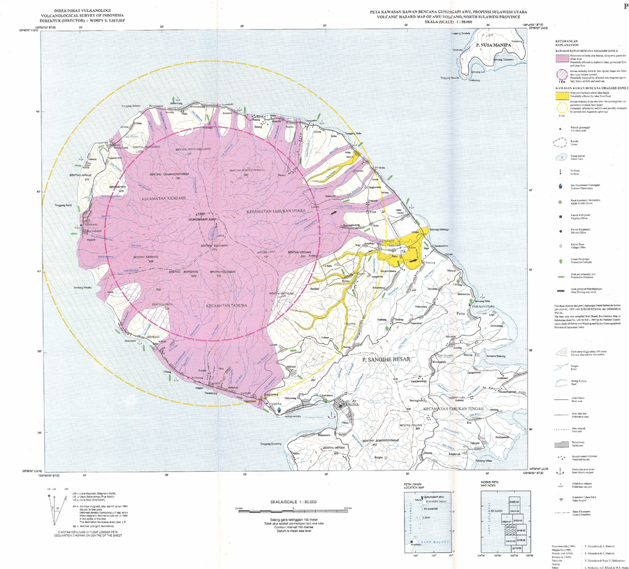
Volcanic Hazard Map of Awu Volcano, North Sulawesi Province
Awu, Indonesia, 1996
Dirasutisna, S., Martono, A., Hadisantono, R.D., Pardyanto, L., Effendi, A.C., & Modjo, W.S. (1996). Volcanic Hazard Map of Awu Volcano, North Sulawesi Province. Volcanological Survey of Indonesia (VSI).
This map was produced by an official agency, but is NOT the most recent, most complete, or main operational map.
For the current operational hazard map, please consult the proper institutional authorities.
Map Data
Map ID 877 Hazard Process(es) Ballistics; Floods or jokulhaups; Lahars; PDCs; Tephra fall Hazard Zone Presentation Grouped by process (e.g. flowage/fall hazards) on a main map panel Temporal Scale Background, or long-term, map Spatial Scale Volcano and surrounding area Publication Format Map sheet or poster Zonation Method(s) Geologic history Zonation Model(s) Scenario(s) Considered No scenarios were discernable from the map Hazard Zone Label(s) Qualitative relative probability (e.g. high-medium-low) Probability Definition(s) Qualitative relative probability (e.g. high-medium-low) Purpose Multiple: intended for multiple purposes including general hazard awareness, planning, and crisis management Audience Multiple audiences (usually the public, civil authorities, and land-use planners) Language(s) Bahasa Indonesia; English Basemap(s) Contour lines Basemap overlay(s) Street map Diemsionality Planimetric (2D or map) view Color Scheme Red to Yellow Volcanic Alert Level System https://global-valid.org/val-indonesia-14/