
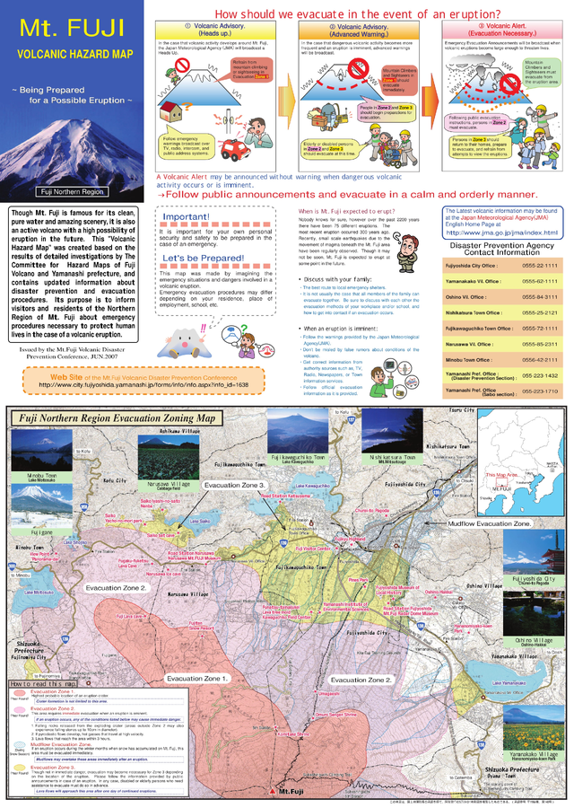
Mt. Fuji Volcanic Hazard Map: Being Prepared for a Possible Eruption
Fujisan, Japan, 2007
Mt. Fuji Volcanic Disaster Prevention Conference. (2007). Mt. Fuji Volcanic Hazard Map: Being Prepared for a Possible Eruption.
This map was produced by an official agency, but may not be the most recent, most complete, or main operational map.
For the current operational hazard map, please consult the proper institutional authorities.
Click on image for full-size map. If link seems broken, try the archived version.