
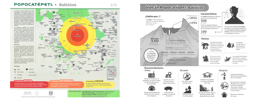
Popocatépetl - Balísticos
Popocatépetl - Ballistics
Popocatépetl, Mexico, 2016
Map 2 in: Instituto de Geofísica Universidad Nacional Autónoma de México (IG-UNAM), Centro Nacional de Prevención de Desastres (CENAPRED), Secretaría de Gobernación (SEGOB). (2016). Popocatépetl - Balísticos. Gobierno de México. (Simplified from: Martin Del Pozzo et al. 2016)
This map was produced by an official agency, but may not be the most recent, most complete, or main operational map.
For the current operational hazard map, please consult the proper institutional authorities.
Click on image for full-size map. If link seems broken, try the archived version.
Map Set