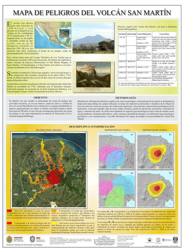
Mapa de Peligros del Volcán San Martín
San Martín Volcano Hazard Map
San Martín, Mexico, 2018
Sieron, K., Rodríguez Elizarraráz, S., Córdoba Montiel, F., Alarcón Ferreira, A.M., & Mora González, I. (2018). Mapa de Peligros del Volcán San Martín. Centro de Ciencias de la Tierra, UV & Instituto de Geofísica, UNAM
This map was produced by an official agency, but may not be the most recent, most complete, or main operational map.
For the current operational hazard map, please consult the proper institutional authorities.