← Back to Search Results

Volcán Concepción Mapa de Amenaza Volcánica I

Concepción Volcano Volcanic Hazard Map I

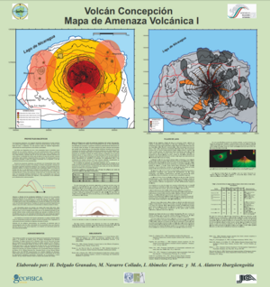
Concepción, Nicaragua, 2002

Delgado Granados, H., Navarro Collado, M., Abimelee Farraz, I., & Alatorre Ibarguesngoitia, M.A. (2002). Volcán Concepción Mapa de Amenaza Volcánica I. Instituto Nicaragüense de Estudios Territoriales (INETER) & Universidad Nacional Autónoma de México (UNAM).


This map was produced by an official agency, but may not be the most recent, most complete, or main operational map. For the current operational hazard map, please consult the proper institutional authorities.


Click on thumbnail for full-size map. We do not have copyright permission to display the full-size image. If you are the copyright holder and wish to provide copyright, please contact us at admin@volcanichazardmaps.org. If link seems broken, try the archived version.

Map Set

Delgado Grenados, H. & Navarro Collado, M. (2002). Mapa de Amenaza Volcánica Volcán Concepción. Instituto Nicaragüense de Estudios Territoriales (INETER) & Universidad Nacional Autónoma de México (UNAM).
https://webserver2.ineter.gob.ni/geofisica/vol/concepcion/mapas_amenaza/Libro%20del%20mapa.pdf

Other Maps In Set:

Map Data

Map ID987
Hazard Process(es)Ballistics; Fire (text only); Lava flows
Hazard Zone PresentationHazard process-focused: Most hazard processes are separated by hazard process type on a main map panel
Temporal ScaleBackground, or long-term, map
Spatial ScaleVolcano and surrounding area
Publication FormatMap sheet or poster
Zonation Method(s)Scenario modeling
Zonation Model(s)FLOW2D or FLOW3D (Sheridan & Macías 1992; Kover 1995); Unnamed ballistic model [Alatorre-Ibargüengoitia & Delgado-Granados (2006)] (Alatorre-Ibargüengoitia & Delgado-Granados 2006)
Scenario(s) ConsideredSize, VEI, or intensity; Source location or direction; Specific past eruption
Hazard Zone Label(s)Qualitative relative probability (e.g. high-medium-low)
Probability Definition(s)Qualitative relative probability (e.g. high-medium-low)
PurposeMultiple: intended for multiple purposes including general hazard awareness, planning, and crisis management
AudienceMultiple audiences (usually the public, civil authorities, and land-use planners)
Language(s)Spanish
Basemap(s)Hillshade
Basemap overlay(s)Contour lines; Simple or sketch map; Street map; Street map
DiemsionalityPlanimetric (2D or map) view
Color SchemeRed to Yellow
Go to Global Volcanism Program page for Concepción →