
Advanced Search for Maps
Showing 1-1 of 1
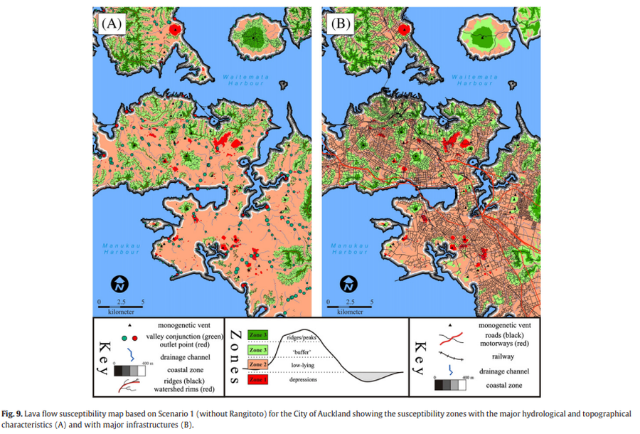
Figure in a journal article
Lava flow susceptibility map based on Scenario 1 (without Rangitoto) for the City of Auckland showing the susceptibility zones with the major hydrological and topographical characteristics and with major infrastructures
Figure 9 in: Kereszturi, G., Procter, J., Cronin, S. J., Németh, K., Bebbington, M., & Lindsay, J. (2012). LiDAR-based quantification of lava flow susceptibility in the City of Auckland (New Zealand). Remote Sensing of Environment, 125, 198-213. https://doi.org/10.1016/j.rse.2012.07.015