
Advanced Search for Maps
Showing 1-3 of 3
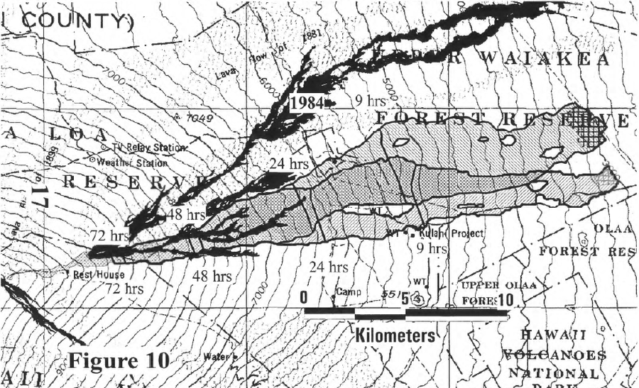
Official, Figure in hazard assessment
Map of the lavashed for future prison Site B and Site C showing the 9-, 24-, 48-, and 72-hour warning lines
Figure 10 in: Kauahikaua, J. P., Trusdell, F. A., & Heliker, C. C. (1998). The probability of lava inundation at the proposed and existing Kulani Prison Sites. US Geological Survey, Open-File Report 98-794. 21 p. https://doi.org/10.3133/ofr98794
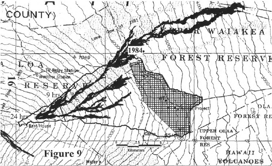
Official, Figure in hazard assessment
Map of the lavashed for the existing prison site showing the 9- and 24-hour warning lines
Figure 9 in: Kauahikaua, J. P., Trusdell, F. A., & Heliker, C. C. (1998). The probability of lava inundation at the proposed and existing Kulani Prison Sites. US Geological Survey, Open-File Report 98-794. 21 p. https://doi.org/10.3133/ofr98794
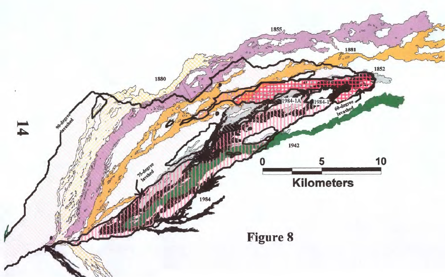
Official, Figure in hazard assessment
Map showing the nested 60-, 75-, and 90-degree lavasheds computed for the terminal lobes of the Mauna Loa 1984-1 and 1984-1A flows
Figure 8 in: Kauahikaua, J. P., Trusdell, F. A., & Heliker, C. C. (1998). The probability of lava inundation at the proposed and existing Kulani Prison Sites. US Geological Survey, Open-File Report 98-794. 21 p. https://doi.org/10.3133/ofr98794