
Advanced Search for Maps
Showing 1-2 of 2
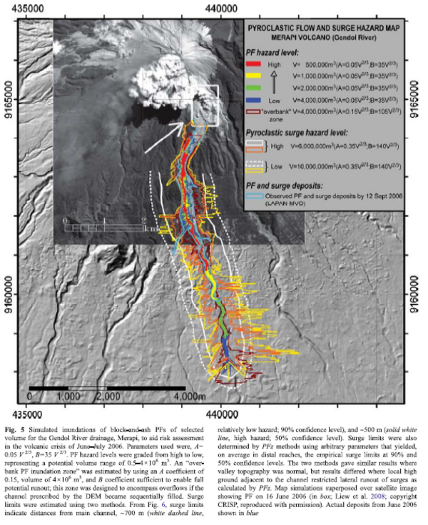
Figure in a journal article
Pyroclastic Flow and Surge Hazard Map Merapi Volcano (Gendol River)
Figure 5 in: Widiwijayanti, C., Voight, B., Hidayat, D., & Schilling, S. P. (2009). Objective rapid delineation of areas at risk from block-and-ash pyroclastic flows and surges. Bulletin of Volcanology, 71(6), p. 687-703. https://doi.org/10.1007/s00445-008-0254-6
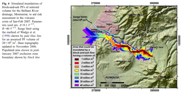
Figure in a journal article
Simulated inundations of block-and-ash PFs of selected volume for the Belham River drainage, Montserrat, to aid risk assessment in the volcanic crisis of Jan-Feb 2007.
Figure 4 in: Widiwijayanti, C., Voight, B., Hidayat, D., & Schilling, S. P. (2009). Objective rapid delineation of areas at risk from block-and-ash pyroclastic flows and surges. Bulletin of Volcanology, 71(6), p. 687-703. https://doi.org/10.1007/s00445-008-0254-6