Advanced Search for Maps
Showing 1971-1980 of 2089
Towada, Japan
Official, Map in a booklet, long fact-sheet, or handbook
Volcanic mud flow
Page 15 in: Towada Volcanic Hazards Mitigation Committee. (2018). Towada Volcano Hazard Expected Impact Area Map. Omori Prefecture Disaster Risk Management Division, Akita Prefecture Disaster Prevention Division, Nagano City General Affairs Division, Kosaka Town General Affairs Division.
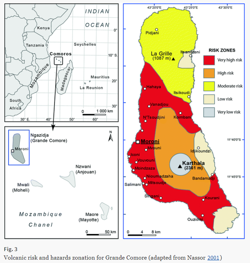
Karthala, Comoros
Figure in a journal article
Volcanic risk and hazards zonation for Grande Comore
Figure 3 in: Komorowski JC., Morin J., Jenkins S., & Kelman I. (2016) Challenges of Volcanic Crises on Small Islands States. In: Fearnley C.J., Bird D.K., Haynes K., McGuire W.J., Jolly G. (eds) Observing the Volcano World. Advances in Volcanology. International Association of Volcanology and Chemistry of the Earth’s Interior – IAVCEI. Springer. https://doi.org/10.1007/11157_2015_15. Adapted from: Nassor, H. (2001) Contribution à l’étude du risque volcanique sur les grands volcans boucliers basaltiques: le Karthala et le Piton de la Fournaise, unpublished PhD dissertation, University of La Réunion, 218 p.
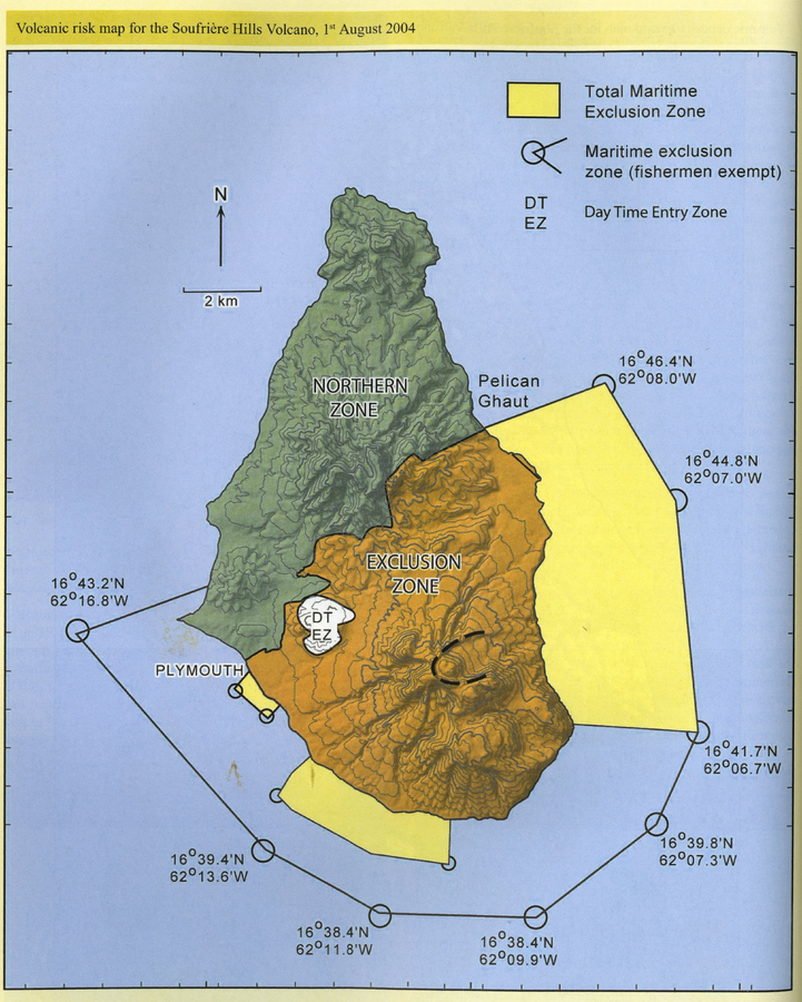
Soufrière Hills, Montserrat [United Kingdom]
Official, Figure in hazard assessment
Volcanic risk map for the Soufrière Hills Volcano, 1st August 2004
Page 164 in: Hincks, T., Sparks, S., Dunkley, P., & Cole, P. (2005). Montserrat. In: Lindsay, J.M., Shepherd, J.B., Robertson, R.E.A., & Ali, S. (Eds) Volcanic hazard atlas of the Lesser Antilles. Seismic Research Unit, The University of the West Indies, Trinidad and Tobago, W.I., p. 148-168.
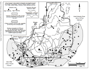
Eastern Snake River Plain, United States
Official, Figure in hazard assessment
Volcanic Source Zones Significant to the Central Facilities Area (CFA)
Figure 8 in: Hackett, W.R., Smith, R.P., & Khericha, S. (2002). Volcanic hazards of the Idaho National Engineering and Environmental Laboratory, southeast Idaho. In: Bonnichsen, B., White, C.M., and McCurry, M. (eds.). Tectonic and Magmatic Evolution of the Snake River Plain Volcanic Province. Idaho Geological Survey Bulletin 30, p. 461-482.
Shasta, United States
Official, Map in a booklet, long fact-sheet, or handbook
Volcanic-Ash Hazard Area Map
Page 14 in: Crandell, D.R. & Nichols, D.R. (1989). Volcanic hazards at Mount Shasta, California. U.S. Geological Survey, General Information Product, 22 p. https://doi.org/10.3133/70039409
Official, Map in a booklet, long fact-sheet, or handbook
Volcanic-Ash Hazard Area Map
Page 14 in: Crandell, D.R. & Nichols, D.R. (1989). Volcanic hazards at Mount Shasta, California. U.S. Geological Survey, General Information Product, 22 p. https://doi.org/10.3133/70039409
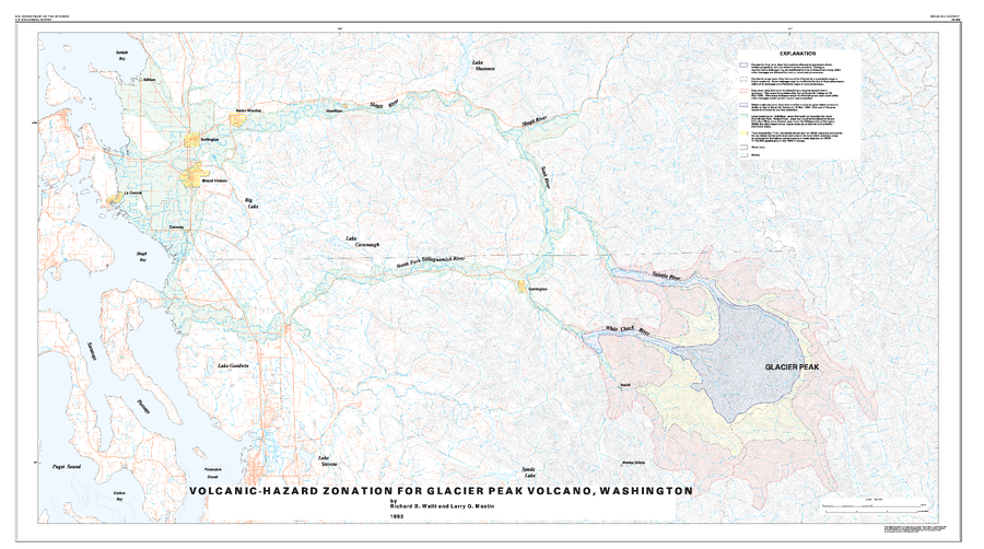
Glacier Peak, United States
Official, Insert/poster-size map with accompanying report
Volcanic-Hazard Zonation For Glacier Peak Volcano, Washington
Plate 1 in: Waitt, R.B., Mastin, L.G., & Begét, J.E. (1995). Volcanic-Hazard Zonation for Glacier Peak Volcano, Washington. U.S. Geological Survey, Open-File Report 95-499, 9 p., 1 plate. https://doi.org/10.3133/ofr95499
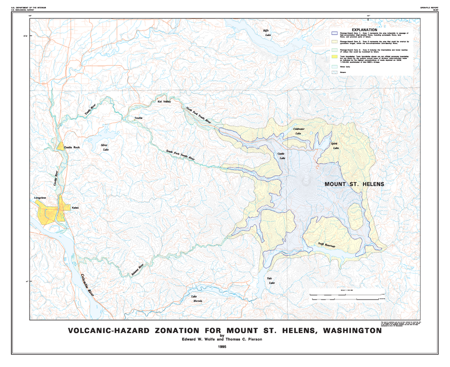
St. Helens, United States
Official, Insert/poster-size map with accompanying report
Volcanic-Hazard Zonation for Mount St. Helens, Washington
Plate 1 in: Wolfe, E.W. & Pierson, T.C. (1995). Volcanic-Hazard Zonation for Mount St. Helens, Washington, 1995. U.S. Geological Survey, Open-File Report 95-497, 12 p., 1 plate. https://doi.org/10.3133/ofr95497
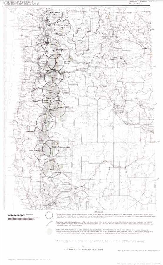
Cascades Range (regional, USA only), United States
Official, Insert/poster-size map with accompanying report
Volcanic-hazard zones in the Cascades Range
Plate 1 in: Hoblitt, R. P., Miller, C. D., & Scott, W. E. (1987). Volcanic hazards with regard to siting nuclear-power plants in the Pacific Northwest. U.S. Geological Survey, Open-File Report 87-297. https://doi.org/10.3133/ofr87297
St. Helens, United States
Official, Map sheet or poster
Volcanic-hazards zones, originally drawn on USFS map (approximately 1/2 in. = 1 mi), April 1, 1980.
Figure 454 in: Miller, C.D., Mullineaux, D.R. & Crandell, D.R. (1981). Hazards assessments at Mount St. Helens. In: Lipman, P. W. & Mullineaux, D. R. (Eds.) The 1980 eruptions of Mount St. Helens, Washington. U.S. Geological Survey, Professional Paper 1250, p. 789-802. https://doi.org/10.3133/pp1250
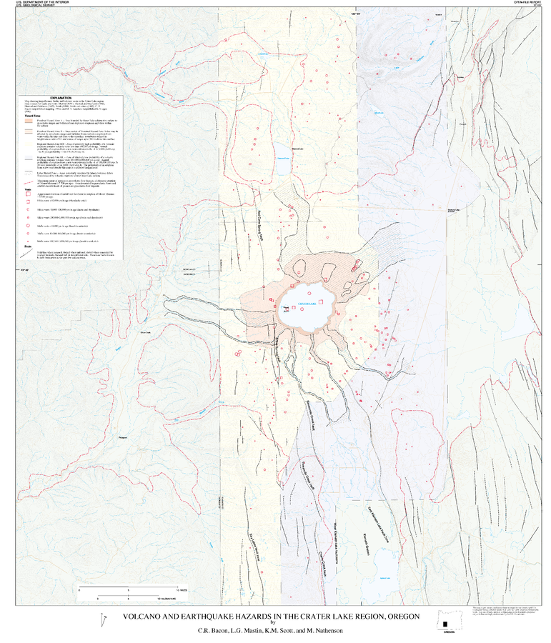
Crater Lake, United States
Official, Insert/poster-size map with accompanying report
Volcano and Earthquake Hazards in the Crater Lake Region, Oregon
Plate 1 in: Bacon, C.R., Mastin, L.G., Scott, K.M., & Nathenson, M. (1997). Volcano and earthquake hazards in the Crater Lake region, Oregon. U.S. Geological Survey, Open-File Report 97-487, 32 p. https://doi.org/10.3133/ofr97487