
Advanced Search for Maps
Showing 21-28 of 28
Official, Map in a booklet, long fact-sheet, or handbook
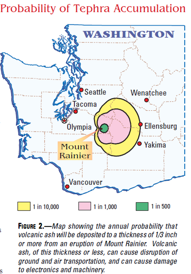
Probability of Tephra Accumulation
Figure 2 in: Driedger, C.L. & Scott, K.M. (2002). Mount Rainier: learning to live with volcanic risk. U.S. Geological Survey, Fact Sheet 034-02, 4 p. https://doi.org/10.3133/fs03402
Official, Figure on website
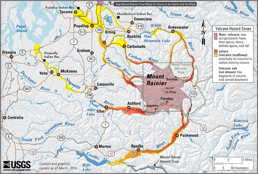
Simplified volcano hazards map of Mount Rainier, Washington
Hoblitt, R.P., Walder, J.S., Driedger, C.L., Scott, K.M., Pringle, P.T., Vallance, J.W., Scott, W.E., Iverson, R.M., Ramsey, D.W., & Faust, L.M. (2014). Simplified volcano hazards map of Mount Rainier, Washington. U.S. Geological Survey. Mount Rainier, WA Simplified Hazards Map. https://www.usgs.gov/media/images/mount-rainier-wa-simplified-hazards-map (Modified from: U.S. Geological Survey, Open-File Report 98-428)
Official, Map sheet or poster
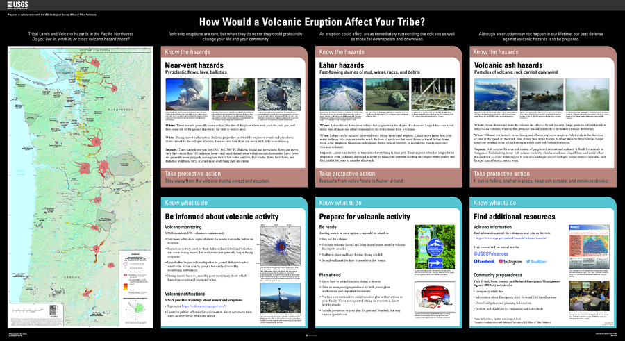
Tribal Lands and Volcano Hazards in the Pacific Northwest
Gardner, C.A. and Bard, J.A. (2021). How would a volcanic eruption affect your Tribe? U.S. Geological Survey General Information Product 209, https://doi.org/10.3133/gip209.
Official, Insert/poster-size map with accompanying report
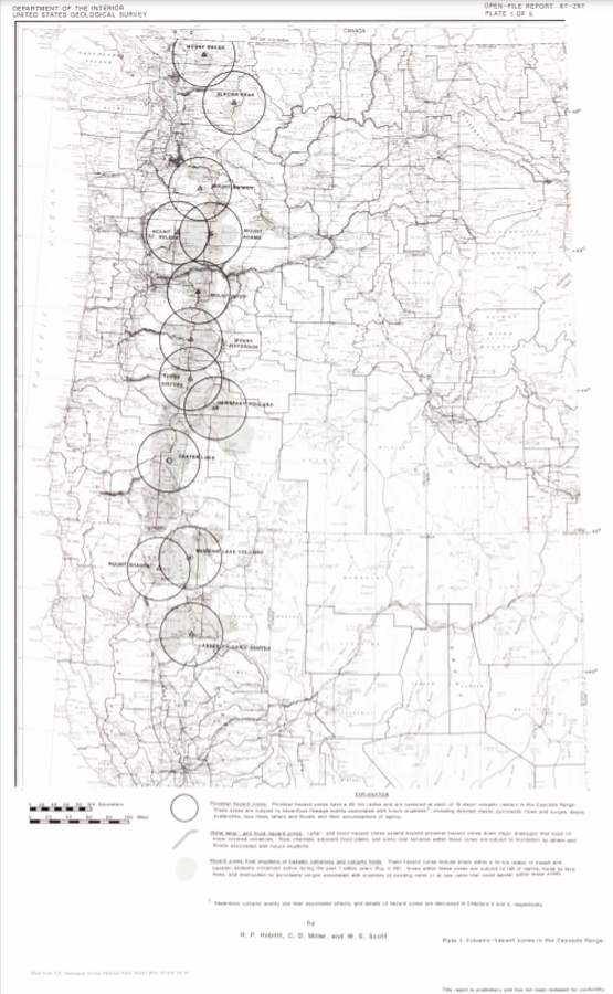
Volcanic-hazard zones in the Cascades Range
Plate 1 in: Hoblitt, R. P., Miller, C. D., & Scott, W. E. (1987). Volcanic hazards with regard to siting nuclear-power plants in the Pacific Northwest. U.S. Geological Survey, Open-File Report 87-297. https://doi.org/10.3133/ofr87297
Official, Insert/poster-size map with accompanying report
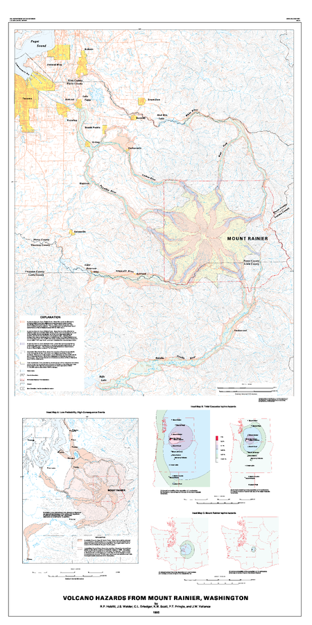
Volcano Hazards from Mount Rainier, Washington
Hoblitt, R.P., Walder, J.S., Driedger, C.L., Scott, K.M., Pringle, P.T. & Vallance, J.W. (1995). Volcano Hazards from Mount Rainier, Washington. U.S. Geological Survey Open-File Report 95-273. https://doi.org/10.3133/ofr95273
Official, Insert/poster-size map with accompanying report
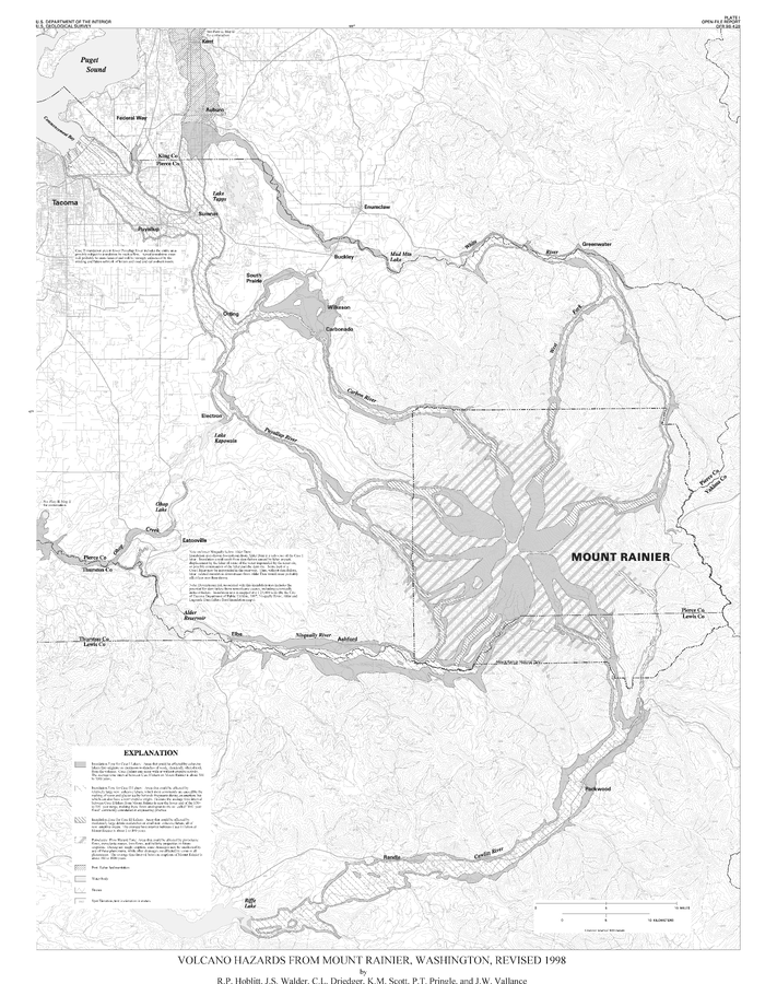
Volcano Hazards From Mount Rainier, Washington, Revised 1998
Plate 1 in: Hoblitt, R.P., Walder, J.S., Driedger, C., Scott, K., Pringle, P.T. & Vallance, J.W. (1998). Volcano Hazards from Mount Rainier, Washington, Revised 1998. U.S. Geological Survey, Open-File Report 98-428, 11 p., 2 plates. https://doi.org/10.3133/ofr98428
Official, Insert/poster-size map with accompanying report
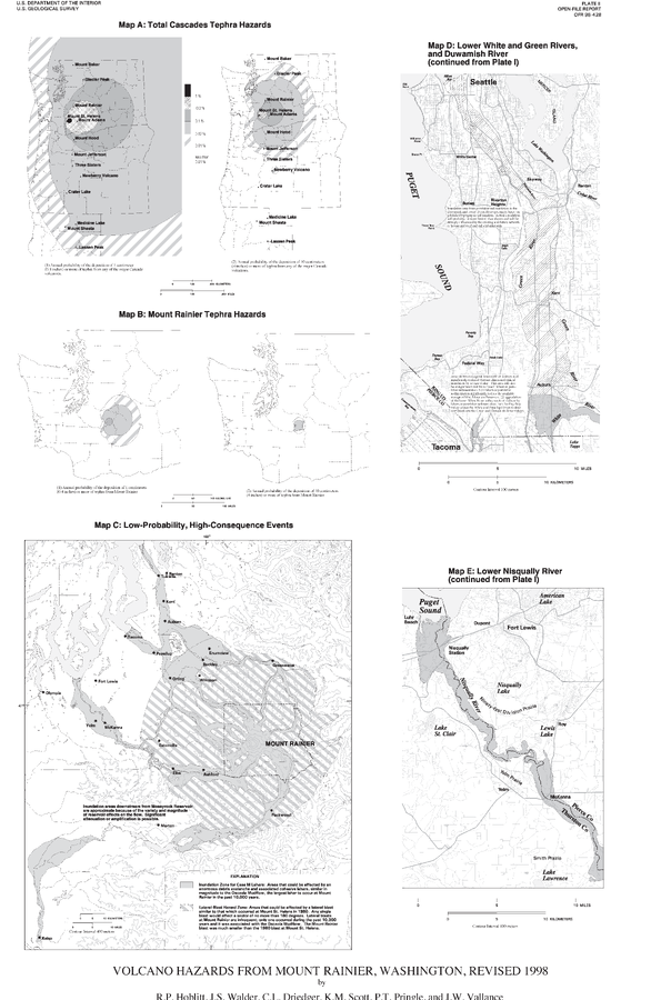
Volcano Hazards From Mount Rainier, Washington, Revised 1998
Plate 2 in: Hoblitt, R.P., Walder, J.S., Driedger, C., Scott, K., Pringle, P.T. & Vallance, J.W. (1998). Volcano Hazards from Mount Rainier, Washington, Revised 1998. U.S. Geological Survey, Open-File Report 98-428, 11 p., 2 plates. https://doi.org/10.3133/ofr98428
Official, Interactive web-based map
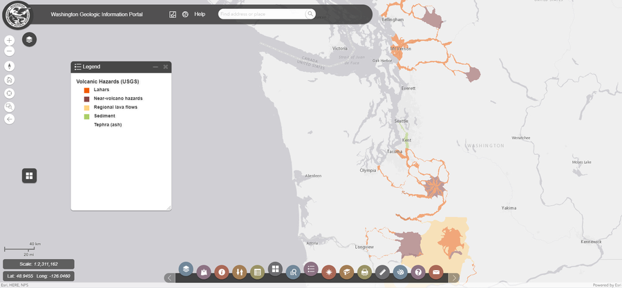
Washington Geologic Information Portal - Volcanic Hazards (USGS)
Washington Department of Natural Resources. Geologic Information Portal.