
Advanced Search for Maps
Showing 1-5 of 5
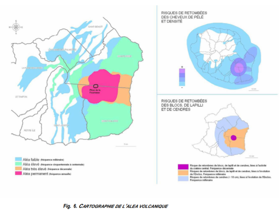
Official, Figure in hazard assessment
Cartographie de l’Alea Volcanique
(Mapping of the Volcanic Hazard)
Figure 6 in: Préfet de la Région Réunion. (2012). Schema de Prevention des Risques Naturels de la Réunion. Diagnostic et Programme d’Actions.

Figure in a journal article
Evolution of the lava flow hazard maps within the Enclos
Figure 7 in: Chevrel, M. O., Favalli, M., Villeneuve, N., Harris, A. J., Fornaciai, A., Richter, N., Derrien, A., Di Muro, A., & Peltier, A. (2021). Lava flow hazard map of Piton de la Fournaise volcano. Natural Hazards and Earth System Sciences, 21(8), 2355-2377. https://doi.org/10.5194/nhess-21-2355-2021, 2021
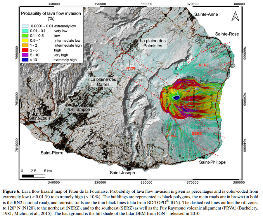
Figure in a journal article
Lava flow hazard map of Piton de la Fournaise
Figure 6 in: Chevrel, M. O., Favalli, M., Villeneuve, N., Harris, A. J., Fornaciai, A., Richter, N., Derrien, A., Di Muro, A., & Peltier, A. (2021). Lava flow hazard map of Piton de la Fournaise volcano. Natural Hazards and Earth System Sciences, 21(8), 2355-2377. https://doi.org/10.5194/nhess-21-2355-2021, 2021
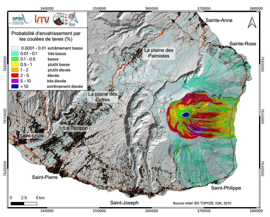
Official, Figure in hazard assessment
Probabilité d'envahissement par les coulées de laves (%)
(Probability of invasion by lava flows (%))
Page 17 in: Préfet de la Région Réunion. (2021). Planification ORSEC, Disposition Spécifique, Volcan Piton de la Fournaise. Etat-Major de Zone et de Protection Civile de l’Océan Indien.
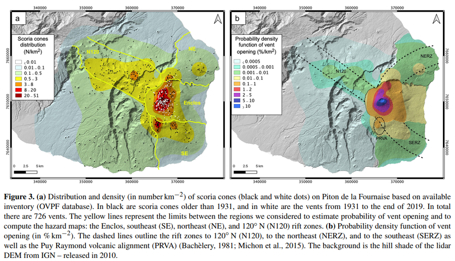
Figure in a journal article
Probability density function of vent opening (in % km−2)
Figure 3 in: Chevrel, M. O., Favalli, M., Villeneuve, N., Harris, A. J., Fornaciai, A., Richter, N., Derrien, A., Di Muro, A., & Peltier, A. (2021). Lava flow hazard map of Piton de la Fournaise volcano. Natural Hazards and Earth System Sciences, 21(8), 2355-2377. https://doi.org/10.5194/nhess-21-2355-2021, 2021