
Advanced Search for Maps
Showing 1-10 of 509
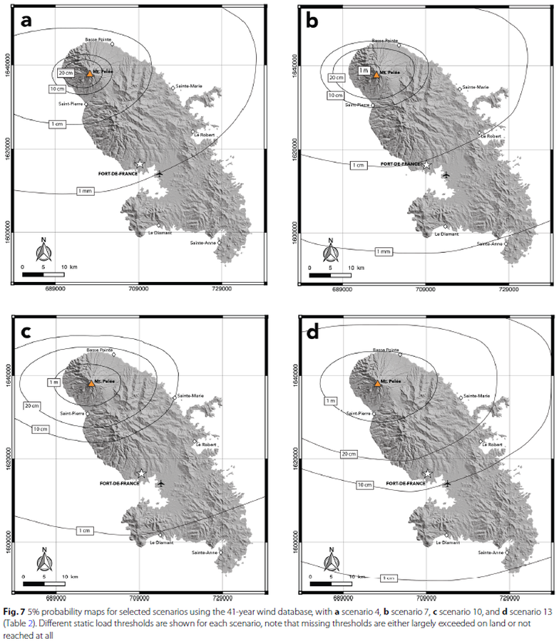
Figure in a journal article
5% probability maps for selected scenarios
Figure 7 in: Michaud-Dubuy, A., Carazzo, G., & Kaminski, E. (2021). Volcanic hazard assessment for tephra fallout in Martinique. Journal of Applied Volcanology, 10(1), 1-20. https://doi.org/10.1186/s13617-021-00106-7.
Official, Map in an information statement
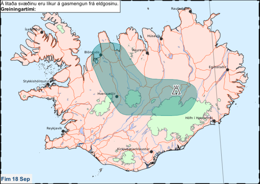
Á litaða svæðinu eru líkur á gasmengun frá eldgosinu. Fim 18 Sep.
(In the colored area there is a likelihood of gas pollution from the eruption. Thu 18 Sep.)
Iceland Meteorological Office (IMO). (2014). Á litaða svæðinu eru líkur á gasmengun frá eldgosinu. Fim 18 Sep.
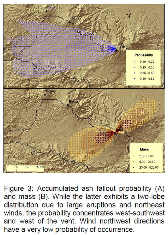
Figure in a journal article
Accumulated ash fallout probability and mass
Figure 3 in: Barrantes, G., Núñez, S., & Malavassi, E. (2018). Ash fallout hazard from Irazú volcano, Costa Rica. Revista Geográfica de Chile Terra Australis, 54(1), 13-25. https://doi.org/10.23854/07199562.2018541Barrantes13
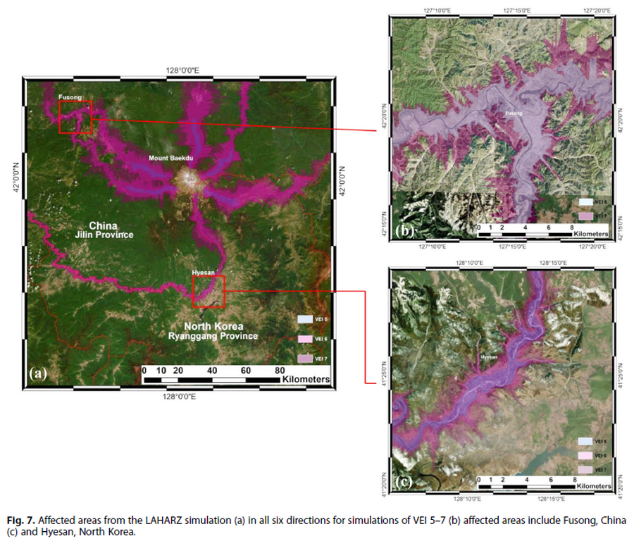
Figure in a journal article
Affected areas from the LAHARZ simulation
Figure 7 in: Achmad, A.R., Lee, S., Park, S. Eom, J., & Lee, C.-W. (2020). Estimating the potential risk of the Mt. Baekdu Volcano using a synthetic interferogram and the LAHARZ inundation zone. Geosciences Journal. 24, 755–768. https://doi.org/10.1007/s12303-020-0032-9
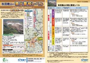
Official, Flyer, brochure, short fact-sheet, or handout
Akita-Yakeyama Volcanic Alert Levels
Japan Meteorological Agency. (2016). Akita-Yakeyama Volcanic Alert Levels. Volcano Monitoring and Warning Center, Volcano Division, Earthquake and Volcano Department.
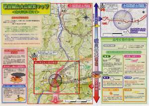
Official, Map in a booklet, long fact-sheet, or handbook
Akita-Yakeyama Volcanic Disaster Prevention Map
Akita Prefecture. (2002). Akita-Yakeyama Volcanic Disaster Prevention Map.
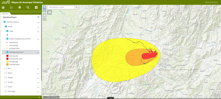
Official, Interactive web-based map
Amenaza Puracé
(Puracé Hazards)
Servicio Geológico Colombiano (SGC). Amenaza Puracé.
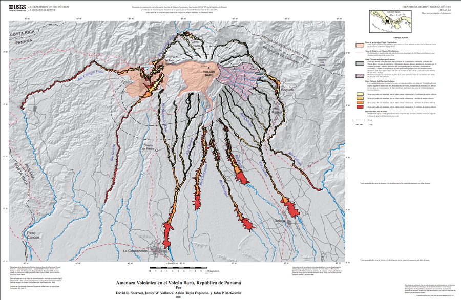
Official (foreign agency), Insert/poster-size map with accompanying report
Amenaza Volcánica en el Volcán Barú, República de Panamá
(Volcano Hazards of Volcán Barú, Republic of Panamá)
Plate 1 (Spanish) in: Sherrod, D. R., Vallance, J. W., Espinosa, A. T., & McGeehin, J. P. (2007). Volcan Baru—eruptive history and volcano-hazards assessment. U.S. Geological Survey, Open-File Report, 2007-1401.
Irazú, Costa Rica
Official, Figure in hazard assessment
Amenaza volcánica por balística
(Volcanic hazard due to ballistics)
Figure 6.45 in: Alvarado, G.E., Campos-Durán, D., Brenes-André, J., Alpízar, Y., Núñez, S., Esquivel, L., Sibaja, J.P. & Fallas, B. (2021). Peligro Volcánico del Irazú, Costa Rica. Comisión Nacional de Prevención de Riesgos y Atención de Emergencias (CNE). Deciembre 2021.
Official, Figure in hazard assessment
Amenaza volcánica por balística
(Volcanic hazard due to ballistics)
Figure 6.45 in: Alvarado, G.E., Campos-Durán, D., Brenes-André, J., Alpízar, Y., Núñez, S., Esquivel, L., Sibaja, J.P. & Fallas, B. (2021). Peligro Volcánico del Irazú, Costa Rica. Comisión Nacional de Prevención de Riesgos y Atención de Emergencias (CNE). Deciembre 2021.
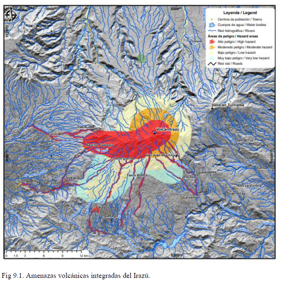
Official, Figure in hazard assessment
Amenazas volcánicas integradas del Irazú
(Integrated volcanic hazards of Irazú)
Figure 9.1 in: Alvarado, G.E., Campos-Durán, D., Brenes-André, J., Alpízar, Y., Núñez, S., Esquivel, L., Sibaja, J.P. & Fallas, B. (2021). Peligro Volcánico del Irazú, Costa Rica. Comisión Nacional de Prevención de Riesgos y Atención de Emergencias (CNE). Deciembre 2021.