
Advanced Search for Maps
Showing 1-10 of 22

Official, Sign or billboard
Area closed. Do not enter. Increased risk of eruption.
Department of Conservation. (2020). Area closed. Do not enter. Increased risk of eruption. December 2020 R183230.
Official, Sign or billboard
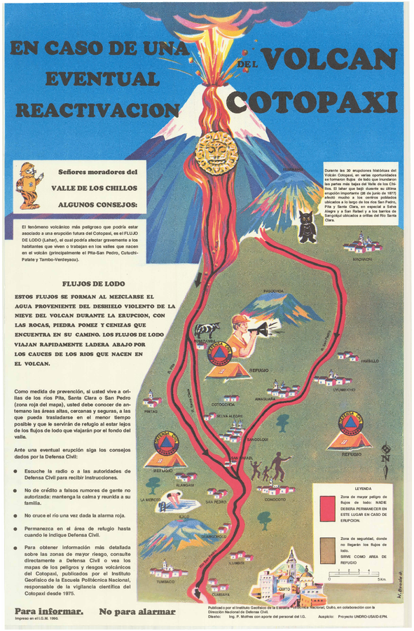
En Caso de Una Eventual Reactivacion del Volcan Cotopaxi
(In Case of a Possible Reactivation of the Cotopaxi Volcano)
Mothes, P. (1990). En Caso de Una Eventual Reactivacion del Volcan Cotopaxi. Instituto Geofísico de la Escuela Politecnica Nacional and Dirección Nacional (IG-EPN) de Defensa Civil, Quito.
Official, Sign or billboard
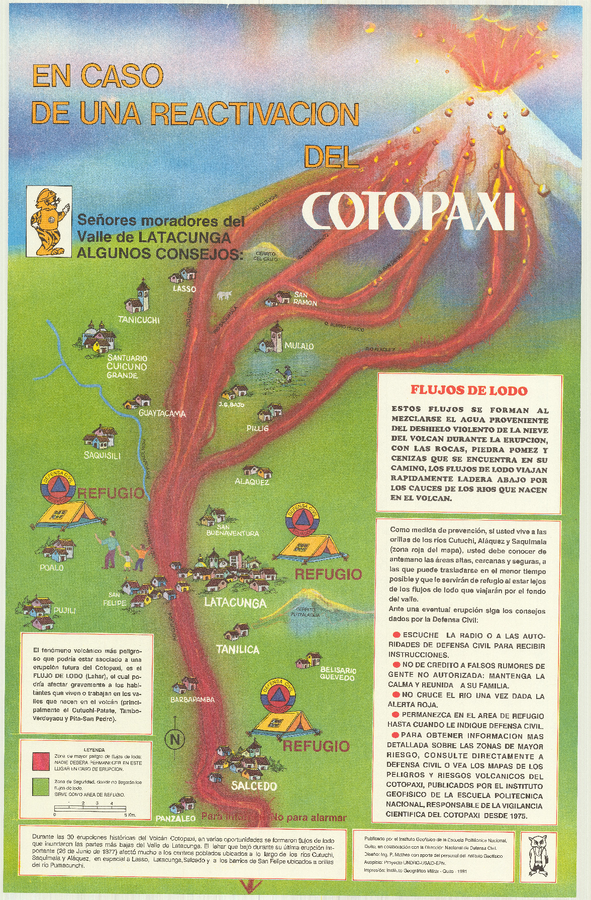
En Caso de Una Eventual Reactivacion del Volcan Cotopaxi
(In Case of a Possible Reactivation of the Cotopaxi Volcano)
Mothes, P. (1991). En Caso de Una Eventual Reactivacion del Volcan Cotopaxi. Instituto Geofísico de la Escuela Politecnica Nacional (IG-EPN) and Dirección Nacional de Defensa Civil, Quito.

Official, Sign or billboard
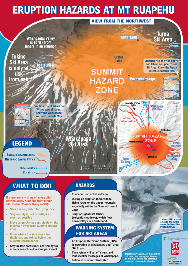
Eruption Hazards at Mt. Ruapehu
GNS Science (compiler). (2007). Eruption Hazards at Mt. Ruapehu. 8 October 2007.
Official, Sign or billboard
Eruption Hazards at Mt. Ruapehu
GNS Science (compiler). (2008). Eruption Hazards at Mt. Ruapehu.
Official, Sign or billboard
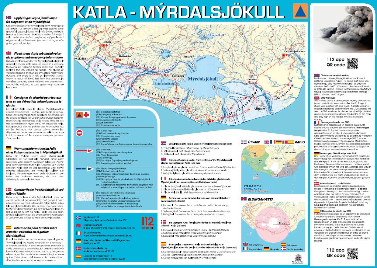
Katla – Mýrdalsjökull
Almannavarnir. (2017). Katla – Mýrdalsjökull.

Official, Sign or billboard
Lahar Warning Whakapapa Village
Department of Conservation. Lahar Warning Whakapapa Village.

Official, Sign or billboard
Map of areas not recommended not to enter or camp - Ruapehu Volcanic Risk
Department of Conservation. (2020). Map of areas not recommended not to enter or camp - Ruapehu Volcanic Risk. September 2020 R183230.
Official, Sign or billboard
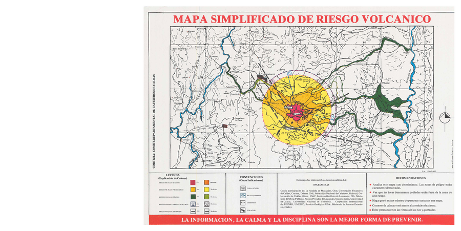
Mapa Simplificado de Riesgo Volcanico
(Simplified Map of Volcanic Risk)
Instituto Colombiano de Geología y Minería (INGEOMINAS). (1985?). Mapa Simplificado de Riesgo Volcanico. Comite Departmental de Cafeteros de Calda, Manizales.
Official, Sign or billboard
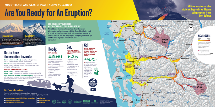
Mount Baker and Glacier Peak | Active Volcanoes. Are You Ready for An Eruption?
Washington Department of Natural Resources. (2014). Mount Baker and Glacier Peak, Active Volcanoes, Are You Ready for An Eruption? Mount Baker And Glacier Peak Combined Hazard Map. (Simplified from: Waitt et al. 1995 and Gardner et al. 1995)