
Advanced Search for Maps
Showing 1-10 of 26
Official, Map sheet or poster
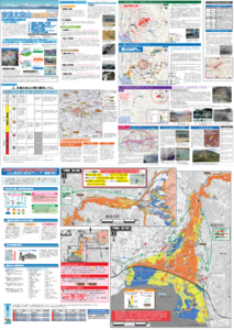
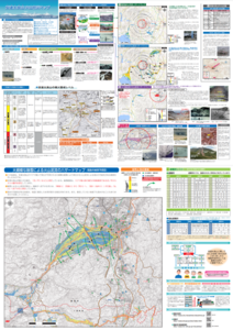
Adatarayama Volcano Disaster Prevention Map [Fukushima City]
Inawashiro Town. (2016). Adatarayama Volcano Disaster Prevention Map [Inawashiro Town].
Official, Map sheet or poster
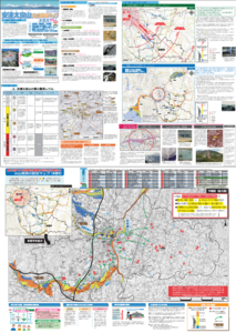
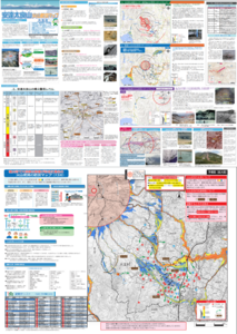
Adatarayama Volcano Disaster Prevention Map [Koriyama City]
Koriyama City. (2016). Adatarayama Volcano Disaster Prevention Map [Koriyama City].
Official, Map sheet or poster
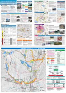
Adatarayama Volcano Disaster Prevention Map [Motomiya City]
Motomiya City. (2016). Adatarayama Volcano Disaster Prevention Map [Motomiya City].
Official, Map sheet or poster
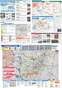
Adatarayama Volcano Disaster Prevention Map [Nihonmatsu City]
Nihonmatsu City. (2016). Adatarayama Volcano Disaster Prevention Map [Nihonmatsu City].
Official, Map sheet or poster
Adatarayama Volcano Disaster Prevention Map [Otama Village]
Fukushima City. (2016). Adatarayama Volcano Disaster Prevention Map [Fukushima City].
Official, Map sheet or poster
Adatarayama Volcano Disaster Prevention Map [Otama Village]
Otama Village. (2016). Adatarayama Volcano Disaster Prevention Map [Otama Village].
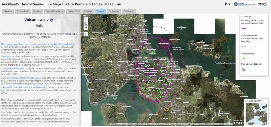
Official, Interactive web-based map
Auckland's Hazard Viewer Volcanic Activity
Auckland Council. Auckland's Hazard Viewer: Volcanic Activity.
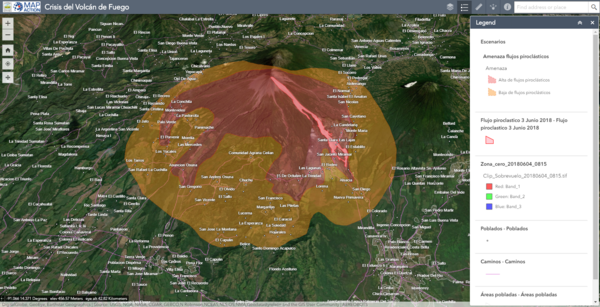
Official, Interactive web-based map
Crisis del Volcán de Fuego
(Fuego Volcano Crisis)
Instituto Nacional de Sismología, Vulcanologia, Meteorologia e Hidrología (INSIVUMEH), Map Action, Volcano Disaster Assistance Program (VDAP), U.S. Geological Survey (USGS), University of Edinburgh & Michigan Technological University. (2018). Crisis del Volcan Fuego.
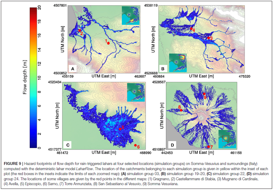
Figure in a journal article
Hazard footprints of flow depth for rain-triggered lahars at four selected locations (simulation groups) on Somma-Vesuvius and surroundings (Italy) computed with the deterministic lahar model LaharFlow
Figure 9 in: Tierz, P., Woodhouse, M.J., Phillips, J.C., Sandri, L., Selva, J., Marzocchi, W., & Odbert, H.M. (2017). A framework for probabilistic multi-hazard assessment of rain-triggered lahars using Bayesian belief networks. Frontiers in Earth Science, 5 (73). https://doi.org/10.3389/feart.2017.00073
Official, Interactive web-based map
Higashikawa Town Disaster Hazard Map (web version)
Higashikawa Town. (2020). Higashikawa Town Disaster Hazard Map (web version).