
Advanced Search for Maps
Showing 1341-1350 of 2217

Official, Figure in a journal article
Persistence maps at FL250 (large class)
Figure D2 in: Titos, M., Martínez Montesinos, B., Barsotti, S., Sandri, L., Folch, A., Mingari, L., Macedonio, G. & Costa, A. (2022). Long-term hazard assessment of explosive eruptions at Jan Mayen (Norway) and implications for air traffic in the North Atlantic. Natural Hazards and Earth System Sciences, 22(1), 139-163. https://doi.org/10.5194/nhess-22-139-2022
Official, Figure in a journal article
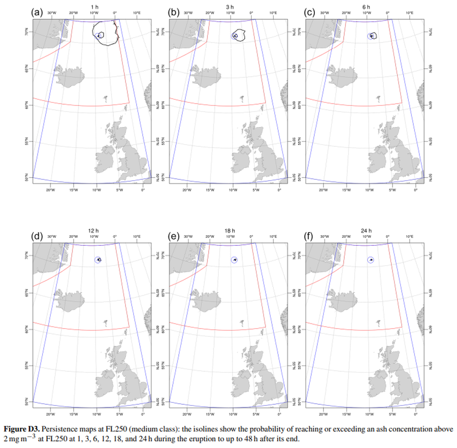
Persistence maps at FL250 (medium class)
Figure D3 in: Titos, M., Martínez Montesinos, B., Barsotti, S., Sandri, L., Folch, A., Mingari, L., Macedonio, G. & Costa, A. (2022). Long-term hazard assessment of explosive eruptions at Jan Mayen (Norway) and implications for air traffic in the North Atlantic. Natural Hazards and Earth System Sciences, 22(1), 139-163. https://doi.org/10.5194/nhess-22-139-2022
Official, Map sheet or poster
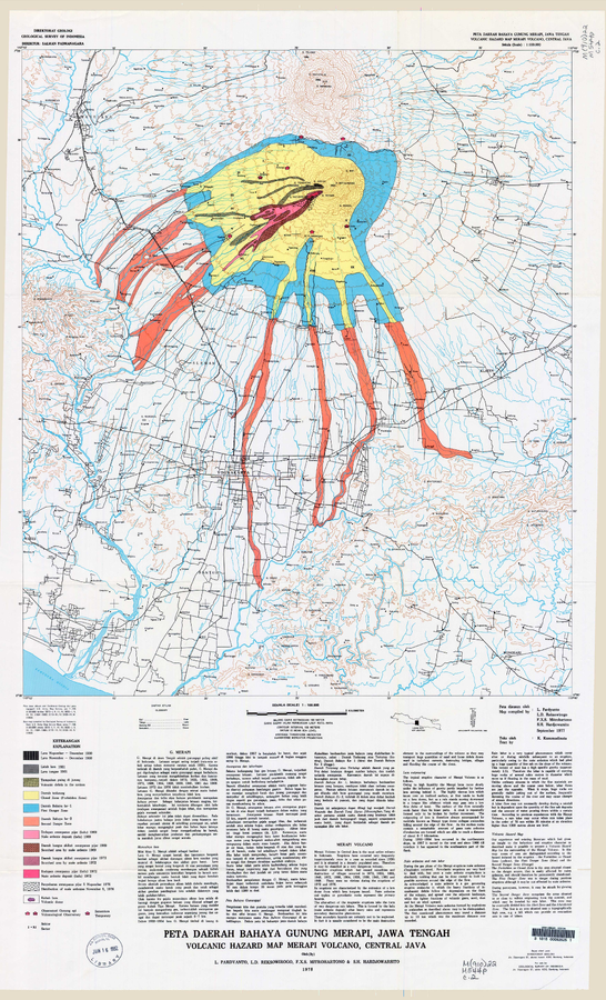
Peta Daerah Bahaya Gunung Merapi, Jawa Tengah
(Volcanic Hazard Map Merapi Volcano, Central Java)
Pardyanto, L., Reksowirogo, L.D., Mitrohartono, F.X.S., & Hardjowarsito, S.H. (1978). Peta Daerah Bahaya Gunung Merapi, Jawa Tengah (Volcanic Hazard Map Merapi Volcano, Central Java). Geological Survey of Indonesia (GSI), scale 1:100,000
Official, Unknown format
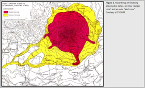
Peta Daerah Bamaya G. Sinabung, Sumatra Utara
(Map of the Danger Area G. Sinabung, North Sumatra)
Center for Volcanology and Geological Hazard Mitigation (CVGHM). (Year Unknown). Peta Daerah Bamaya G. Sinabung, Sumatra Utara. Reprinted in: Global Volcanism Program. (2010). Report on Sinabung (Indonesia) (Wunderman, R., ed.). Bulletin of the Global Volcanism Network, 35:7. Smithsonian Institution. https://doi.org/10.5479/si.GVP.BGVN201007-261080
Official, Unknown format
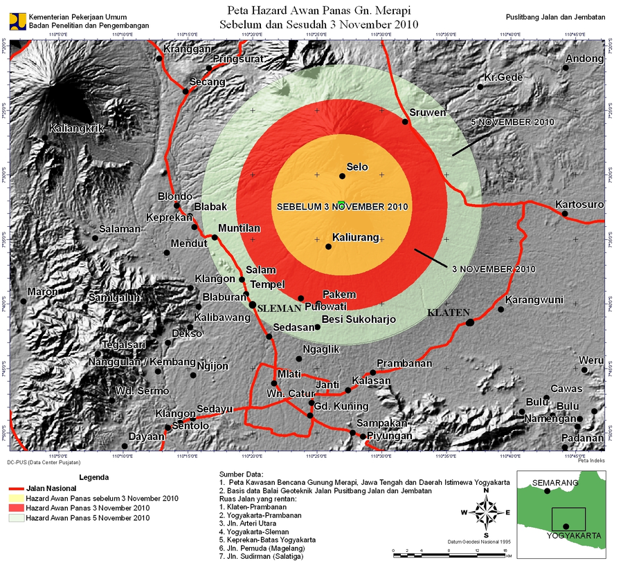
Peta Hazard Awan Panas Gn. Merapi Sebelum dan Sesudah 3 November 2010
(Pyroclastic Flow Hazard Map Mt. Merapi Before and After 3 November 2010)
Kementerian Pekerjaan Umum, Badan Penelitian dan Pengembangan, Puslitbang Jalan dan Jembatan. (2010). Peta Hazard Awan Panas Gn. Merapi Sebelum dan Sesudah 3 November 2010.
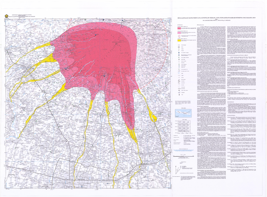
Official, Map sheet or poster
Peta Kawasan Rawan Bencana Gunungapi Merapi, Jawa Tengah Dan Daerah Istimewa Yogyakarta 2010
(Map of Merapi Volcano Prone Areas, Central Java and Yogyakarta Special Region 2010)
Sayudi, D.S., Nurnaning A., Juliani Dj., & Muzani, M. (2010). Peta Kawasan Rawan Bencana Gunungapi Merapi, Jawa Tengah Dan Daerah Istimewa Yogyakarta 2010. Center for Volcanology and Geological Hazard Mitigation.

Official, Map sheet or poster
Peta Kawasan Rawan Bencana Gunungapi Sinabung, Provinsi Sumatera Utara
(Volcanic Hazard Map of Sinabung Volcano, North Sumatera Province)
Gunawan, H., Mulyana, A.R., Solihin, A., Pujowarsito, & Riyadi. (2014). Volcanic Hazard Map of Sinabung Volcano, North Sumatera Province. Center for Volcanology and Geological Hazard Mitigation (CVGHM).

Official, Map sheet or poster
Peta Kawasan Rawan Bencana Gunungapi Sinabung, Provinsi Sumatera Utara
(Volcanic Hazard Map of Sinabung Volcano, North Sumatera Province)
Mulyana, A.R., Solihin, A., Pujowarsito, & Riyadi. (2011). Volcanic Hazard Map of Sinabung Volcano, North Sumatera Province. Center for Volcanology and Geological Hazard Mitigation (CVGHM).

Official, Map sheet or poster
Peta Kawasan Rawan Bencana Gunungapi Sinabung, Provinsi Sumatera Utara
(Volcanic Hazard Map of Sinabung Volcano, North Sumatera Province)
Gunawan, H., Mulyana, A.R., Solihin, A., Pujowarsito, & Riyadi. (2013). Volcanic Hazard Map of Sinabung Volcano, North Sumatera Province. Center for Volcanology and Geological Hazard Mitigation (CVGHM).
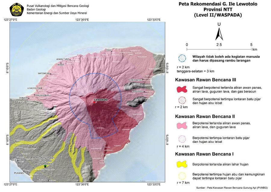
Official, Map in an information statement
Peta Rekomendasi G. Ile Lewotolo Provinsi NTT (Level II/WASPADA)
(Recommended Map of G. Ile Lewotolo NTT Province (Level II/ALERT))
Pusat Vulanologi dan Mitigasi Bencana Geologi (PVMBG). (2024). Peta Rekomendasi G. Ile Lewotolo Provinsi NTT (Level II/WASPADA). Press Release PERLUASAN JARAK REKOMENDASI GUNUNGAPI ILI LEWOTOLOK 24 FEBRUARI 2024 PUKUL 17:00 WITA. https://vsi.esdm.go.id/press-release/press-release-perluasan-jarak-rekomendasi-gunungapi-ili-lewotolok-24-februari-2024-pukul-1700-wita