
Advanced Search for Maps
Showing 21-30 of 1194
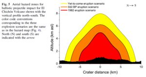
Figure in a journal article
Aerial hazard zones for ballistic projectile impact for El Chichón Volcano shown with the vertical profile north–south
Figure 5 in: Alatorre-Ibargüengoitia, M.A., Morales-Iglesias, H., Ramos-Hernández, S.G., Jon-Selvas, J., & Jiménez-Aguilar, J.M. (2016). Hazard zoning for volcanic ballistic impacts at El Chichón Volcano (Mexico). Natural Hazards, 81(3), p. 1733-1744. https://doi.org/10.1007/s11069-016-2152-0
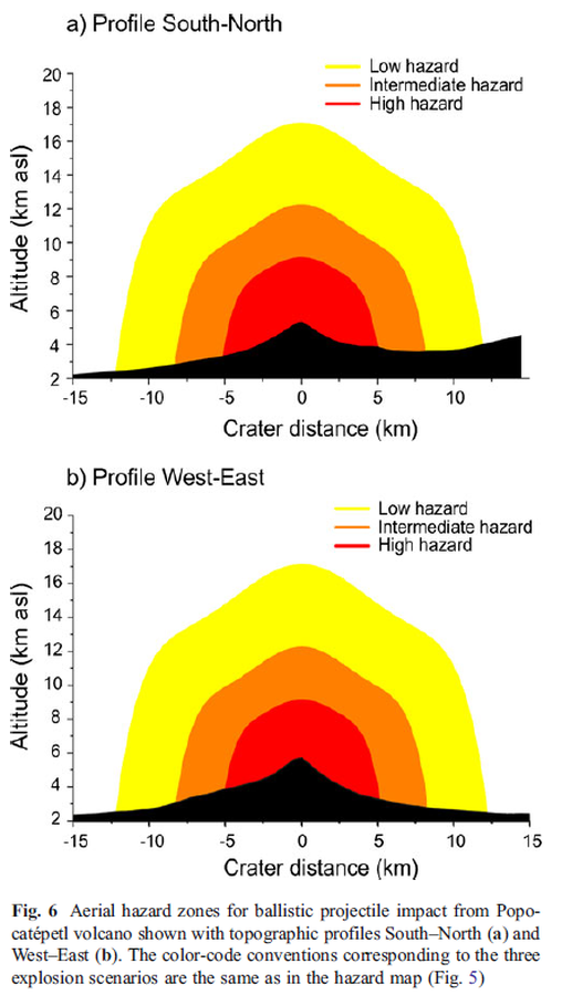
Figure in a journal article
Aerial hazard zones for ballistic projectile impact from Popocatépetl volcano shown with topographic profiles
Figure 6 in: Alatorre-Ibargüengoitia, M. A., Delgado-Granados, H., & Dingwell, D. B. (2012). Hazard map for volcanic ballistic impacts at Popocatépetl volcano (Mexico). Bulletin of Volcanology, 74(9), p. 2155-2169. https://doi.org/10.1007/s00445-012-0657-2
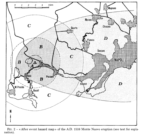
Figure in a journal article
After event hazard map of the A.D. 1538 Monte Nuevo eruption
Figure 2 in: Rosi, M., & Santacroce, R. (1984). Volcanic hazard assessment in the Phlegraean Fields: a contribution based on stratigraphic and historical data. Bulletin Volcanologique, 47(2), p. 359-370. https://doi.org/10.1007/BF01961567
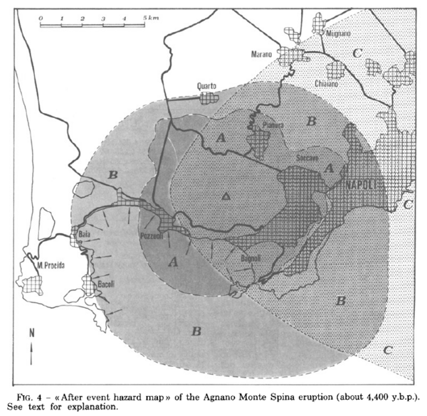
Figure in a journal article
After event hazard map of the Agnano Monte Spina eruption (about 4,400 y.b.p.)
Figure 4 in: Rosi, M. & Santacroce, R. (1984). Volcanic hazard assessment in the Phlegraean Fields: a contribution based on stratigraphic and historical data. Bulletin Volcanologique, 47(2), p. 359-370. https://doi.org/10.1007/BF01961567
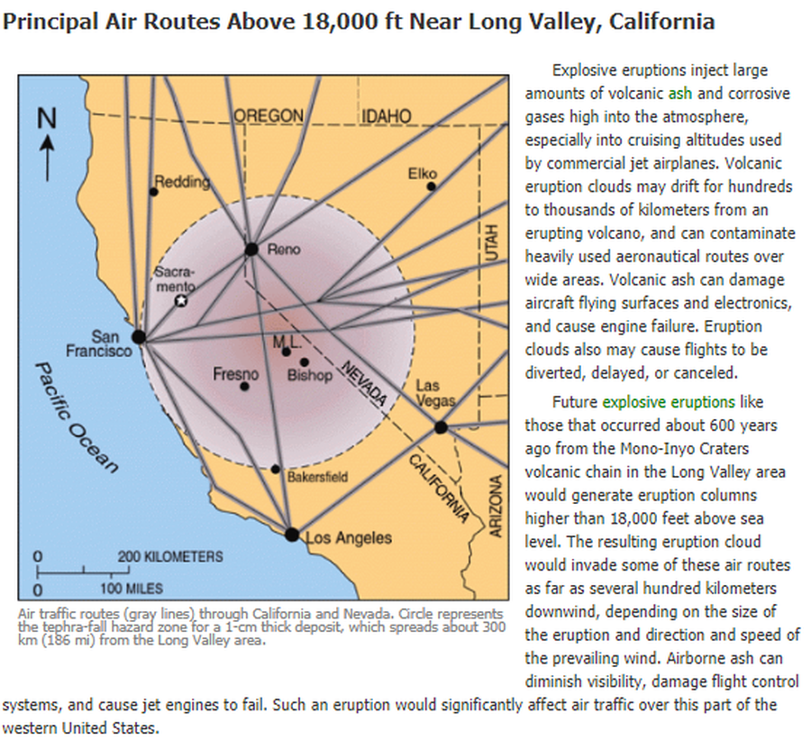
Official, Figure on website
Air traffic routes (gray lines) through California and Nevada. Circle represents the tephra-fall hazard zone for a 1-cm thick deposit, which spreads about 300 km (186 mi) from the Long Valley area.
U.S. Geological Survey (USGS). (2012). Air traffic routes (gray lines) through CA and Nevada. U.S. Geological Survey. Long Valley Caldera Hazards, Principal Air Routes Above 18,000 ft Near Long Valley, California. https://www.usgs.gov/volcanoes/long-valley-caldera/principal-air-routes-above-18000-ft-near-long-valley-california
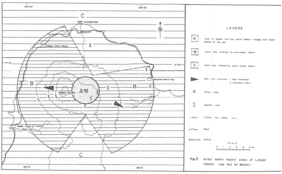
Official, Figure in hazard assessment
Airfall tephra hazard zones at Langila Volcano
Figure 5 in: Talai, B. (1987). Volcanic hazards at Langila volcano. Geological Survey of Papua New Guinea, Report 87/25
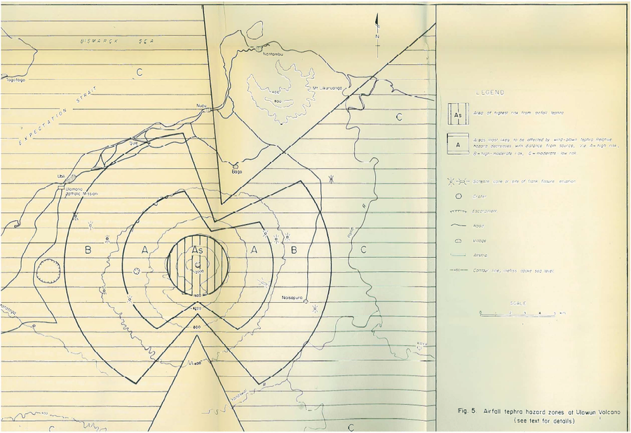
Official, Figure in hazard assessment
Airfall tephra hazard zones at Ulawun Volcano
Figure 5 in: McKee, C.O. (1983). Volcanic hazards at Uluwan volcano. Geological Survey of Papua New Guinea, Report 83/13, 1:100,000
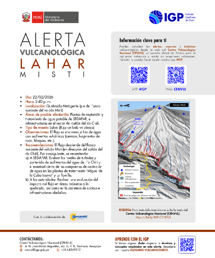
Official, Map in an information statement
Alerta Vulcanológica Lahar Misti
(Volcanological Alert Lahar Misti)
Centro Vulcanológico Nacional (CENVUL) Instituto Geofísico del Perú (IGP). (2026). Alerta Vulcanológica Lahar Misti. https://cenvul.igp.gob.pe/backend/uploads/alerta_misti_lahar_matagente_22_02_2026_b227415ea4.pdf
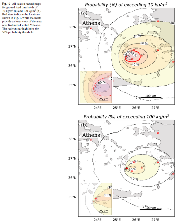
Figure in a journal article
All-season hazard maps for ground load thresholds of 10 kg/m² and 100 kg/m²
Figure 10 in: Pardini, F., Bevilacqua, A., Cerminara, M., Vitturi, M. D. M., Tadini, A., Neri, A., ... & Vougioukalakis, G. (2025). Explosive eruptions of Kolumbo Central Volcano and associated tephra fallout hazards assessment. Bulletin of Volcanology, 87(12), 116. https://doi.org/10.1007/s00445-025-01907-z
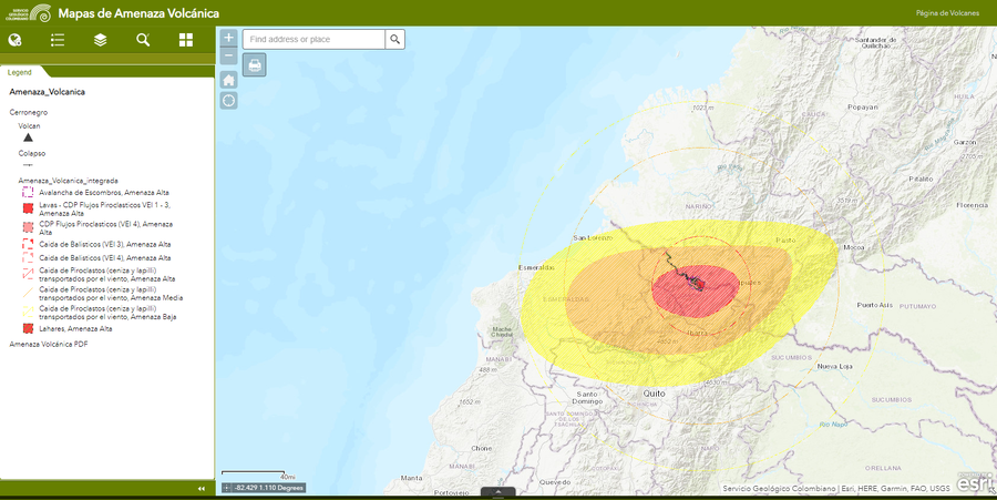
Official, Interactive web-based map
Amenaza Cerro Negro
(Cerro Negro hazards)
Servicio Geológico Colombiano (SGC). Amenaza Cerro-Negro.