
Advanced Search for Maps
Showing 51-60 of 252
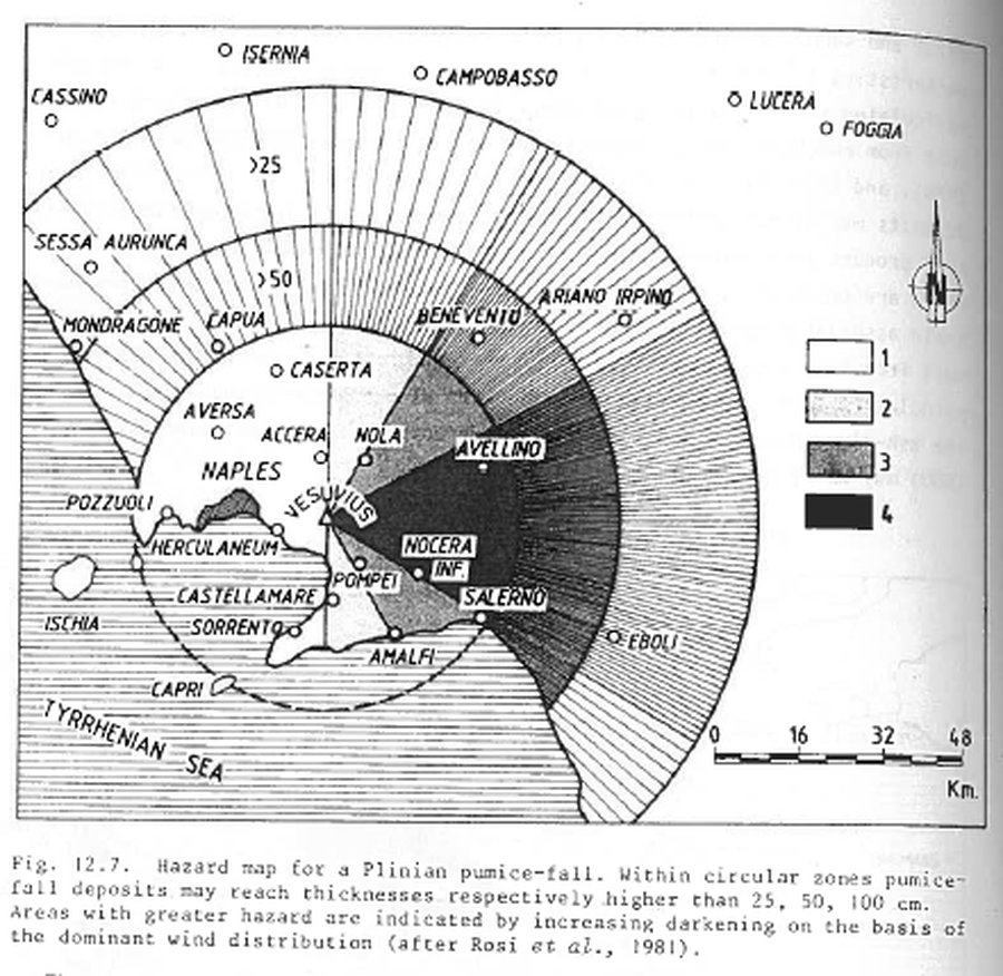
Figure in a journal article
Hazard map for a Plinian pumice-fall
Figure 12.7 in: Barberi, F., Rosi, M., Santacroce, R., & Sheridan, M.F. (1983). Volcanic hazard zonation: Mt. Vesuvius. In: Tazieff, H. & Sabroux, J.-C. (Eds.) Forecasting Volcanic Events, Elsevier, Amsterdam, p. 149-161.
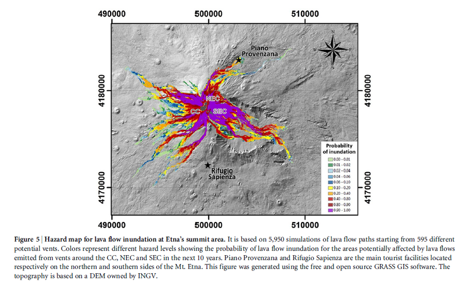
Figure in a journal article
Hazard map for lava flow inundation at Etna’s summit area.
Figure 5 in: Del Negro, C., Cappello, A., Neri, M., Bilotta, G., Hérault, A., & Ganci, G. (2013). Lava flow hazards at Mount Etna: constraints imposed by eruptive history and numerical simulations. Scientific Reports, 3(1). https://doi.org/10.1038/srep03493
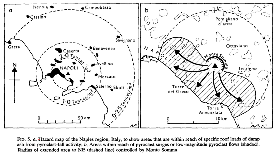
Figure in a journal article
Hazard map of the Naples region, Italy
Figure 5 in: Booth, B. (1979). Assessing volcanic risk. Journal of the Geological Society, 136(3), 331-340.
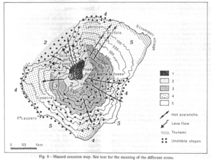
Figure in a journal article
Hazard zonation map
Figure 8 in: Barberi, F., Rosi, M., & Sodi, A. (1993). Volcanic hazard assessment at Stromboli based on review of historical data. Acta Vulcanologica, 3, 173-187. (Reprinted in: Nave, R., Isaia, R., Vilardo, G., & Barclay, J. (2010). Re-assessing volcanic hazard maps for improving volcanic risk communication: application to Stromboli Island, Italy. Journal of Maps, 6(1), p. 260-269.)
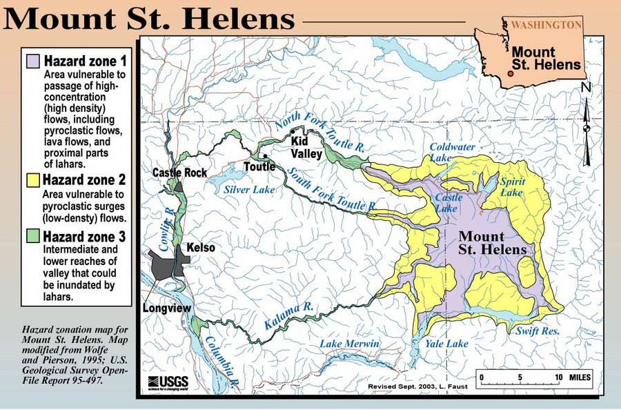
Official, Figure on website
Hazard Zonation Map for Mount St. Helens
Faust, L. (2003). Hazard zonation map for Mount St. Helens. U.S. Geological Survey. (Simplified from: Wolfe & Pierson 1995) (Reprinted in: Bluth, G. (Year Unknown). Mt. St. Helens Activity Update (+ 2004 events). Michigan Technological University, GE4150 Lecture. https://pages.mtu.edu/~gbluth/Teaching/GE4150/lecture_pdfs/L11_msh_seismic.pdf#page=2)

Figure in a journal article
Hazard zonation map showcasing the three preliminary hazard zones in Santorini.
Figure 7 in: Katsigera, A., Nomikou, P., & Pavlopoulos, K. (2024). A preliminary hazard assessment of Kolumbo Volcano (Santorini, Greece). GeoHazards, 5(3), 816-832. https://doi.org/10.3390/geohazards5030041
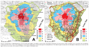
Figure in a journal article
Hazard zones 1 (highest hazard) to 6 (lowest hazard, but highest vulnerability) based on the volcanological parameters of past eruptions, high vent density areas, and present day morphology
Figure 6 in: Behncke, B., Neri, M., & Nagay, A. (2005). Lava flow hazard at Mount Etna (Italy): new data from a GIS-based study. In: Manga, M. and Ventura, G. Kinematics and Dynamics of Lava Flows. Geological Society of America, Special Paper 396. https://doi.org/10.1130/0-8137-2396-5.189
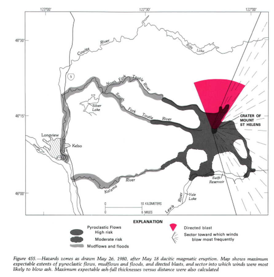
Official, Unknown format
Hazard zones as drawn May 26, 1980, after May 18 dacitic magmatic eruption.
Figure 455 in: Miller, C.D., Mullineaux, D.R. & Crandell, D.R. (1981). Hazards assessments at Mount St. Helens. In: Lipman, P. W. & Mullineaux, D. R. (Eds.) The 1980 eruptions of Mount St. Helens, Washington. U.S. Geological Survey, Professional Paper 1250, p. 789-802. https://doi.org/10.3133/pp1250

Official, Map in a booklet, long fact-sheet, or handbook
Hazard zones for debris flows, lahars, lava flows, and pyroclastic flows from Mount Rainier
Page 3 in: Driedger, C.L. & Scott, W.E. (2008). Mount Rainier: living safely with a volcano in your backyard. U.S. Geological Survey, Fact Sheet 2008-3062, 4 p. https://doi.org/10.3133/fs20083062
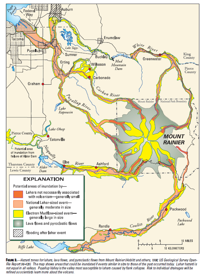
Official, Map in a booklet, long fact-sheet, or handbook
Hazard zones for lahars, lava flows, and pyroclastic flows from Mount Rainier
Figure 3 in: Driedger, C.L. & Scott, K.M. (2002). Mount Rainier: learning to live with volcanic risk. U.S. Geological Survey, Fact Sheet 034-02, 4 p. https://doi.org/10.3133/fs03402