
Advanced Search for Maps
Showing 11-20 of 1237
Official, Map sheet or poster
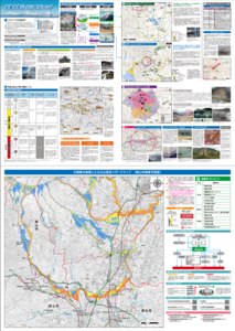
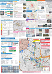
Adatarayama Volcano Disaster Prevention Map [Koriyama City]
Koriyama City. (2016). Adatarayama Volcano Disaster Prevention Map [Koriyama City].
Official, Map sheet or poster
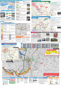
Adatarayama Volcano Disaster Prevention Map [Motomiya City]
Motomiya City. (2016). Adatarayama Volcano Disaster Prevention Map [Motomiya City].
Official, Map sheet or poster
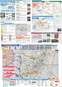
Adatarayama Volcano Disaster Prevention Map [Nihonmatsu City]
Nihonmatsu City. (2016). Adatarayama Volcano Disaster Prevention Map [Nihonmatsu City].
Official, Map sheet or poster
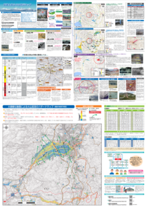
Adatarayama Volcano Disaster Prevention Map [Otama Village]
Fukushima City. (2016). Adatarayama Volcano Disaster Prevention Map [Fukushima City].
Official, Map sheet or poster
Adatarayama Volcano Disaster Prevention Map [Otama Village]
Otama Village. (2016). Adatarayama Volcano Disaster Prevention Map [Otama Village].
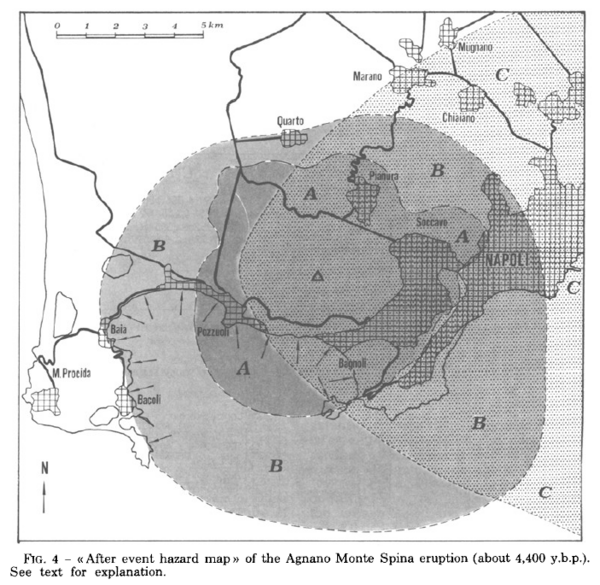
Figure in a journal article
After event hazard map of the Agnano Monte Spina eruption (about 4,400 y.b.p.)
Figure 4 in: Rosi, M. & Santacroce, R. (1984). Volcanic hazard assessment in the Phlegraean Fields: a contribution based on stratigraphic and historical data. Bulletin Volcanologique, 47(2), p. 359-370. https://doi.org/10.1007/BF01961567
Official, Figure in hazard assessment
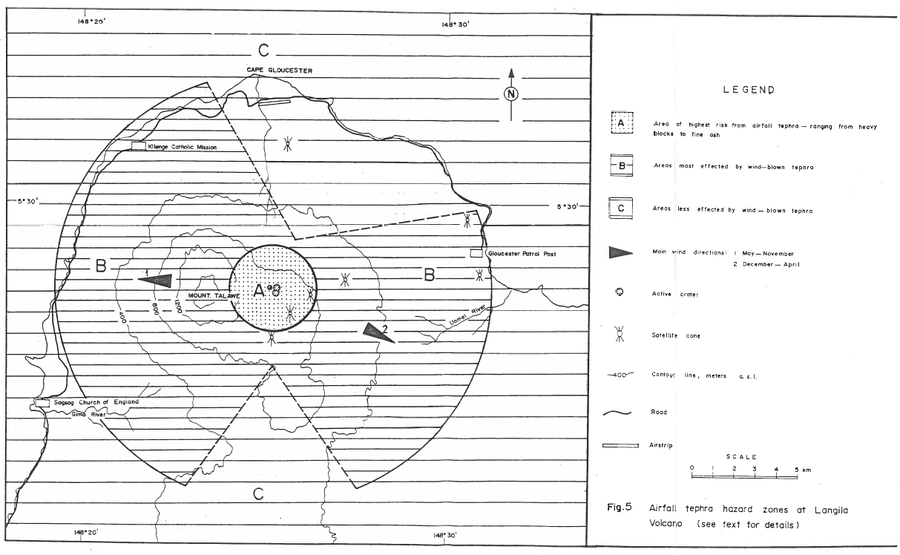
Airfall tephra hazard zones at Langila Volcano
Figure 5 in: Talai, B. (1987). Volcanic hazards at Langila volcano. Geological Survey of Papua New Guinea, Report 87/25
Official, Figure in hazard assessment
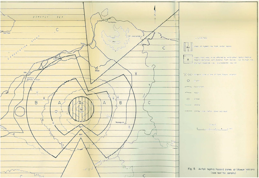
Airfall tephra hazard zones at Ulawun Volcano
Figure 5 in: McKee, C.O. (1983). Volcanic hazards at Uluwan volcano. Geological Survey of Papua New Guinea, Report 83/13, 1:100,000
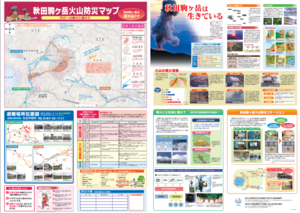
Official, Map sheet or poster
Akita Komagatake Volcano Disaster Prevention Map
Akita Prefecture. (2013). Akita Komagatake Volcano Disaster Prevention Map.
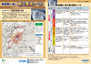
Official, Flyer, brochure, short fact-sheet, or handout
Akita-Komagatake Volcanic Alert Levels
Japan Meteorological Agency. (2016). Akita-Komagatake Volcanic Alert Levels. Volcano Monitoring and Warning Center, Volcano Division, Earthquake and Volcano Department.