
Advanced Search for Maps
Showing 21-22 of 22
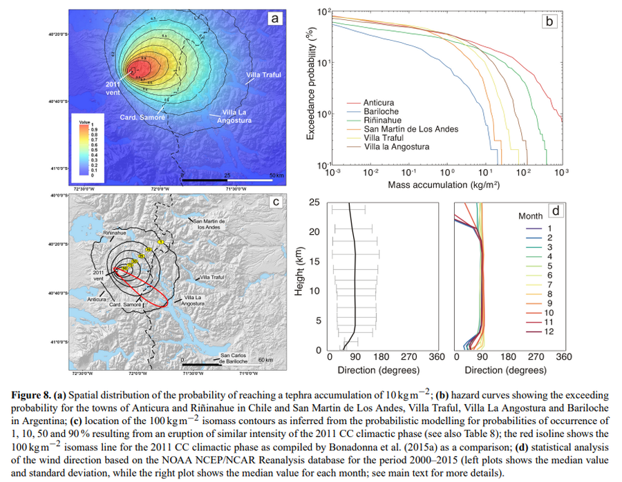
Figure in a journal article
Spatial distribution of the probability of reaching a tephra accumulation of 10 kg m−2
Figure 8 in: Elissondo, M., Baumann, V., Bonadonna, C., Pistolesi, M., Cioni, R., Bertagnini, A., Biass, S., Herrero, J.-C., & Gonzalez, R. (2016). Chronology and impact of the 2011 Cordón Caulle eruption, Chile. Natural Hazards and Earth System Sciences, 16(3), 675-704. https://doi.org/10.5194/nhess-16-675-2016, 2016
Official, Figure in hazard assessment
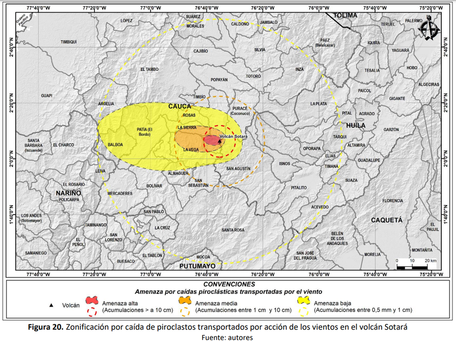
Zonificación por caída de piroclastos transportados por acción de los vientos en el volcán Sotará
(Zoning due to the fall of pyroclasts transported by the action of the winds at Sotará volcano)
Figure 20 in: Pulgarín, B., Zuluaga, I., Galarza, J. Muñoz, C. y Laverde, C. (2019). Memoria del mapa de amenaza volcánica del volcán Sotará. Popayán, Pasto y Bogotá: Servicio Geológico Colombiano.