
Advanced Search for Maps
Showing 21-30 of 1802
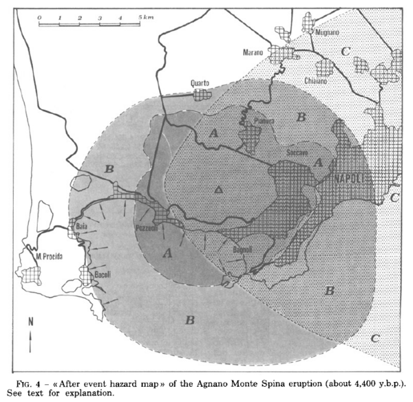
Figure in a journal article
After event hazard map of the Agnano Monte Spina eruption (about 4,400 y.b.p.)
Figure 4 in: Rosi, M. & Santacroce, R. (1984). Volcanic hazard assessment in the Phlegraean Fields: a contribution based on stratigraphic and historical data. Bulletin Volcanologique, 47(2), p. 359-370. https://doi.org/10.1007/BF01961567
Official, Figure on website
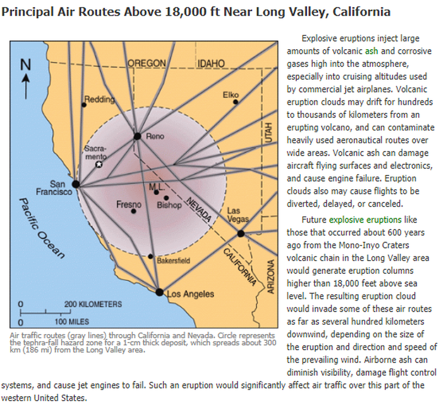
Air traffic routes (gray lines) through California and Nevada. Circle represents the tephra-fall hazard zone for a 1-cm thick deposit, which spreads about 300 km (186 mi) from the Long Valley area.
U.S. Geological Survey (USGS). (2012). Air traffic routes (gray lines) through CA and Nevada. U.S. Geological Survey. Long Valley Caldera Hazards, Principal Air Routes Above 18,000 ft Near Long Valley, California. https://www.usgs.gov/volcanoes/long-valley-caldera/principal-air-routes-above-18000-ft-near-long-valley-california
Official, Figure in hazard assessment
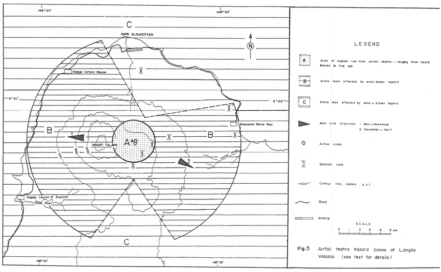
Airfall tephra hazard zones at Langila Volcano
Figure 5 in: Talai, B. (1987). Volcanic hazards at Langila volcano. Geological Survey of Papua New Guinea, Report 87/25
Official, Figure in hazard assessment
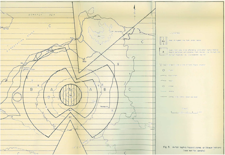
Airfall tephra hazard zones at Ulawun Volcano
Figure 5 in: McKee, C.O. (1983). Volcanic hazards at Uluwan volcano. Geological Survey of Papua New Guinea, Report 83/13, 1:100,000
Official, Map sheet or poster
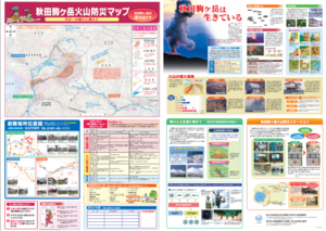
Akita Komagatake Volcano Disaster Prevention Map
Akita Prefecture. (2013). Akita Komagatake Volcano Disaster Prevention Map.
Official, Flyer, brochure, short fact-sheet, or handout
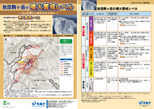
Akita-Komagatake Volcanic Alert Levels
Japan Meteorological Agency. (2016). Akita-Komagatake Volcanic Alert Levels. Volcano Monitoring and Warning Center, Volcano Division, Earthquake and Volcano Department.
Official, Flyer, brochure, short fact-sheet, or handout
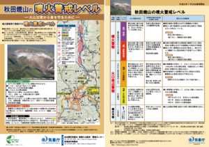
Akita-Yakeyama Volcanic Alert Levels
Japan Meteorological Agency. (2016). Akita-Yakeyama Volcanic Alert Levels. Volcano Monitoring and Warning Center, Volcano Division, Earthquake and Volcano Department.
Official, Map in a booklet, long fact-sheet, or handbook
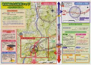
Akita-Yakeyama Volcanic Disaster Prevention Map
Akita Prefecture. (2002). Akita-Yakeyama Volcanic Disaster Prevention Map.
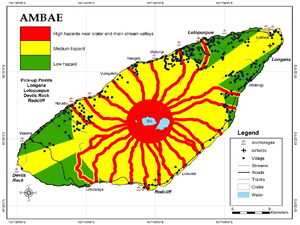
Figure in a journal article
Ambae
Cronin, S.J., Gaylord, D.R., Charley, D., Alloway, B.V., Wallez, S., & Esau, J.W. (2004). Participatory methods of incorporating scientific with traditional knowledge for volcanic hazard management on Ambae Island, Vanuatu. Bulletin of volcanology, 66(7), p. 652-668. https://doi.org/10.1007/s00445-004-0347-9. (Reprinted in: Cronin, S. J., & Németh, K., Stewart, R.B. (2006). Volcanic hazards planning on rifting island and fissure volcanoes. Joint Conference of the Geological Society of New Zealand and the New Zealand Geophysical Society.)
Official, Map in an information statement
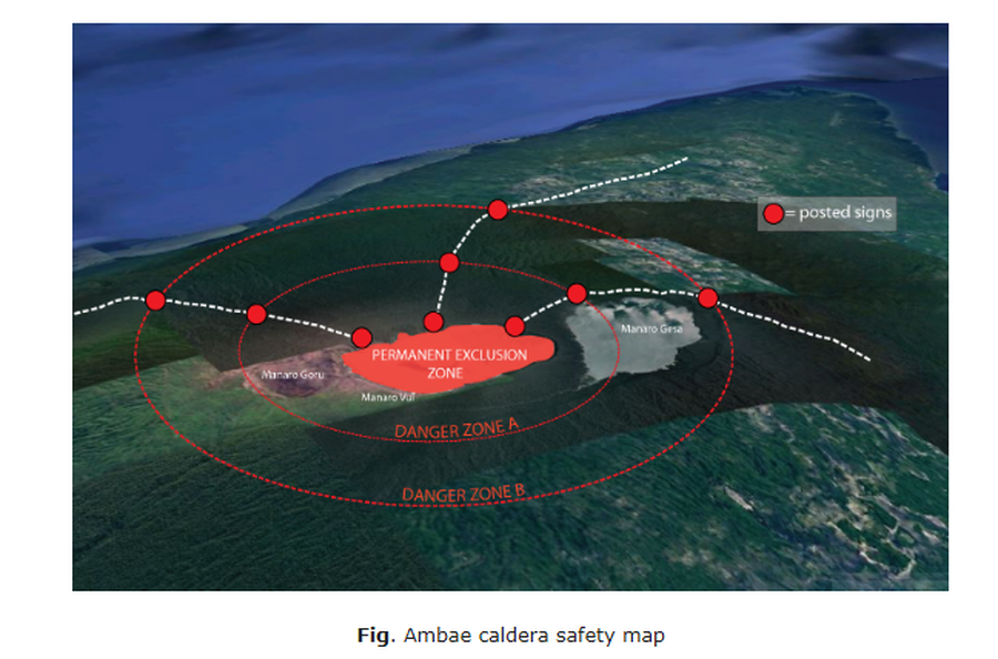
Ambae caldera safety map
Figure 1 in: Vanuatu Meteorology & Geo-Hazards Department. (2020). Vanuatu Volcano Alert Bulletin No. 4 - Ambae Activity, Thursday May 28th 2020.