
Advanced Search for Maps
Showing 61-70 of 236
Official, Figure on website
Hakone-machi volcanic disaster prevention map whole area
Hakone-machi Town. (2004). Entire volcano disaster prevention map. Hakone Volcano Disaster Prevention Map. https://www.town.hakone.kanagawa.jp/index.cfm/10,1218,46,167,html
Official, Hiking or trail map
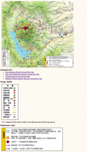
Hakusan volcanic disaster prevention map (mobile version for climbers)
Gifu Prefecture Hakusan Volcano Disaster Prevention Council. (2018). Hakusan volcanic disaster prevention map (mobile version for climbers).
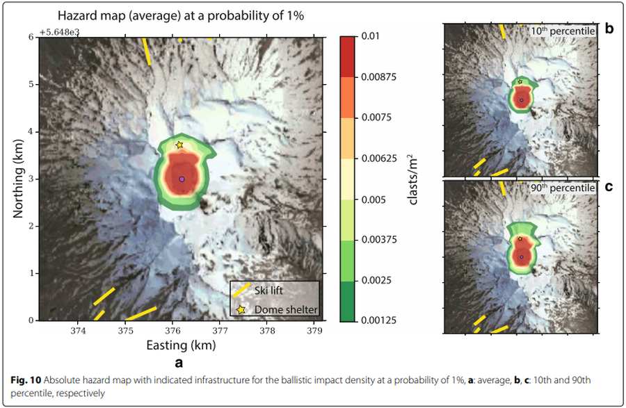
Figure in a journal article
Hazard map (average) at a probability of 1%
Figure 10 in: Strehlow, K., Sandri, L., Gottsmann, J. H., Kilgour, G., Rust, A. C., & Tonini, R. (2017). Phreatic eruptions at crater lakes: occurrence statistics and probabilistic hazard forecast. Journal of Applied Volcanology, 6(1), 4. https://doi.org/10.1186/s13617-016-0053-2
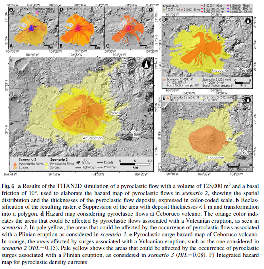
Figure in a journal article
Hazard map considering pyroclastic flows at Ceboruco volcano
Figure 6 in: Sieron, K., Ferrés, D., Siebe, C., Constantinescu, R., Capra, L., Connor, C., Connor, L., Groppelli, G. & Zuccolotto, K.G. (2019). Ceboruco hazard map: part II—modeling volcanic phenomena and construction of the general hazard map. Natural Hazards, 96(2), p. 893-933. https://doi.org/10.1007/s11069-019-03577-5
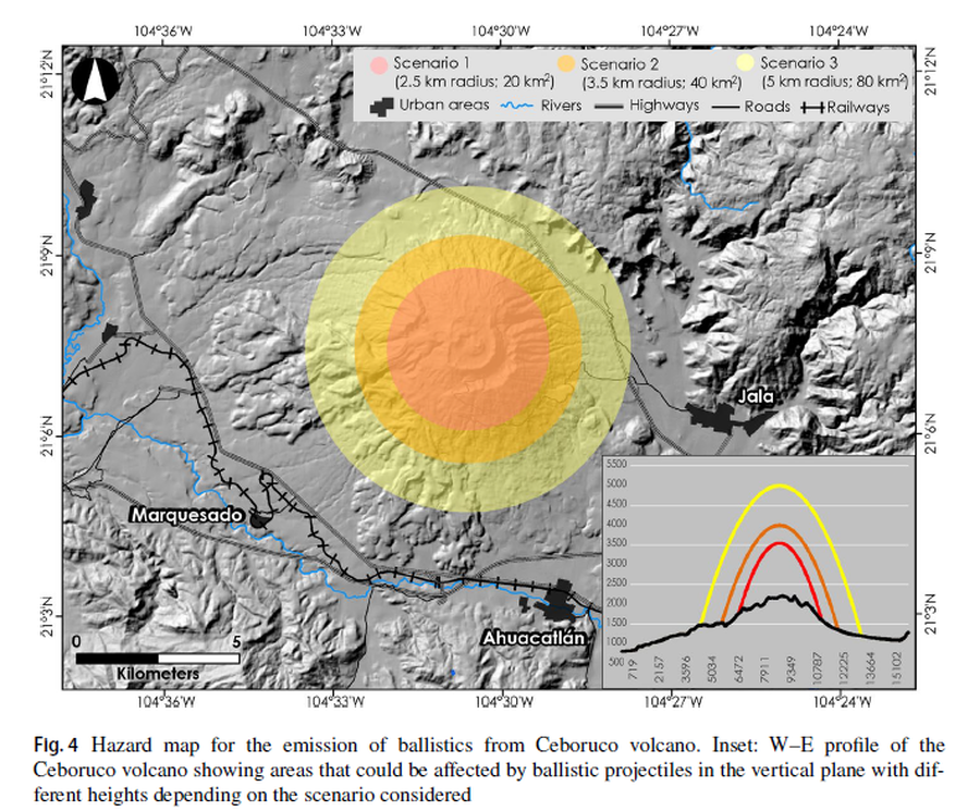
Figure in a journal article
Hazard map for the emission of ballistics from Ceboruco volcano
Figure 4 in: Sieron, K., Ferrés, D., Siebe, C., Constantinescu, R., Capra, L., Connor, C., Connor, L., Groppelli, G. & Zuccolotto, K.G. (2019). Ceboruco hazard map: part II—modeling volcanic phenomena and construction of the general hazard map. Natural Hazards, 96(2), p. 893-933. https://doi.org/10.1007/s11069-019-03577-5
Official, Map sheet or poster
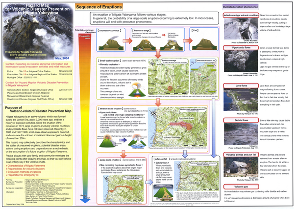
Hazard Map for Volcanic Disaster Prevention in Niigata Yakekama
Niigata Prefecture & Itoigawa City. (2004). Hazard Map for Volcanic Disaster Prevention in Niigata Yakayama.
Official, Map in a booklet, long fact-sheet, or handbook
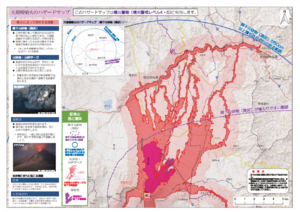
Hazard map of large-scale eruption
Asamayama Volcanic Disaster Prevention Committee. (2019). Asamayama Volcanic Disaster Prevention Map. Tsumagoi Village.
Official, Map sheet or poster
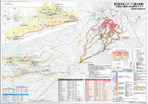
Higashikawa Town Flood Hazard (largest scale) and Daisetsu-san (Asahi-dake) Volcano Disaster Prevention Map
Higashikawa Town. (2020). Higashikawa Town Flood Hazard (largest scale) and Daisetsu-san (Asahi-dake) Volcano Disaster Prevention Map. Hokkaido Map Co., Ltd. Asahikawa Branch.
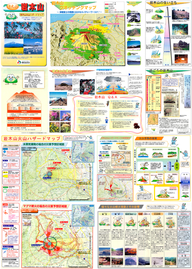
Official, Map sheet or poster
Iwakisan Volcano Hazard Map
Aomori Prefecture. (2002). Active Volcano Iwakisan - Iwakisan Volcanic Hazard Map.
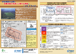
Official, Flyer, brochure, short fact-sheet, or handout
Izu-Tobu Volcanoes Volcanic Alert Levels
Japan Meteorological Agency. (2016). Izu-Tobu Volcano Volcanic Alert Levels. Volcano Monitoring and Warning Center, Volcano Division, Earthquake and Volcano Department.