
Advanced Search for Maps
Showing 41-50 of 236
Official, Map sheet or poster
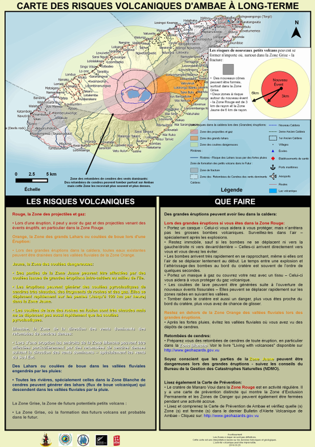
Carte des Risques Volcaniques d'Ambae à Long-terme
(Ambae Long-Term Background Volcanic Hazards Map)
Vanuatu Meteorology & Geo-Hazards Department. (2019). Carte des Risques Volcaniques d'Ambae à Long-terme. Government of Vanuatu, Vanuatu Meteorology & Geo-Hazards Department, Vanuatu National Disaster Risk Management Office, New Zealand Foreign Affairs & Trade Aid Programme, GNS Science.
Official, Map sheet or poster
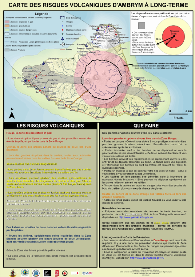
Carte des Risques Volcaniques d'Ambrym à Long-terme
(Ambrym Long-Term Background Volcanic Hazards Map)
Vanuatu Meteorology & Geo-Hazards Department. (2016). Carte des Risques Volcaniques d'Ambrym à Long-terme. Government of Vanuatu, Vanuatu Meteorology & Geo-Hazards Department, Vanuatu National Disaster Risk Management Office, New Zealand Foreign Affairs & Trade Aid Programme, GNS Science, The Vanuatu Red Cross Society, Croix Rouge Francaise, USAID.
Official, Figure in hazard assessment
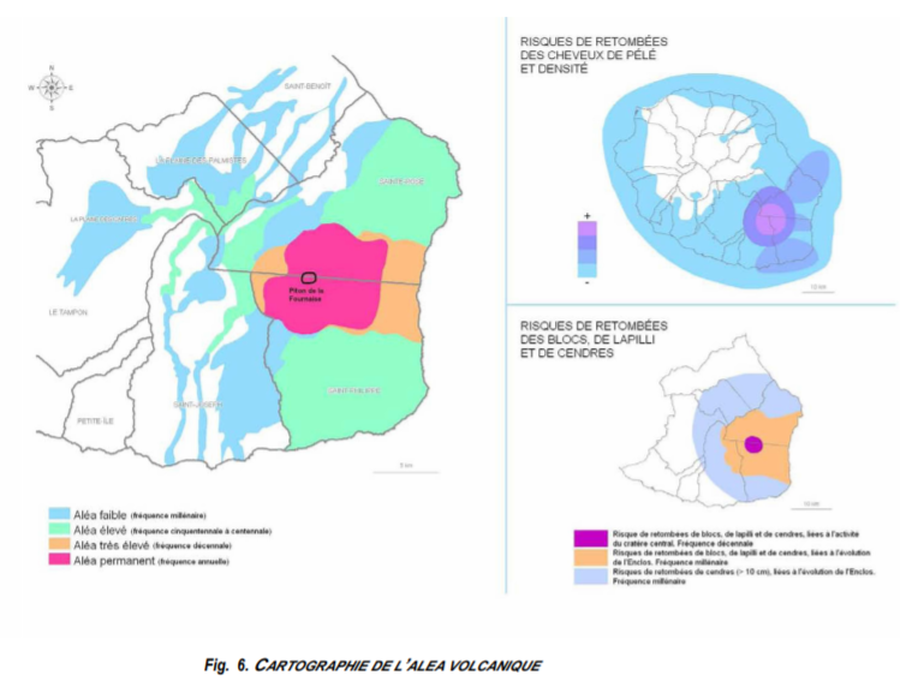
Cartographie de l’Alea Volcanique
(Mapping of the Volcanic Hazard)
Figure 6 in: Préfet de la Région Réunion. (2012). Schema de Prevention des Risques Naturels de la Réunion. Diagnostic et Programme d’Actions.
Soufrière St. Vincent, Saint Vincent and the Grenadines
Official, Figure on website
Chateaubelair & Fitz Hughes Community Multi-Hazard Map
The University of the West Indies Seismic Research Centre (UWI-SRC) and National Emergency Management Organization (NEMO). (2021). Chateaubelair & Fitz Hughes Community Multi-Hazard Map. https://uwiseismic.com/wp-content/uploads/2021/10/Chateau-fitzhughes_Hazard-Map-scaled.jpg
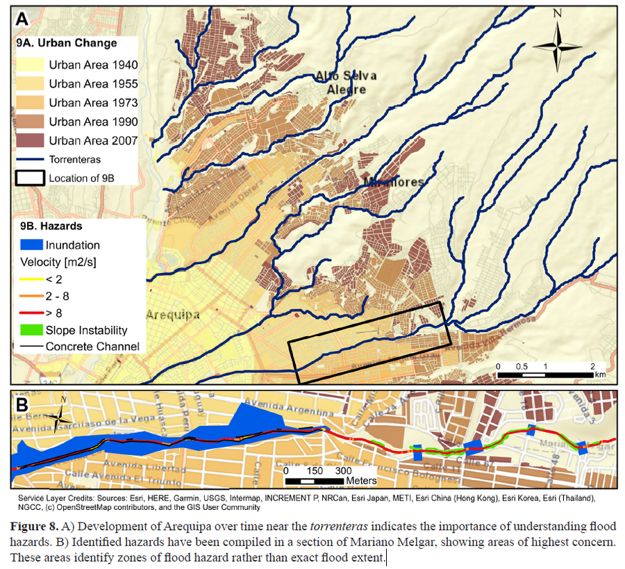
Figure in a journal article
Development of Arequipa over time near the torrenteras indicates the importance of understanding flood hazards
Figure 8 in: Mazer, K. E., Tomasek, A. A., Daneshvar, F., Bowling, L. C., Frankenberger, J. R., McMillan, S. K., Novoa, H.M., & Zeballos‐Velarde, C. (2021). Integrated hydrologic and hydraulic analysis of torrential flood hazard in Arequipa, Peru. Journal of Contemporary Water Research & Education, 171(1), 93-110. https://doi.org/10.1111/j.1936-704X.2020.3347.x
Official, Figure on website
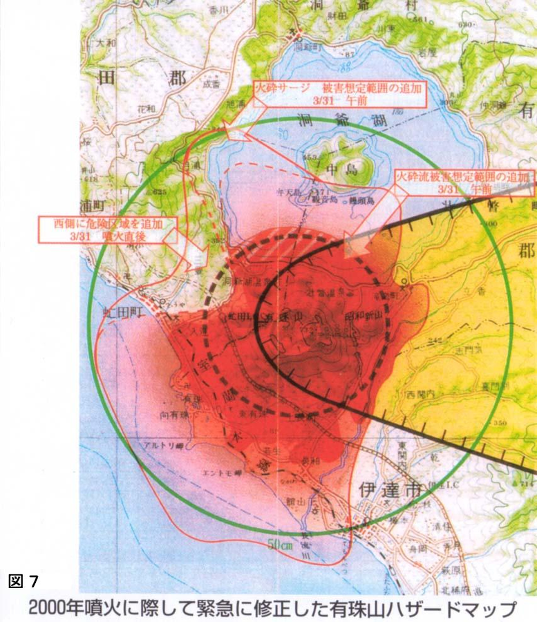
Emergency hazard map of Mt. usu revised after the 2000 eruption
Figure 7 in: Nakao, M. (2005). Eruption of Mt Usu, March 31 st 2000, at Mt Usu in Hokkaido. In: Failure Knowledge Database, 100 Selected Cases. http://www.shippai.org/fkd/en/cfen/CA1000619.html. Reprinted from: The Hokkaido Shimbun Press. (2002) 2000-Nen Usu-Zan Funka (The 2000 Mt. Usu Eruption). The Hokkaido Shimbun Press.
Official, Map in a booklet, long fact-sheet, or handbook
Enlarged view around Yakeyama
Akita Prefecture. (2002). Akita-Yakeyama Volcanic Disaster Prevention Map.
Official, Flyer, brochure, short fact-sheet, or handout
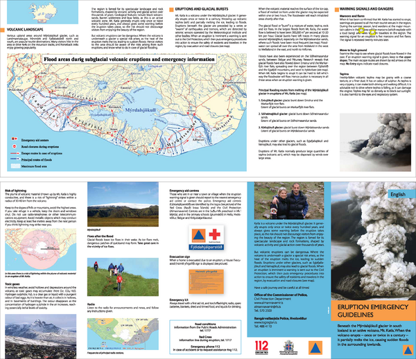
Eruption emergency guidelines – Katla in Mýrdalsjökull: English
Almannavarnir. (2017). Eruption emergency guidelines - Katla in Mýrdalsjökull.

Official, Sign or billboard
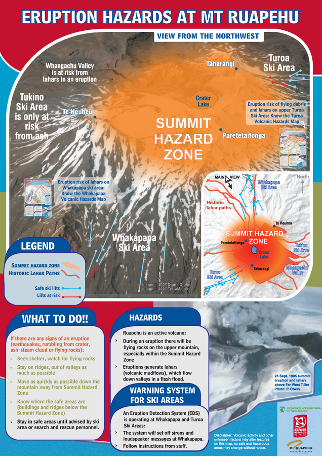
Eruption Hazards at Mt. Ruapehu
GNS Science (compiler). (2007). Eruption Hazards at Mt. Ruapehu. 8 October 2007.
Official, Sign or billboard
Eruption Hazards at Mt. Ruapehu
GNS Science (compiler). (2008). Eruption Hazards at Mt. Ruapehu.