
Advanced Search for Maps
Showing 11-20 of 924
Official, Map sheet or poster
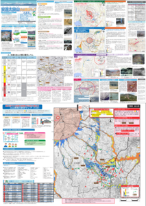
Adatarayama Volcano Disaster Prevention Map [Otama Village]
Otama Village. (2016). Adatarayama Volcano Disaster Prevention Map [Otama Village].
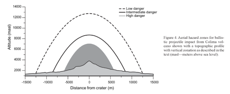
Figure in a journal article
Aerial hazard zones for ballistic impact from Colima volcano shown with a topographic profile with vertical zonation as described in the text
Figure 4 in: Alatorre-Ibargüengoitia, M.A., Delgado-Granados, H., & Farraz-Montes, I.A. (2006). Hazard zoning for ballistic impact during volcanic explosions at Volcán de Fuego de Colima (México). In: Siebe, C., Macías Gerardo, J.L., Aguirre-Díaz, J. (Eds.). Neogene-Quaternary Continental Margin Volcanism: A perspective from México. Geological Society of America, Special Papers 402, p. 209-216. https://doi.org/10.1130/2006.2402(09)
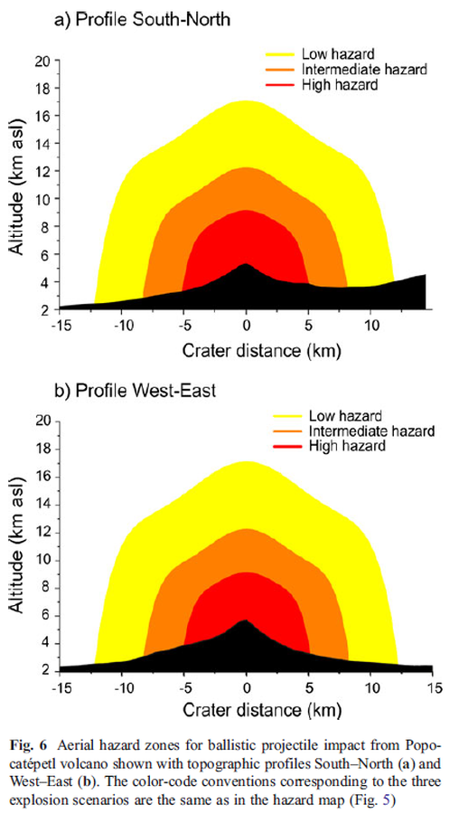
Figure in a journal article
Aerial hazard zones for ballistic projectile impact from Popocatépetl volcano shown with topographic profiles
Figure 6 in: Alatorre-Ibargüengoitia, M. A., Delgado-Granados, H., & Dingwell, D. B. (2012). Hazard map for volcanic ballistic impacts at Popocatépetl volcano (Mexico). Bulletin of Volcanology, 74(9), p. 2155-2169. https://doi.org/10.1007/s00445-012-0657-2
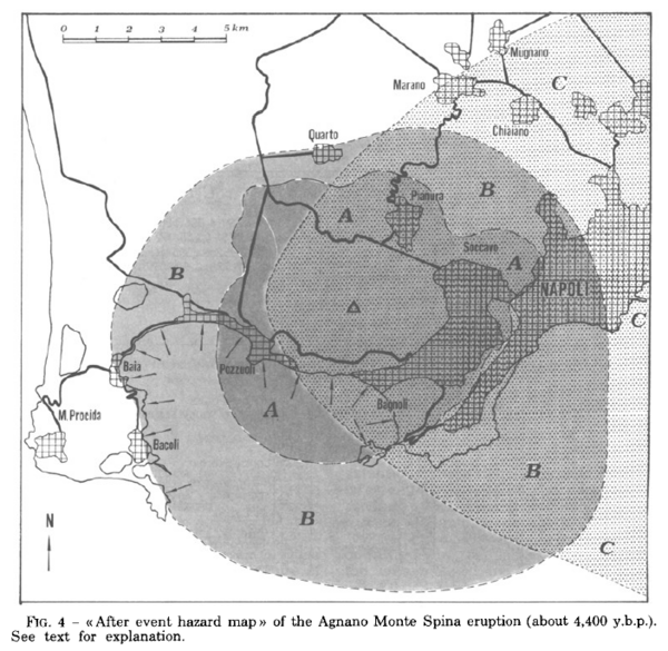
Figure in a journal article
After event hazard map of the Agnano Monte Spina eruption (about 4,400 y.b.p.)
Figure 4 in: Rosi, M. & Santacroce, R. (1984). Volcanic hazard assessment in the Phlegraean Fields: a contribution based on stratigraphic and historical data. Bulletin Volcanologique, 47(2), p. 359-370. https://doi.org/10.1007/BF01961567
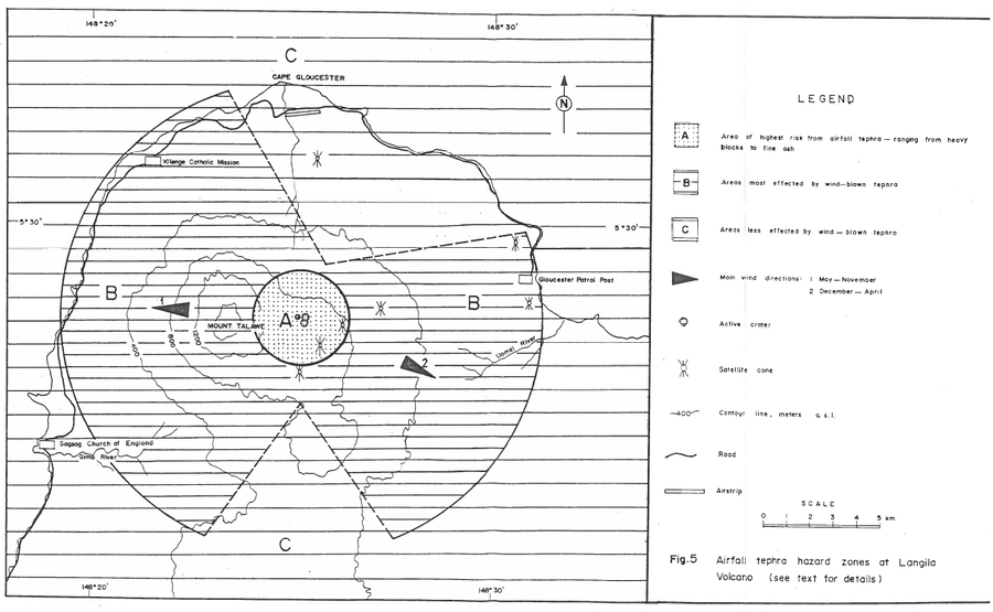
Official, Figure in hazard assessment
Airfall tephra hazard zones at Langila Volcano
Figure 5 in: Talai, B. (1987). Volcanic hazards at Langila volcano. Geological Survey of Papua New Guinea, Report 87/25
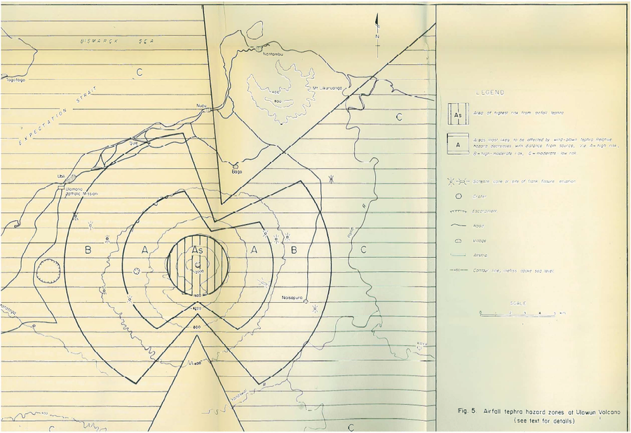
Official, Figure in hazard assessment
Airfall tephra hazard zones at Ulawun Volcano
Figure 5 in: McKee, C.O. (1983). Volcanic hazards at Uluwan volcano. Geological Survey of Papua New Guinea, Report 83/13, 1:100,000
Official, Map sheet or poster
Akita Komagatake Volcano Disaster Prevention Map
Akita Prefecture. (2013). Akita Komagatake Volcano Disaster Prevention Map.
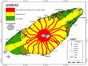
Figure in a journal article
Ambae
Cronin, S.J., Gaylord, D.R., Charley, D., Alloway, B.V., Wallez, S., & Esau, J.W. (2004). Participatory methods of incorporating scientific with traditional knowledge for volcanic hazard management on Ambae Island, Vanuatu. Bulletin of volcanology, 66(7), p. 652-668. https://doi.org/10.1007/s00445-004-0347-9. (Reprinted in: Cronin, S. J., & Németh, K., Stewart, R.B. (2006). Volcanic hazards planning on rifting island and fissure volcanoes. Joint Conference of the Geological Society of New Zealand and the New Zealand Geophysical Society.)
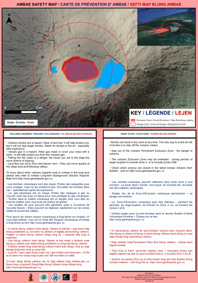
Official, Map sheet or poster
Ambae Safety Map
Vanuatu Meteorology & Geo-Hazards Department. (2019). Ambae Safety Map. Government of Vanuatu, Vanuatu Meteorology & Geo-Hazards Department, Vanuatu National Disaster Risk Management Office, New Zealand Foreign Affairs & Trade Aid Programme, GNS Science.
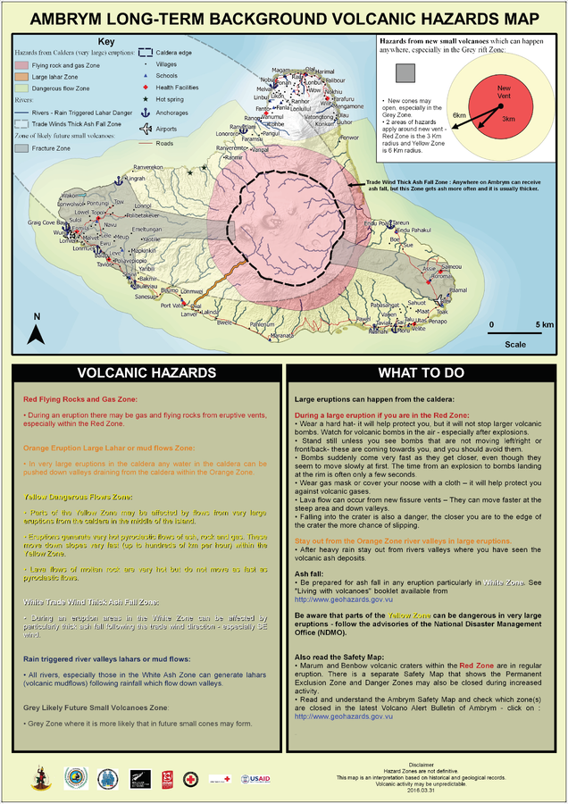
Official, Map sheet or poster
Ambrym Long-Term Background Volcanic Hazards Map
Vanuatu Meteorology & Geo-Hazards Department. (2016). Ambrym Long-Term Background Volcanic Hazards Map. Government of Vanuatu, Vanuatu Meteorology & Geo-Hazards Department, Vanuatu National Disaster Risk Management Office, New Zealand Foreign Affairs & Trade Aid Programme, GNS Science, The Vanuatu Red Cross Society, Croix Rouge Francaise, USAID.