
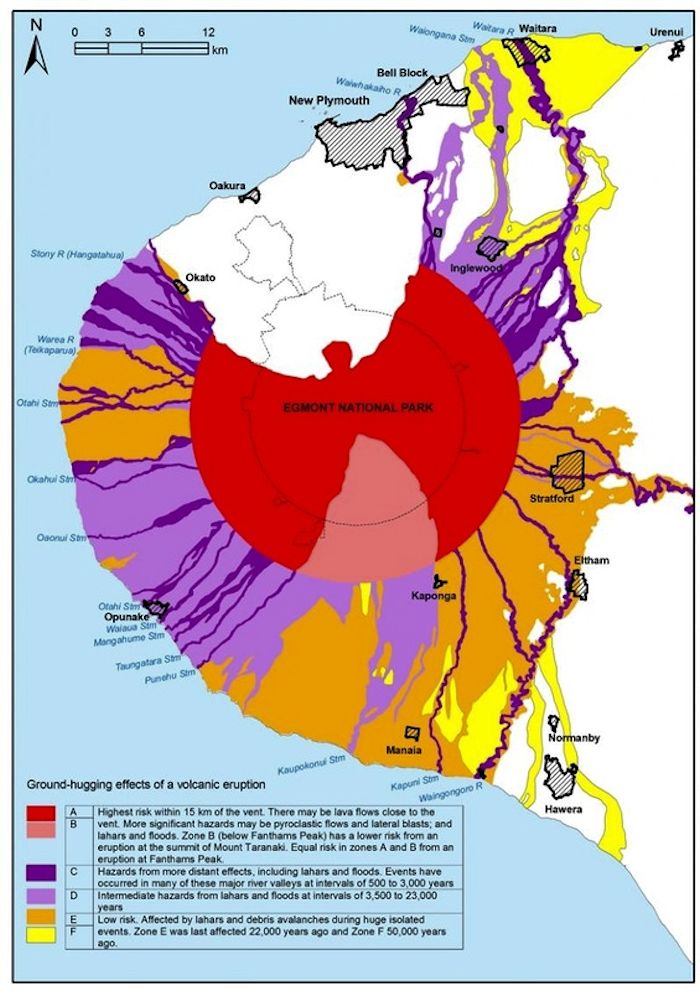
Ground hugging effects of a volcanic eruption
Taranaki, New Zealand, 2004
Taranaki Regional Council. (2004). Civil Defence Emergency Management, Group Plan for Taranaki. Stratford.
This map was produced by an official agency, but is NOT the most recent, most complete, or main operational map.
For the current operational hazard map, please consult the proper institutional authorities.
Click on image for full-size map. If link seems broken, try the archived version.
Taranaki Regional CouncilMap Set
Other Maps In Set: