
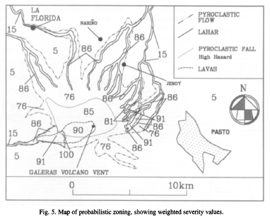
Map of probabilistic zoning, showing weighted severity values
Galeras, Colombia, 1997
Figure 5 in: Artunduaga, A.D.H., & Jiménez, G.P.C. (1997). Third version of the hazard map of Galeras Volcano, Colombia. Journal of Volcanology and Geothermal research, 77(1-4), p. 89-100. https://doi.org/10.1016/S0377-0273(96)00088-1
This map was produced by an official agency, but is NOT the most recent, most complete, or main operational map.
For the current operational hazard map, please consult the proper institutional authorities.
Click on image for full-size map.
Map Set
Artunduaga, A.D.H., & Jiménez, G.P.C. (1997). Third version of the hazard map of Galeras Volcano, Colombia. Journal of Volcanology and Geothermal research, 77(1-4), p. 89-100. https://doi.org/10.1016/S0377-0273(96)00088-1
https://doi.org/10.1016/S0377-0273(96)00088-1
Other Maps In Set:
- Mapa de Amenaza Volcánica del Galeras, Tercera Version
- High Hazard Area of Pyroclastic Flows. High Hazard Area of Lahars. Area Affedted by Pyroclastic Falls. High Hazard Area of Lavas Flows.
- Map of potencial volcanic hazards of Galeras volcano, with three zones of hazards: high, medium and low
- Modeling of hazard for shock waves from Galeras using the expansion wave theory of Prandl-Meyer
- Modeling of hazard for ballistic fragments using information collected from the eruptions that have occurred during the last seven years of surveillance of Galeras