
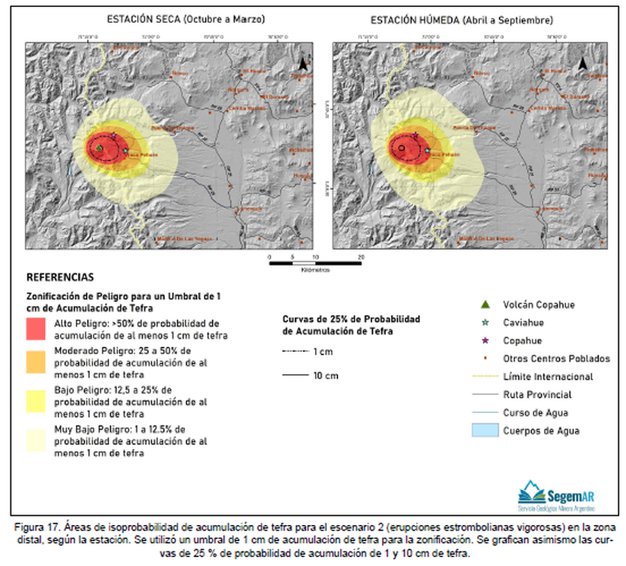
Áreas de isoprobabilidad de acumulación de tefra para el escenario 2 (erupciones estrombolianas vigorosas) en la zona distal, según la estación
Tephra accumulation isoprobability areas for scenario 2 (vigorous Strombolian eruptions) in the distal zone, according to the season
Copahue, Chile-Argentina, 2023
Figure 17 in: Kaufman, J. F., Elissondo, M., Sruoga, P., Yamín, M. G. 2023. Peligrosidad del volcán Copahue. Provincia del Neuquén, República Argentina. Serie de Contribuciones Técnicas Peligrosidad Geológica N° 24. 51 pp. Buenos Aires, Servicio Geológico Minero Argentino (SEGEMAR). Instituto de Geología y Recursos Minerales.
This map was produced by an official agency, but may not be the most recent, most complete, or main operational map.
For the current operational hazard map, please consult the proper institutional authorities.
Click on thumbnail for full-size map. We do not have copyright permission to display the full-size image. If you are the copyright holder and wish to provide copyright, please contact us at admin@volcanichazardmaps.org. If link seems broken, try the archived version.
Kaufman, J. F., Elissondo, M., Sruoga, P., Yamín, M. G. 2023. Peligrosidad del volcán Copahue. Provincia del Neuquén, República Argentina. Serie de Contribuciones Técnicas Peligrosidad Geológica N° 24. 51 pp. Buenos Aires, Servicio Geológico Minero Argentino (SEGEMAR). Instituto de Geología y Recursos Minerales.Map Set
https://repositorio.segemar.gov.ar/handle/308849217/4308
Other Maps In Set: