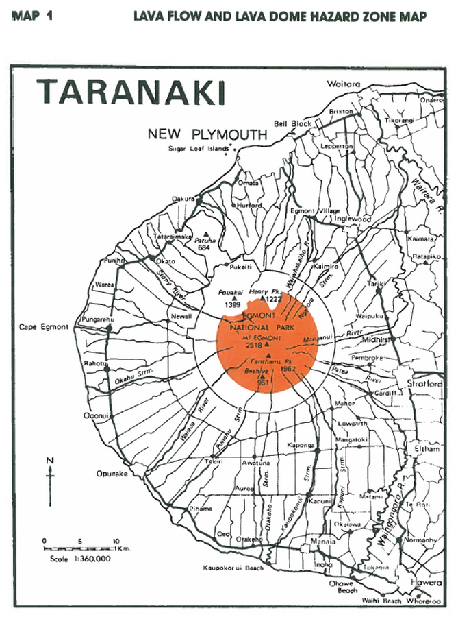
Lava Flow and Lava Dome Hazard Zone Map
Taranaki, New Zealand, 1993
Map 1, Page 15 in: Neall, V.E. & Alloway, B.V. (1993). Volcanic hazards at Egmont volcano. Volcanic Hazards Working Group of the Scientific Advisory Committee, Ministry of Civil Defence. Volcanic Hazards Information Series, Number One, 2nd ed. 31 p.
This map was produced by an official agency, but is NOT the most recent, most complete, or main operational map.
For the current operational hazard map, please consult the proper institutional authorities.

Click on image for full-size map. If link seems broken, try the archived version.
Map Data
Map ID 983 Hazard Process(es) Lava dome-related hazards; Lava flows Hazard Zone Presentation Single hazard: A single hazard process is represented on a main map panel Temporal Scale Background, or long-term, map Spatial Scale Volcano and surrounding area Publication Format Figure in a hazard assessment or mitigation plan Zonation Method(s) Geologic history Zonation Model(s) Scenario(s) Considered No scenarios were discernable from the map Hazard Zone Label(s) Hazard process name Probability Definition(s) No probability definition was discernable from the map Purpose Hazard awareness: Intended for educating the audience about the extent and probability of volcanic hazard Audience General public and/or media Language(s) English Basemap(s) Simple or sketch map Basemap overlay(s) Street map Diemsionality Planimetric (2D or map) view Color Scheme Single color
