
Advanced Search for Maps
Showing 1-3 of 3
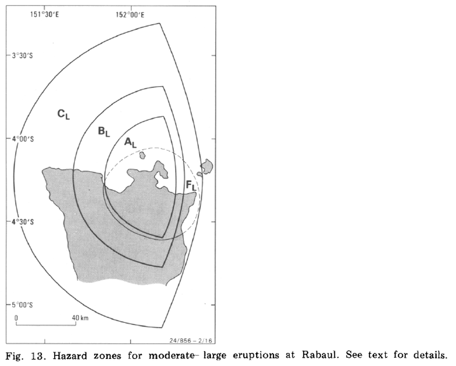
Official, Figure in a journal article
Hazard zones for moderate-large eruptions at Rabaul
Figure 13 in: McKee, C. O., Johnson, R. W., Lowenstein, P. L., Riley, S. J., Blong, R. J., De Saint Ours, P., & Talai, B. (1985). Rabaul caldera, Papua New Guinea: volcanic hazards, surveillance, and eruption contingency planning. Journal of Volcanology and Geothermal Research, 23(3-4), p. 195-237. https://doi.org/10.1016/0377-0273(85)90035-6
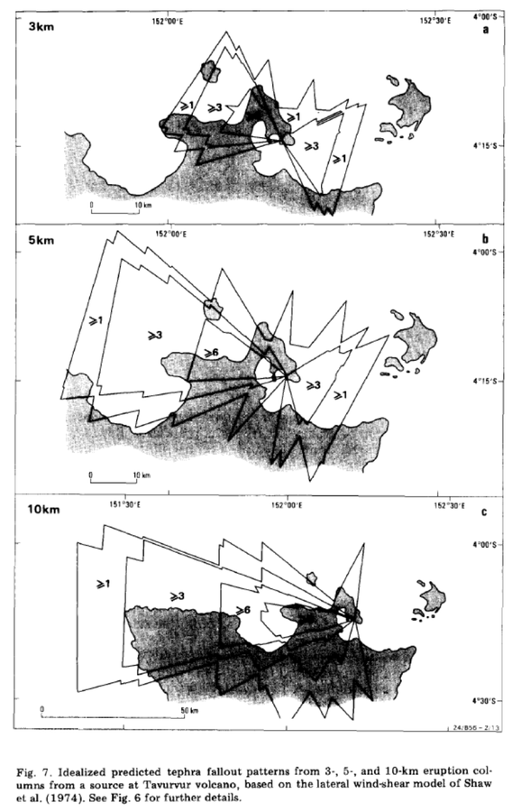
Official, Figure in a journal article
Idealized predicted tephra fallout patterns from 3-, 5-, and 10-km eruption columns from a source at Tavurvur volcano
Figure 7 in: McKee, C. O., Johnson, R. W., Lowenstein, P. L., Riley, S. J., Blong, R. J., De Saint Ours, P., & Talai, B. (1985). Rabaul caldera, Papua New Guinea: volcanic hazards, surveillance, and eruption contingency planning. Journal of Volcanology and Geothermal Research, 23(3-4), p. 195-237. https://doi.org/10.1016/0377-0273(85)90035-6
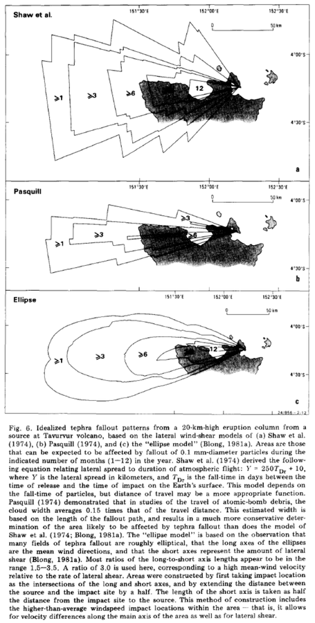
Official, Figure in a journal article
Idealized tephra fallout patterns from a 20-km-high eruption column from a source at Tavurvur volcano
Figure 6 in: McKee, C. O., Johnson, R. W., Lowenstein, P. L., Riley, S. J., Blong, R. J., De Saint Ours, P., & Talai, B. (1985). Rabaul caldera, Papua New Guinea: volcanic hazards, surveillance, and eruption contingency planning. Journal of Volcanology and Geothermal Research, 23(3-4), p. 195-237. https://doi.org/10.1016/0377-0273(85)90035-6