
Advanced Search for Maps
Showing 181-190 of 726
Official, Figure in hazard assessment
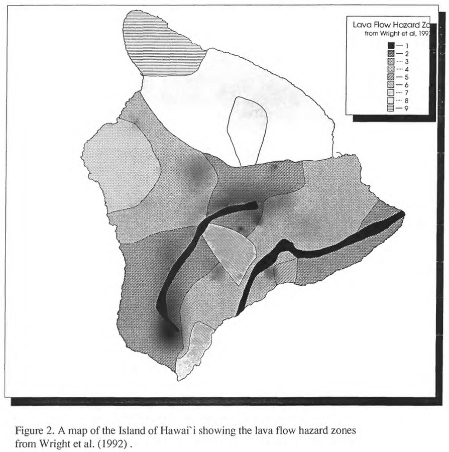
Lava Flow Hazard Zones
Figure 2 in: Kauahikaua, J. P., Moore, R. B., & Delaney, P. (1994). Volcanic activity and ground deformation hazard analysis for the Hawaii geothermal project environmental impact statement. US Geological Survey, Open File Report 94-553. 44 p. https://doi.org/10.3133/ofr94553 (Modified from: Wright et al. 1992)
Official, Map in a booklet, long fact-sheet, or handbook
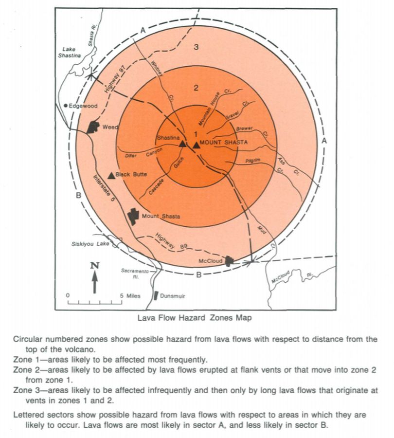
Lava Flow Hazard Zones Map
Page 17 in: Crandell, D.R. & Nichols, D.R. (1989). Volcanic hazards at Mount Shasta, California. U.S. Geological Survey, General Information Product, 22 p. https://doi.org/10.3133/70039409
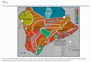
Figure in a journal article
Lava flow inundation hazard zones for Hawai‘i shown with colors indicating increasing hazard (adapted from Heliker 1990; Wright et al. 1992). Superimposed on hazard zones are channel-length contours from Fig. 4 (dashed color lines).
Figure 5 in: Rowland, S. K., Garbeil, H., & Harris, A. J. (2005). Lengths and hazards from channel-fed lava flows on Mauna Loa, Hawai ‘i, determined from thermal and downslope modeling with FLOWGO. Bulletin of Volcanology, 67(7), 634-647. https://doi.org/10.1007/s00445-004-0399-x
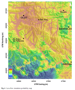
Figure in a journal article
Lava flow simulation probability map
Figure 6 in: Bartolini, S., Bolós, X., Martí, J., Pedra, E. R., & Planagumà, L. (2015). Hazard assessment at the quaternary La Garrotxa volcanic field (NE Iberia). Natural Hazards, 78(2), 1349-1367. https://doi.org/10.1007/s11069-015-1774-y
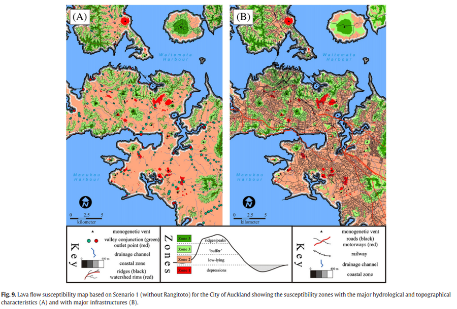
Figure in a journal article
Lava flow susceptibility map based on Scenario 1 (without Rangitoto) for the City of Auckland showing the susceptibility zones with the major hydrological and topographical characteristics and with major infrastructures
Figure 9 in: Kereszturi, G., Procter, J., Cronin, S. J., Németh, K., Bebbington, M., & Lindsay, J. (2012). LiDAR-based quantification of lava flow susceptibility in the City of Auckland (New Zealand). Remote Sensing of Environment, 125, 198-213. https://doi.org/10.1016/j.rse.2012.07.015
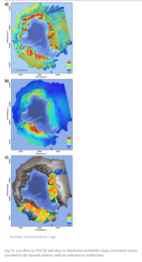
Figure in a journal article
Lava flow, PDC and lahar simulation probability maps.
Figure 11 in: Bartolini, S., Geyer, A., Martí, J., Pedrazzi, D., & Aguirre-Díaz, G. (2014). Volcanic hazard on Deception Island (South Shetland Islands, Antarctica). Journal of Volcanology and Geothermal Research, 285, p. 150-168. https://doi.org/10.1016/j.jvolgeores.2014.08.009
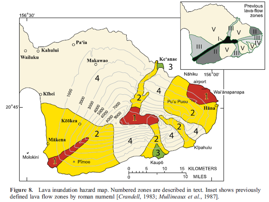
Official, Figure in a journal article
Lava inundation hazard map
Figure 8 in: Sherrod, D. R., Hagstrum, J. T., McGeehin, J. P., Champion, D. E., & Trusdell, F. A. (2006). Distribution, 14C chronology, and paleomagnetism of latest Pleistocene and Holocene lava flows at Haleakalā volcano, Island of Maui, Hawai ‘i: A revision of lava flow hazard zones. Journal of Geophysical Research: Solid Earth, 111(B5).
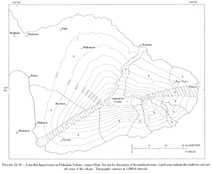
Official, Figure in hazard assessment
Lava-flow hazard zones on Haleakala Volcano, eastern Maui.
Figure 22.14 in: Mullineaux, D.R., Peterson, D.W., & Crandell, D.R. (1987). Volcanic hazards in the Hawaiian Islands. In: Decker, R.W., Wright, T.L., & Stauffer, P.H. (Eds.) Volcanism in Hawaii. US Geological Survey Professional Paper 1350, Chapter 22, p. 599-621. https://doi.org/10.3133/pp1350
Official, Figure in hazard assessment
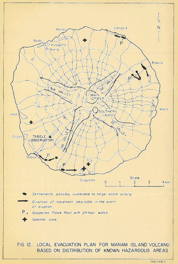
Local evacuation plan for Manam Island Volcano based on distribution of known hazardous areas
Figure 12 in: Lowenstein, P.L. (1982). Problems of volcanic hazards in Papua New Guinea. Geological Survey of Papua New Guinea, Report 82/7, 62 p.

Official, Figure in hazard assessment
Localisation des Secteurs Susceptibles de Glisser sous L'action des Explosions Phréatiques ou des Secousses Sismiques Superficielles
(Location of Sectors Likely to Slip Under the Action of Ground Explosions or Superficial Earthquakes)
Figure 13 in: Westercamp, D. (1977) Levés géologiques, évaluation et zonation des risques volcaniques à la Soufrière de Guadeloupe F. W. I. (Rapport de mission) Mai-Juin 1977. Délégation Générale a la Recherche Scientifique et Technique. 77 Ant 29