
Advanced Search for Maps
Showing 1531-1540 of 2217
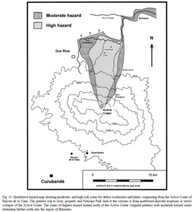
Figure in a journal article
Qualitative hazard map showing moderate- and high-risk zones for debris avalanches and lahars, originating from the Active Crater of Rincón de la Vieja
Figure 11 in: Kempter, K. A., & Rowe, G. L. (2000). Leakage of Active Crater lake brine through the north flank at Rincón de la Vieja volcano, northwest Costa Rica, and implications for crater collapse. Journal of Volcanology and Geothermal Research, 97(1-4), 143-159. https://doi.org/10.1016/S0377-0273(99)00181-X
Official, Figure in hazard assessment
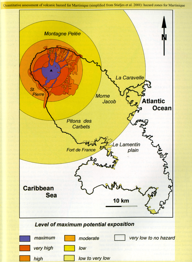
Quantitative assessment of volcanic hazard for Martinique (simplified from Stieltjes et al. 2001): hazard zones for Martinique
Page 141 in: Boudon, G., Le Friant, A., Villemant, B., & Viode, J.-P. (2005). Martinique. In: Lindsay, J.M., Shepherd, J.B., Robertson, R.E.A., & Ali, S. (Eds) Volcanic hazard atlas of the Lesser Antilles. Seismic Research Unit, The University of the West Indies, Trinidad and Tobago, W.I., p. 128-146. (Simplified from: Stieltjes et al. 2001)

Official, Figure in hazard assessment
Radio de Influencia del Volcán de Colima
(Radius of Influence of Colima Volcano)
Figure 5.7 in: Grupo de Análisis, Evaluación y Gestión de Riesgos de la Universidad de Colima. (2014). Atlas de Riesgos Naturales del Municipio de Colima. Universidad de Colima, Colima, Mexico.
Official, Figure in hazard assessment
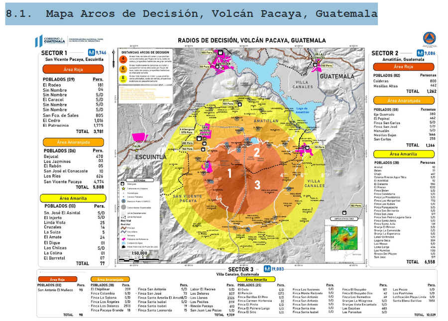
Radios de Decisión, Volcán Pacaya, Guatemala
(Decision Radii, Pacaya Volcano, Guatemala)
8.1 in: Coordinadora Nacional para la Reducción de Desastres (CONRED). (2021). Protocolo Operativo por Actividad Efusiva del Volcán Pacaya. https://conred.gob.gt/documentos/planes/DRE_20210211_01_PROTOCOLO_OPERATIVO_POR_ACTIVIDAD_EFUSIVA_VOLCAN_PACAYA.pdf

Official, Figure in hazard assessment
Range of crater area regulation (Jigokunuma crater) (volcanic alert level 2)
Figure 1-8 in: Hakkodasan Volcanic Hazards Mitigation Committee. (2019). Hakkoda volcano evacuation plan. Aomori Prefecture, Aomori City, Towada City, Kuroishi City, and Hirakawa City.
Official, Figure in hazard assessment
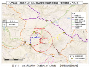
Range of crater area regulation (Odake crater) (volcanic alert level 2)
Figure 1-7 in: Hakkodasan Volcanic Hazards Mitigation Committee. (2019). Hakkoda volcano evacuation plan. Aomori Prefecture, Aomori City, Towada City, Kuroishi City, and Hirakawa City.
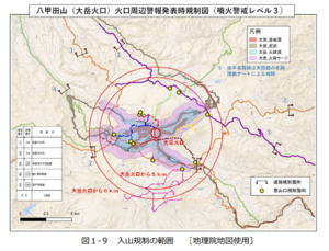
Official, Figure in hazard assessment
Range of mountain climbing regulation (volcanic alert level 3)
Figure 1-9 in: Hakkodasan Volcanic Hazards Mitigation Committee. (2019). Hakkoda volcano evacuation plan. Aomori Prefecture, Aomori City, Towada City, Kuroishi City, and Hirakawa City.
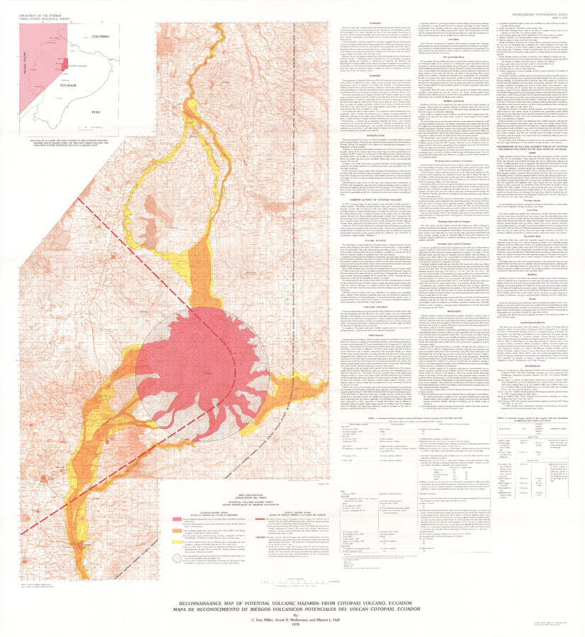
Official (foreign agency), Map sheet or poster
Reconnaissance Map of Potential Volcanic Hazards from Cotopaxi Volcano, Ecuador. Mapa de Reconocimiento de Riesgos Volganicos Potenciales Del Volcan Cotopaxi, Ecuador.
Plate 1 in: Miller, C.D., Mullineaux, D.R., & Hall, M.L. (1978). Reconnaissance Map of Potential Volcanic Hazards from Cotopaxi Volcano, Ecuador. Mapa de Reconocimiento de Riesgos Volganicos Potenciales Del Volcan Cotopaxi, Ecuador. U.S. Geological Survey, IMAP 1072. https://doi.org/10.3133/i1072
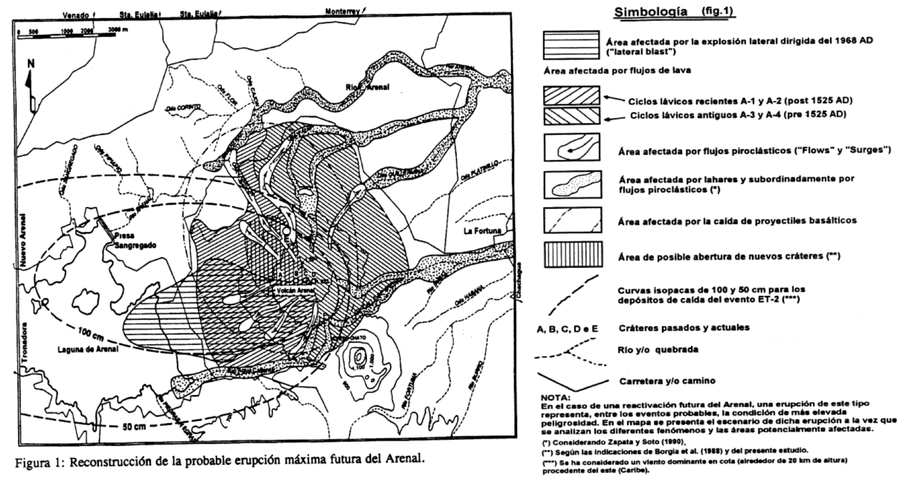
Official, Figure in hazard assessment
Reconstrucción de la probable erupción máxima futura del Arenal
(Reconstruction of the probable future maximum eruption of Arenal)
Figure 1 in: Alvarado, G.E., Soto, G.J., Ghigliotti, M., & Frullani, A. (1997). Peligro volcánico del Arenal. Boletín OSIVAM, 8(15-16), p. 62-82.
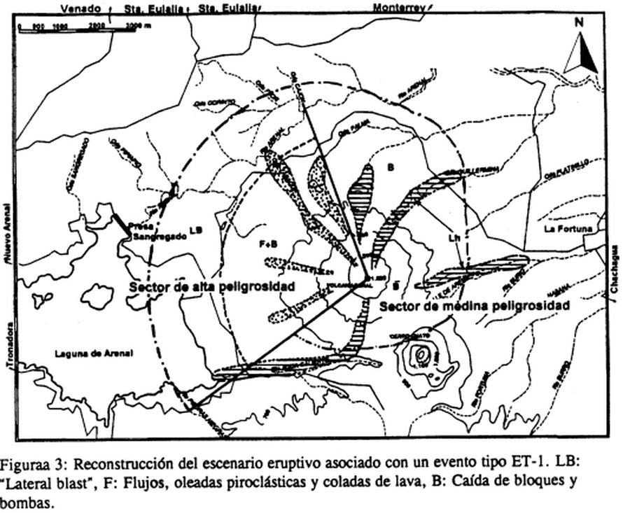
Official, Figure in hazard assessment
Reconstrucción del escenario eruptivo asociado con un evento tipo ET-1
(Reconstruction of the eruptive scenario associated with an ET-1 type event)
Figure 3 in: Alvarado, G.E., Soto, G.J., Ghigliotti, M., & Frullani, A. (1997). Peligro volcánico del Arenal. Boletín OSIVAM, 8(15-16), p. 62-82.