
Advanced Search for Maps
Showing 1791-1800 of 2217

Figure in a journal article
The outline of the threatened region of Mt. Tjerimai
Figure 4 in: Neumann Van Padang, M. (1960). Measures taken by the authorities of the Vulcanological Survey to safeguard the population from the consequences of volcanic outbursts. Bulletin Volcanologique, 23(1), 181-192.
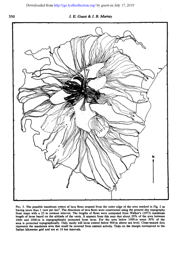
Figure in a journal article
The possible maximum extent of lava flows erupted from the outer edge of the area marked in Fig, 2 as having more than 1 vent per km²
Figure 3 in: Guest, J.E. & Murray, J.B. (1979). An analysis of hazard from Mount Etna volcano. Journal of the Geological Society, 136(3), p. 347-354. https://doi.org/10.1144/gsjgs.136.3.0347
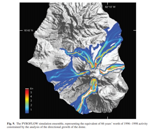
Figure in a journal article
The PYROFLOW simulation ensemble, representing the equivalent of 66 years' worth of 1996-1998 activity constrained by the analysis of the directional growth of the dome.
Figure 9 in: Wadge, G. (2009). Assessing the pyroclastic flow hazards from dome collapse at Soufriere Hills Volcano, Montserrat. In: Thordarson, S., Self, S., Larsen, G., Rowland, S.K., & Hoskuldsson, A. (Eds.) Studies in Volcanology: The Legacy of George Walker. IAVCEI, Special Publications, 2, p. 211-224. https://doi.org/10.1144/IAVCEl002.11
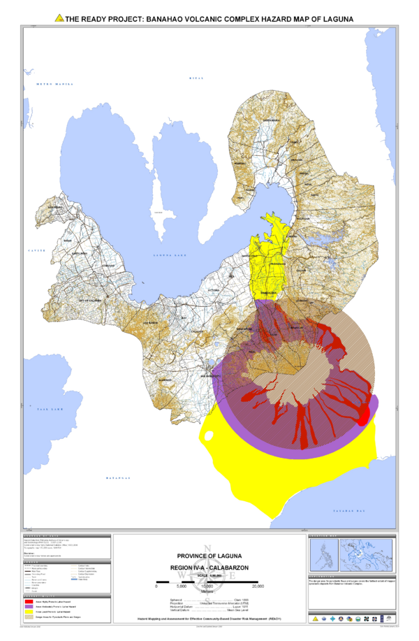
Official, Map sheet or poster
The Ready Project: Banahao Volcanic Complex Hazard Map of Laguna
Philippine Institute of Volcanology and Seismology – Department of Science and Technology (PHIVOLCS-DOST). 2010. The Ready Project: Banahao Volcanic Complex Hazard Map of Laguna. Province of Laguna, Region IV-A-Calabarzon. Hazards Mapping and Assessment for Effective Community-Based Disaster Risk Management (READY) Project

Official, Map sheet or poster
The Ready Project: Volcanic Hazard Map of Mahagnao Volcano
Philippine Institute of Volcanology and Seismology – Department of Science and Technology (PHIVOLCS-DOST). (2007). The Ready Project: Volcanic Hazard Map of Mahagnao Volcano. Province of Leyte, Region VIII-Eastern Visayas. Hazards Mapping and Assessment for Effective Community-Based Disaster Risk Management (READY) Project
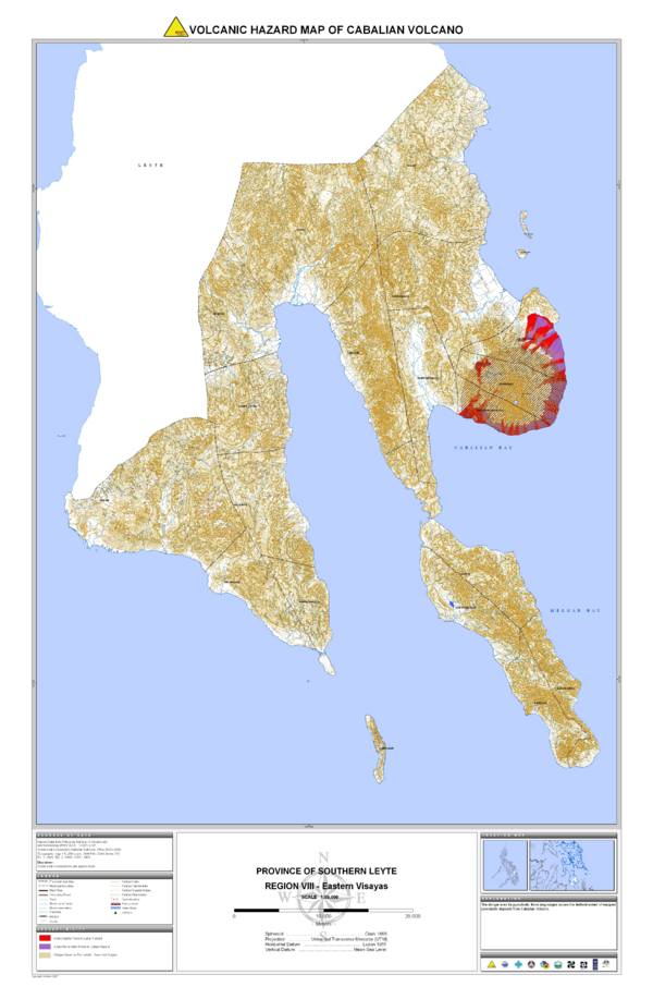
Official, Map sheet or poster
The Ready Project: Volcanic Hazard Map of Mt. Cabalian
Philippine Institute of Volcanology and Seismology – Department of Science and Technology (PHIVOLCS-DOST). (2007). The Ready Project: Volcanic Hazard Map of Cabalian Volcano. Province of Southern Leyte, Region VIII-Eastern Visayas. Hazards Mapping and Assessment for Effective Community-Based Disaster Risk Management (READY) Project
Official, Map sheet or poster
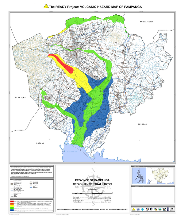
The READY Project: Volcanic Hazard Map of Pampanga
Philippine Institute of Volcanology and Seismology – Department of Science and Technology (PHIVOLCS-DOST). (2009). The Ready Project: Volcanic Hazard Map of Pampanga. Province of Pampanga, Region III-Central Luzon. Hazards Mapping and Assessment for Effective Community-Based Disaster Risk Management (READY) Project
Official, Map sheet or poster
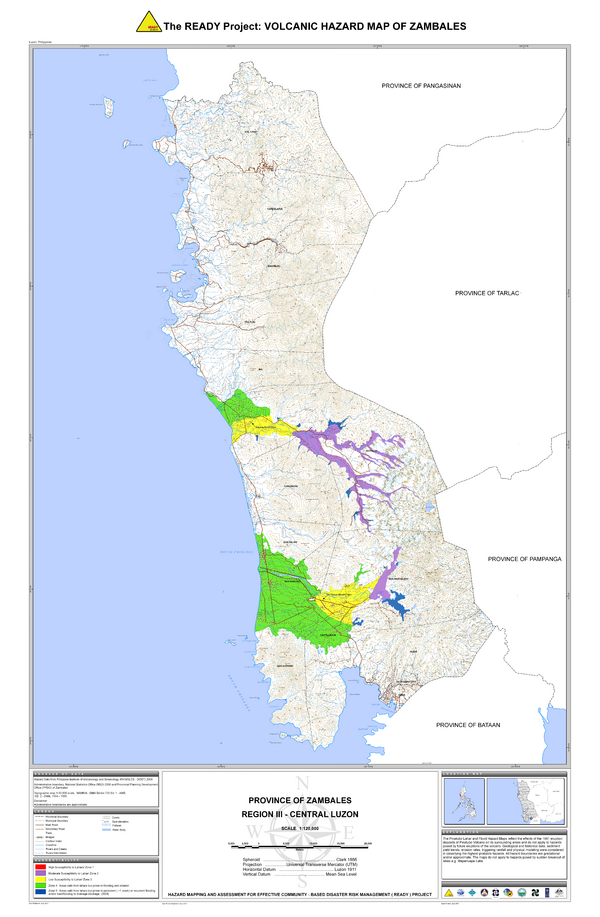
The READY Project: Volcanic Hazard Map of Zambales
Philippine Institute of Volcanology and Seismology – Department of Science and Technology (PHIVOLCS-DOST). (2011). The Ready Project: Volcanic Hazard Map of Zambales. Province of Zambales, Region III-Central Luzon. Hazards Mapping and Assessment for Effective Community-Based Disaster Risk Management (READY) Project
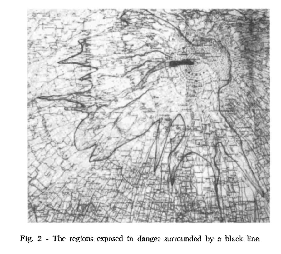
Figure in a journal article
The regions exposed to danger surrounded by a black line
Figure 2 in: Neumann Van Padang, M. (1960). Measures taken by the authorities of the Vulcanological Survey to safeguard the population from the consequences of volcanic outbursts. Bulletin Volcanologique, 23(1), 181-192.
Official, Figure in hazard assessment
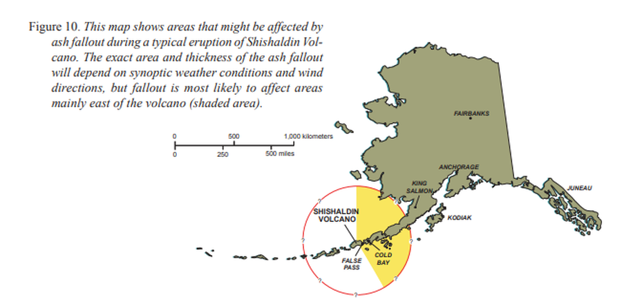
This map shows areas that might be affected by ash fallout during a typical eruption of Shishaldin Volcano
Figure 10 in: Beget, J.E., Nye, C.J., Schaefer, J.R. & Stelling, P.L. (2003). Preliminary volcano-hazard assessment for Shishaldin Volcano, Alaska. Alaska Division of Geological & Geophysical Surveys, Report of Investigations 2002-4, 28 p., 1 sheet, scale 1:500,000. http://doi.org/10.14509/2872