
Advanced Search for Maps
Showing 61-70 of 118
Official, Map sheet or poster
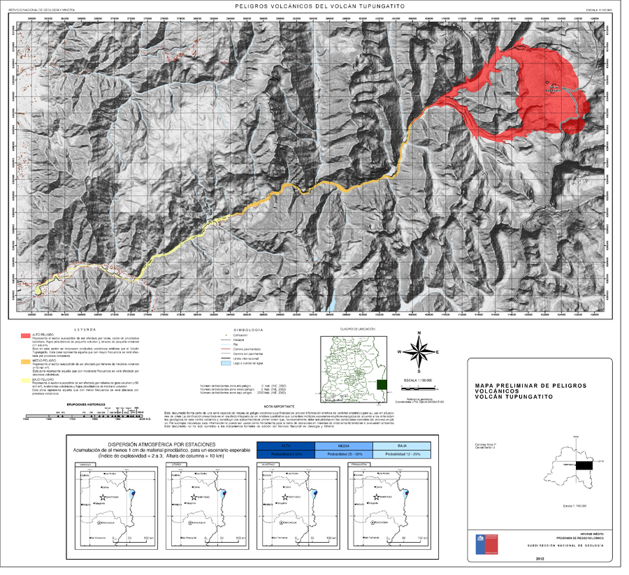
Peligros Volcánicos del Volcán Tupungatito
(Volcanic Hazards of Tupungatito Volcano)
Silva, C. & Bertin, D. (2012). Mapa Preliminar de peligros volcánicos Volcán Tupungatito, Región Metropolitana de Santiago. Informe inédito, Subdirección Nacional de Geología, Programa de Riesgo Volcánico. Escala 1:100.000. Santiago.
Official, Map sheet or poster
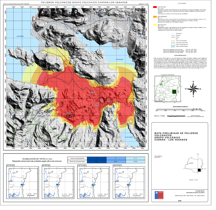
Peligros Volcánicos Grupo Volcánico Carrán-los Venados
(Volcanic Hazards Carrán-los Venados Volcanic Group)
Bertin, D. & Lara, L. (2012). Mapa Preliminar De Peligros Volcánicos Grupo Volcánico Carrán - Los Venados. Servicio Nacional de Geología y Minería (SERNAGEOMIN), mapa escala 1:75,000. Santiago.
Official, Map sheet or poster
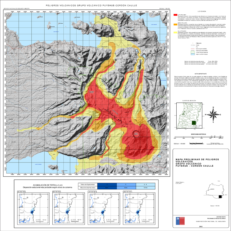
Peligros Volcánicos Grupo Volcánico Puyehue-Cordón Caulle
(Volcanic Hazards of the Puyehue-Cordón Caulle Volcanic Group)
Orozco, G. & Lara, L. (2012). Mapa Preliminar de peligros volcánicos Grupo Volcánico Puyehue-Cordón Caulle, Región de Los Ríos. Informe inédito, Subdirección Nacional de Geología. Programa de Riesgo Volcánico, mapa escala 1:100.000. Santiago.
Official, Map sheet or poster
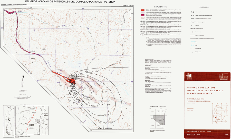
Peligros Volcánicos Potenciales del Complejo Planchón-Peteroa
(Potential Volcanic Hazards of the Planchón-Peteroa Complex)
Naranjo, J.A., & Haller, M.J. (1999). Peligros Volcánisoc Potenciales del Complejo Planchon-Peteroa, Región del Maule, Chile - Provincia de Mendoza, Argentina. Servcio Nacional de Geología y Minería (SERNAGEOMIN), Boletín No. 52, 55 p., 2 mapas escala 1:100.000.
Official, Figure in hazard assessment
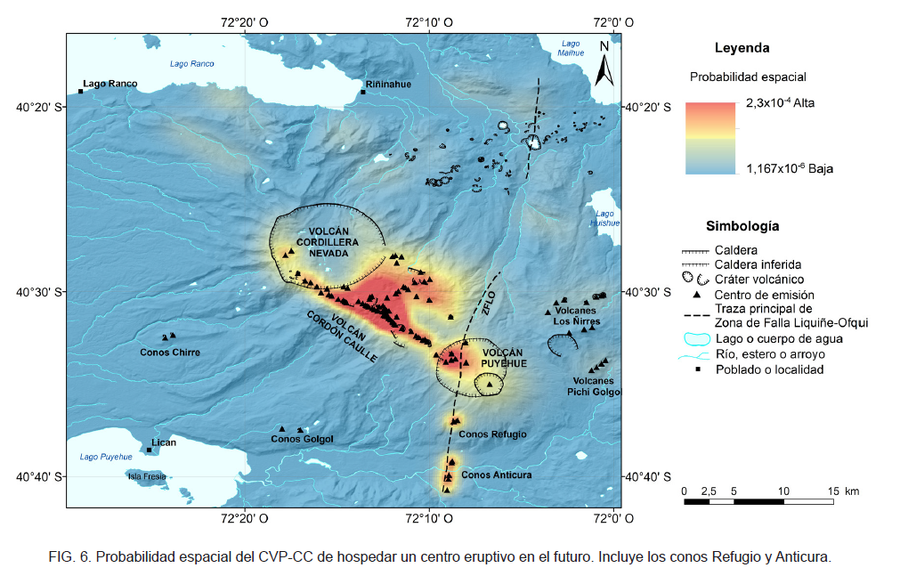
Probabilidad espacial del CVP-CC de hospedar un centro eruptivo en el futuro
(Spatial probability of the CVP-CC of hosting an eruptive center in the future)
Figure 6 in: Toloza, V., Jorquera, C., Mella, M., Gho, R. (2020). Peligros del Complejo Volcánico Puyehue-Cordón Caulle, regiones de Los Ríos y Los Lagos. Servicio Nacional de Geología y Minería, Carta Geológica de Chile, Serie Geología Ambiental 36, 63 p., 1 mapa escala 1:75.000. Santiago.
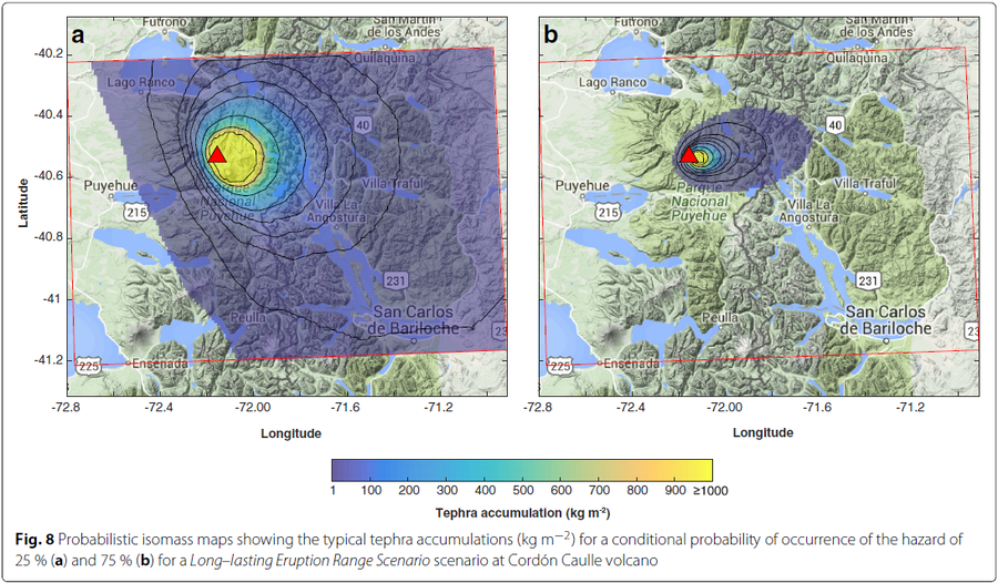
Figure in a journal article
Probabilistic isomass maps showing the typical tephra accumulations (kg m−2) for a conditional probability of occurrence of the hazard
Figure 8 in: Biass, S., Bonadonna, C., Connor, L., & Connor, C. (2016). TephraProb: a Matlab package for probabilistic hazard assessments of tephra fallout. Journal of Applied Volcanology, 5(1), 1-16. https://doi.org/10.1186/s13617-016-0050-5
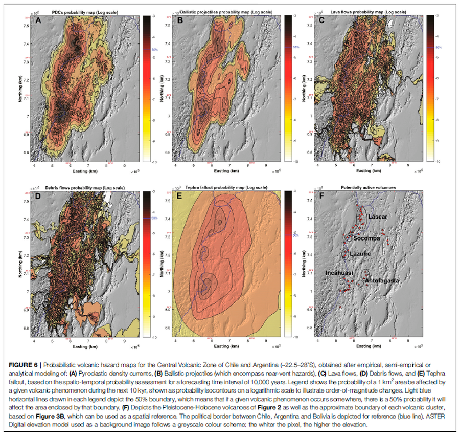
Figure in a journal article
Probabilistic volcanic hazard maps for the Central Volcanic Zone of Chile and Argentina (∼22.5–28°S), obtained after empirical, semi-empirical or analytical modeling
Figure 6 in: Bertin, D., Lindsay, J.M., Cronin, S.J., de Silva, S.L., Connor, C.B., Caffe, P.J., Grosse, P., Báez, W., Bustos, E., & Constantinescu, R. (2022). Probabilistic Volcanic Hazard Assessment of the 22.5–28° S Segment of the Central Volcanic Zone of the Andes. Frontiers in Earth Science, 10. https://doi.org/10.3389/feart.2022.875439
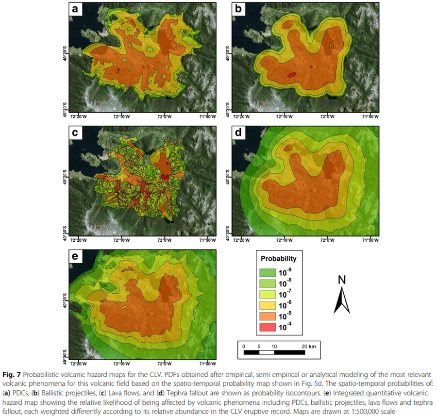
Figure in a journal article
Probabilistic volcanic hazard maps for the CLV
Figure 7 in: Bertin, D., Lindsay, J. M., Becerril, L., Cronin, S. J., & Bertin, L. J. (2019). MatHaz: a Matlab code to assist with probabilistic spatio-temporal volcanic hazard assessment in distributed volcanic fields. Journal of Applied Volcanology, 8(1), 1-25. https://doi.org/10.1186/s13617-019-0084-6
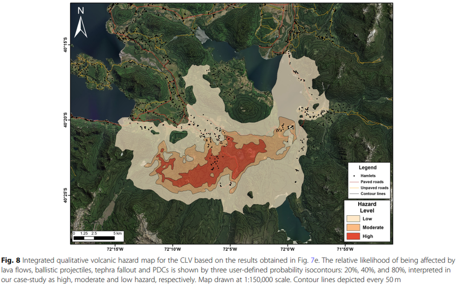
Figure in a journal article
Probabilistic volcanic hazard maps for the CLV
Figure 8 in: Bertin, D., Lindsay, J. M., Becerril, L., Cronin, S. J., & Bertin, L. J. (2019). MatHaz: a Matlab code to assist with probabilistic spatio-temporal volcanic hazard assessment in distributed volcanic fields. Journal of Applied Volcanology, 8(1), 1-25. https://doi.org/10.1186/s13617-019-0084-6
Official, Map in an information statement
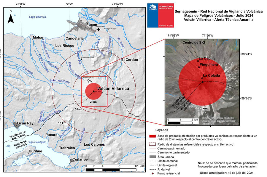
SERNAGEOMIN - Red Nacional de Vigilancia Volcánica - Mapa de Peligros Volcánicos - Julio 2024 - Volcán Villarrica, Alerta Técnica Amarilla
(SERNAGEOMIN - National Network of Volcanic Surveillance - Map of Volcanic Hazards - July 2024 - Villarrica Volcano - Yellow Technical Alert)
Servicio Nacional de Geología y Minería (SERNAGEOMIN) Observatorio Volcanológico de los Andes del Sur (OVDAS). (2024). Reporte Especial de Actividad Volcánica (REAV), Región de la Araucanía y Los Ríos, Volcán Villarrica, 12 de julio de 2024, 11:30 Hora local (Chile continental).