
Advanced Search for Maps
Showing 1-5 of 5
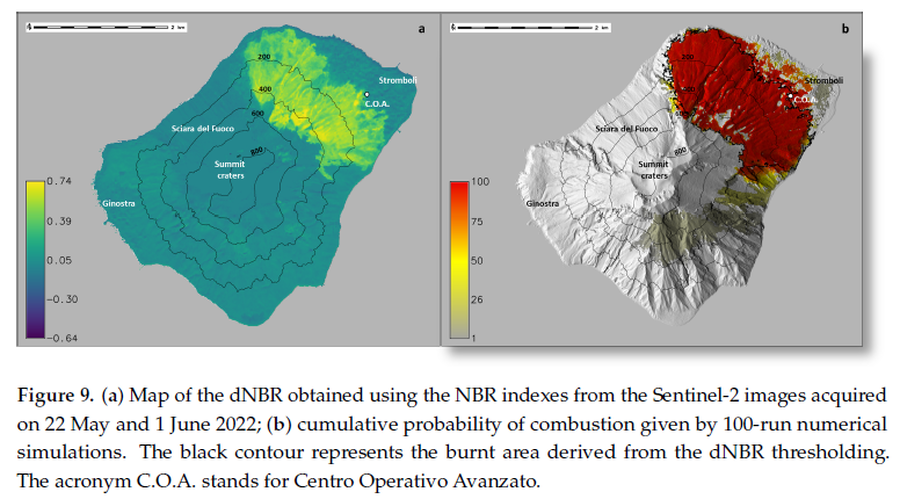
Official, Figure in a journal article
(a) Map of the dNBR obtained using the NBR indexes from the Sentinel-2 images acquired on 22 May and 1 June 2022; (b) cumulative probability of combustion given by 100-run numerical simulations
Figure 9 in: Guardo, R., Bilotta, G., Ganci, G., Zuccarello, F., Andronico, D., & Cappello, A. (2024). Modeling Fire Hazards Induced by Volcanic Eruptions: The Case of Stromboli (Italy). Fire, 7(3), 70.
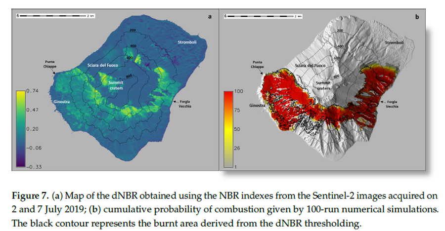
Official, Figure in a journal article
(a) Map of the dNBR obtained using the NBR indexes from the Sentinel-2 images acquired on 2 and 7 July 2019; (b) cumulative probability of combustion given by 100-run numerical simulations
Figure 7 in: Guardo, R., Bilotta, G., Ganci, G., Zuccarello, F., Andronico, D., & Cappello, A. (2024). Modeling Fire Hazards Induced by Volcanic Eruptions: The Case of Stromboli (Italy). Fire, 7(3), 70.
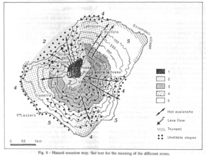
Figure in a journal article
Hazard zonation map
Figure 8 in: Barberi, F., Rosi, M., & Sodi, A. (1993). Volcanic hazard assessment at Stromboli based on review of historical data. Acta Vulcanologica, 3, 173-187. (Reprinted in: Nave, R., Isaia, R., Vilardo, G., & Barclay, J. (2010). Re-assessing volcanic hazard maps for improving volcanic risk communication: application to Stromboli Island, Italy. Journal of Maps, 6(1), p. 260-269.)
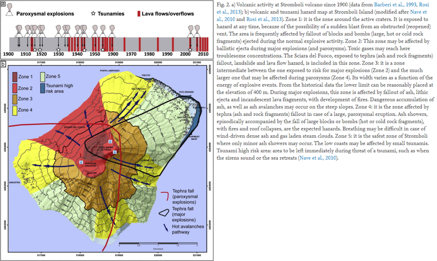
Figure in a journal article
Volcanic and tsunami hazard map at Stromboli Island
Figure 2 in: Di Traglia, F., Nolesini, T., Intrieri, E., Mugnai, F., Leva, D., Rosi, M., & Casagli, N. (2014). Review of ten years of volcano deformations recorded by the ground-based InSAR monitoring system at Stromboli volcano: a tool to mitigate volcano flank dynamics and intense volcanic activity. Earth-Science Reviews, 139, 317-335. https://doi.org/10.1016/j.earscirev.2014.09.011
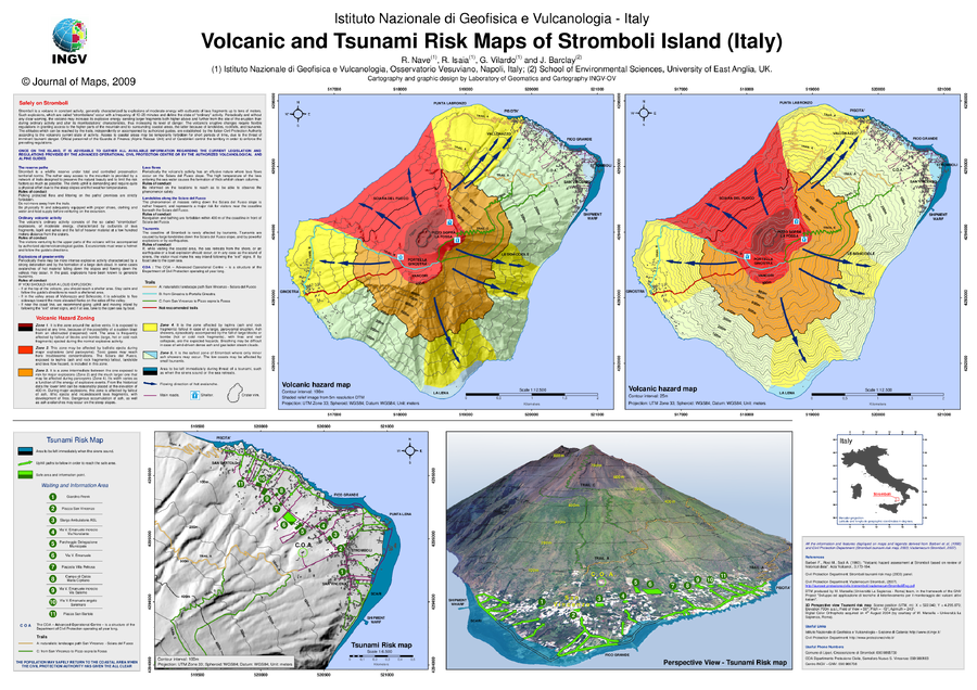
Official, Insert/poster-size map with accompanying report
Volcanic and Tsunami Risk Maps of Stromboli Island (Italy)
Supplemental Material in: Nave, R., Isaia, R., Vilardo, G., & Barclay, J. (2010). Re-assessing volcanic hazard maps for improving volcanic risk communication: application to Stromboli Island, Italy. Journal of Maps, 6(1), p. 260-269. https://doi.org/10.4113/jom.2010.1061