
Advanced Search for Maps
Showing 1-10 of 88
Official, Figure on website
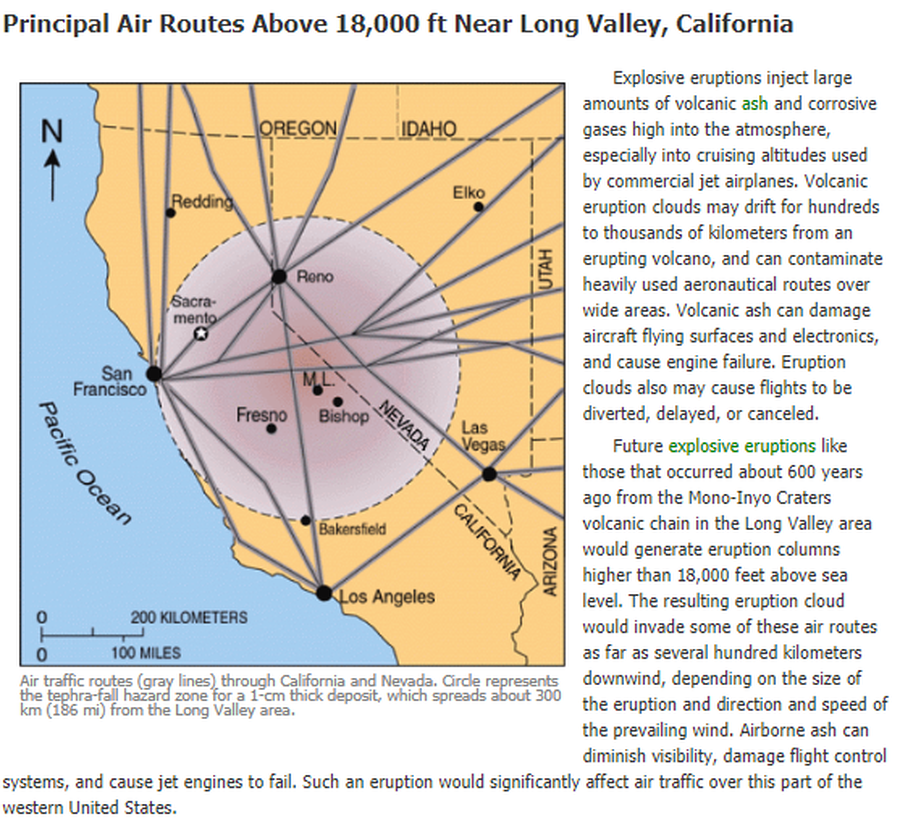
Air traffic routes (gray lines) through California and Nevada. Circle represents the tephra-fall hazard zone for a 1-cm thick deposit, which spreads about 300 km (186 mi) from the Long Valley area.
U.S. Geological Survey (USGS). (2012). Air traffic routes (gray lines) through CA and Nevada. U.S. Geological Survey. Long Valley Caldera Hazards, Principal Air Routes Above 18,000 ft Near Long Valley, California. https://www.usgs.gov/volcanoes/long-valley-caldera/principal-air-routes-above-18000-ft-near-long-valley-california
Official, Figure in hazard assessment
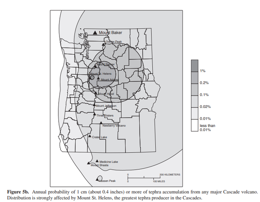
Annual probability of 1 cm (about 0.4 inches) or more of tephra accumulation from any major Cascade volcano
Figure 5b in: Gardner, C.A., Scott, K.M., Miller, C.D., Myers, B., Hildreth, W., & Pringle, P.T. (1995). Potential volcanic hazards from future activity of Mount Baker, Washington. U.S. Geological Survey, Open-File Report 95-498, 16 p., 1 plate, scale 1:100,000. https://doi.org/10.3133/ofr95498
Official, Figure in hazard assessment
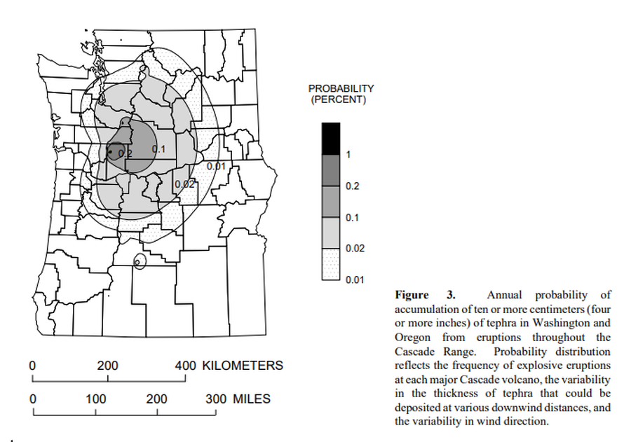
Annual probability of accumulation of ten or more centimeters (four or more inches) of tephra in Washington and Oregon from eruptions throughout the Cascade Range.
Figure 3 in: Wolfe, E.W. & Pierson, T.C. (1995). Volcanic-Hazard Zonation for Mount St. Helens, Washington, 1995. U.S. Geological Survey, Open-File Report 95-497, 12 p., 1 plate. https://doi.org/10.3133/ofr95497

Official, Flyer, brochure, short fact-sheet, or handout
Are You at Risk from the Next Eruption of Mount Hood? Hazards Zonation Map
Gardner, C. A., Scott, W. E., Major, J. J., & Pierson, T. C. (2000). Mount Hood-history and hazards of Oregon's most recently active volcano. US Geological Survey, Fact Sheet 060-00 (PDF Version). https://doi.org/10.3133/fs06000
Official, Insert/poster-size map with accompanying report
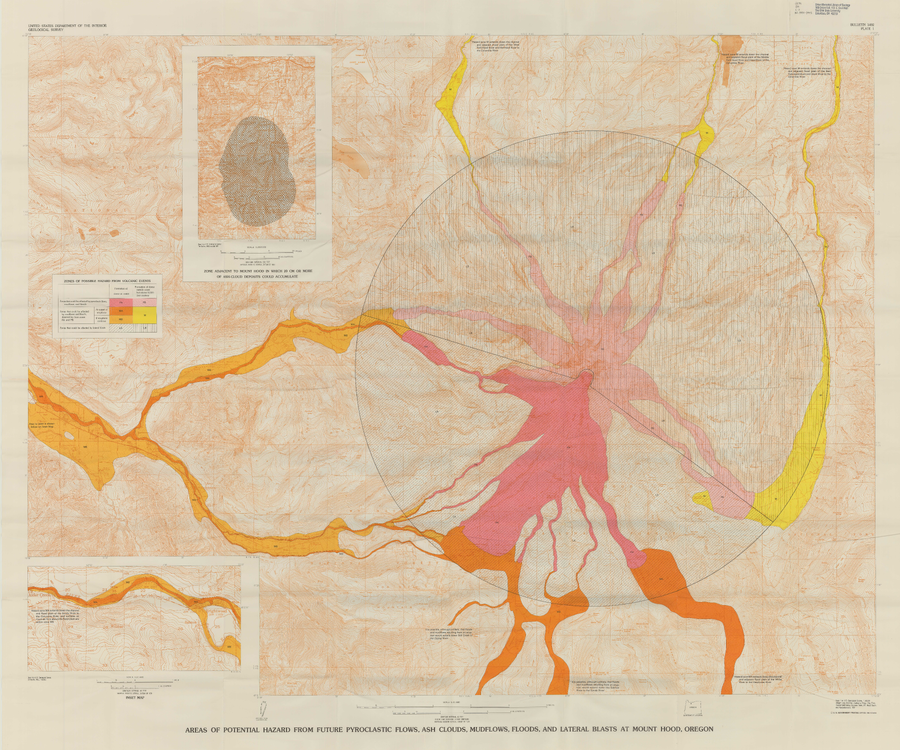
Areas of Potential Hazard from Future Pyroclastic Flows, Ash Clouds, Mudflows, and Lateral Blasts at Mount Hood, Oregon
Plate 1 in: Crandell, D.R. (1980). Recent eruptive history of Mount Hood, Oregon, and potential hazards from future eruptions. U.S. Geological Survey, Bulletin 1492, 81 p. https://doi.org/10.3133/b1492
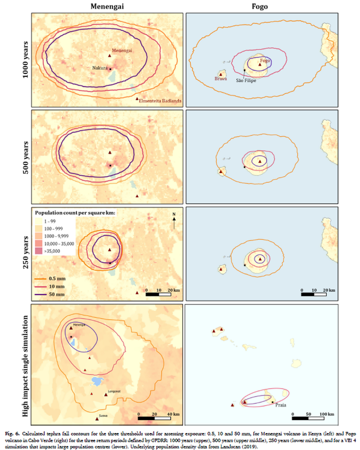
Figure in a journal article
Calculated tephra fall contours for the three thresholds used for assessing exposure: 0.5, 10 and 50 mm, for Menengai volcano in Kenya (left) and Fogo volcano in Cabo Verde (right) for the three return periods defined by GFDRR: 1000 years (upper), 500 years (upper middle), 250 years (lower middle), and for a VEI 4 simulation that impacts large population centres (lower)
Figure 6 in: Jenkins, S. F., Mee, K., Engwell, S. L., Loughlin, S. C., Faria, B. V. E., Yirgu, G., ... & Crummy, J. (2024). Assessing volcanic hazard and exposure in a data poor context: Case study for Ethiopia, Kenya, and Cabo Verde. Progress in Disaster Science, 23, 100350.
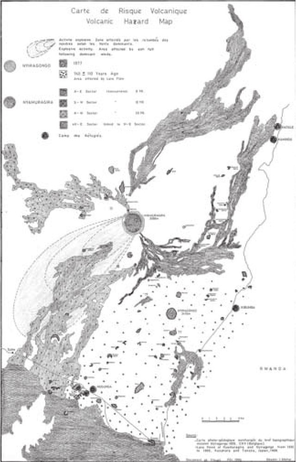
Figure in a journal article
Carte de Risque Volcanique
(Volcanic Hazard Map)
Figure 1 in: Tedesco, D. (2003). 1995 Nyiragongo and Nyamulagira activity in the Virunga National Park: A volcanic crisis. Acta vulcanologica, 14(1-2), 149-155.
Official, Map in a booklet, long fact-sheet, or handbook
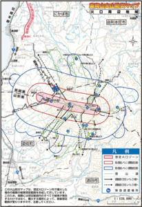
Chokaisan Hazard Map - Area around Chokaisan
Page 15 in: Volcano Disaster Management Councils of Chokaisan. (2019). Chokaisan Volcanic Disaster Prevention Map.
Official, Map in a booklet, long fact-sheet, or handbook
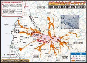
Chokaisan Hazard Map - In case of large scale lava flow eruption
Page 12 in: Volcano Disaster Management Councils of Chokaisan. (2019). Chokaisan Volcanic Disaster Prevention Map.
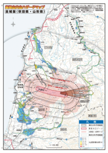
Official, Map in a booklet, long fact-sheet, or handbook
Chokaisan Hazard Map - Whole Area Version (Akita/Yamagata)
Page 13-14 in: Volcano Disaster Management Councils of Chokaisan. (2019). Chokaisan Volcanic Disaster Prevention Map.