
Advanced Search for Maps
Showing 1-6 of 6
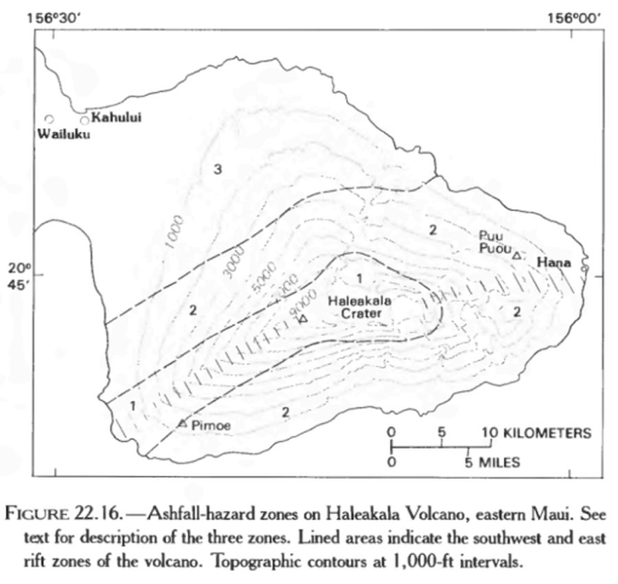
Official, Figure in hazard assessment
Ashfall-hazard zones on Haleakala Volcano, eastern Maui.
Figure 22.16 in: Mullineaux, D.R., Peterson, D.W., & Crandell, D.R. (1987). Volcanic hazards in the Hawaiian Islands. In: Decker, R.W., Wright, T.L., & Stauffer, P.H. (Eds.) Volcanism in Hawaii. US Geological Survey Professional Paper 1350, Chapter 22, p. 599-621. https://doi.org/10.3133/pp1350
Official, Figure in a journal article
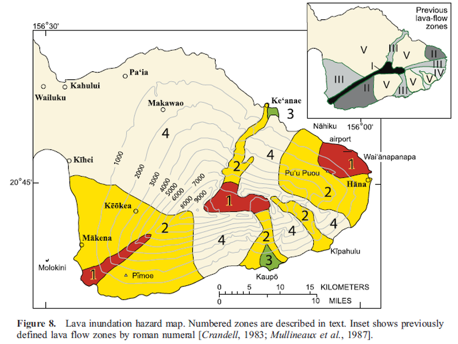
Lava inundation hazard map
Figure 8 in: Sherrod, D. R., Hagstrum, J. T., McGeehin, J. P., Champion, D. E., & Trusdell, F. A. (2006). Distribution, 14C chronology, and paleomagnetism of latest Pleistocene and Holocene lava flows at Haleakalā volcano, Island of Maui, Hawai ‘i: A revision of lava flow hazard zones. Journal of Geophysical Research: Solid Earth, 111(B5).
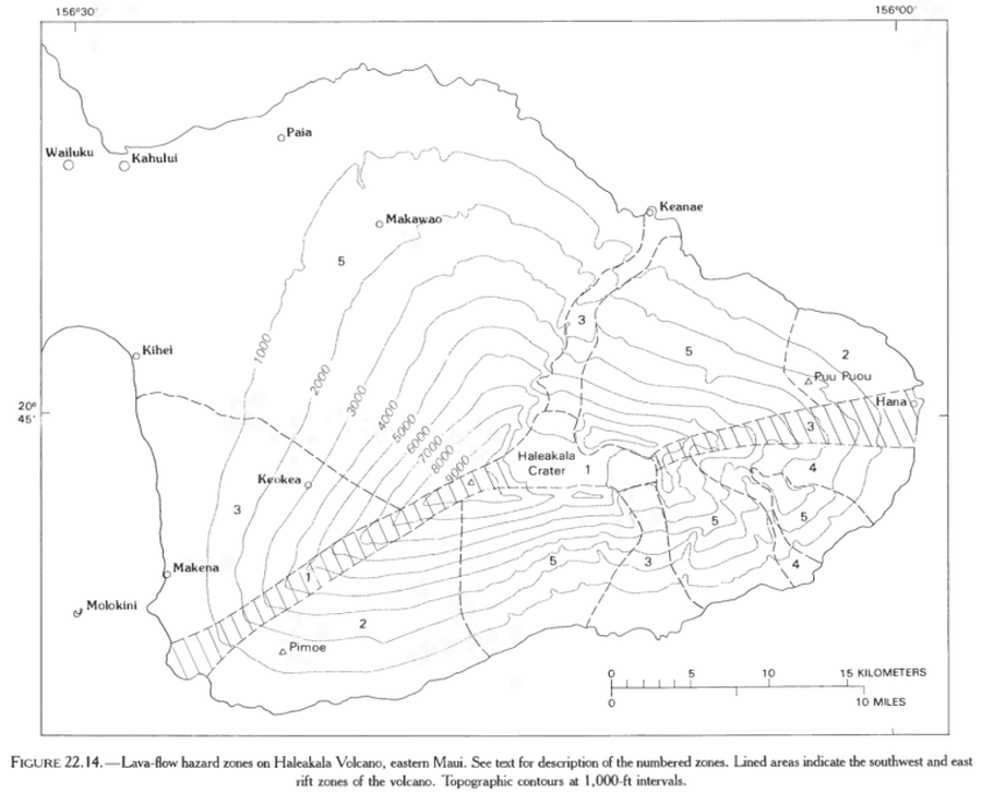
Official, Figure in hazard assessment
Lava-flow hazard zones on Haleakala Volcano, eastern Maui.
Figure 22.14 in: Mullineaux, D.R., Peterson, D.W., & Crandell, D.R. (1987). Volcanic hazards in the Hawaiian Islands. In: Decker, R.W., Wright, T.L., & Stauffer, P.H. (Eds.) Volcanism in Hawaii. US Geological Survey Professional Paper 1350, Chapter 22, p. 599-621. https://doi.org/10.3133/pp1350
Official, Figure in a journal article
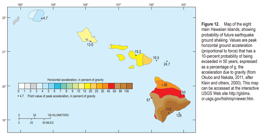
Map of the eight main Hawaiian Islands, showing probability of future earthquake ground shaking
Figure 12 in: Kauahikaua, J.P. & Tilling, R.I. (2014). Natural hazards and risk reduction in Hawai‘i. In: Poland, M.P., Takahashi, T.J., & Landowski, C.M. (eds.) Characteristics of Hawaiian Volcanoes. US Geological Survey Professional Paper 1801, p. 397-427. https://doi.org/10.3133/pp180110
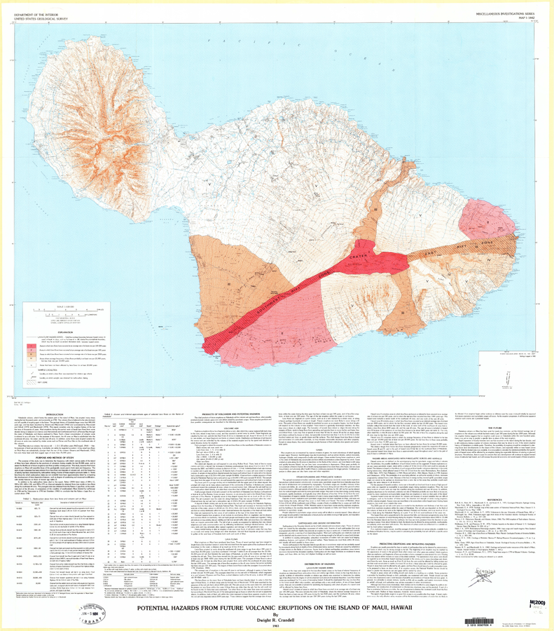
Official, Map sheet or poster
Potential Hazards from Future Volcanic Eruptions of the Island of Maui, Hawaii
Plate 1 in: Crandell, D.R. (1983). Potential hazards from future volcanic eruptions on the Island of Maui, Hawaii. U.S. Geological Survey, IMAP 1442. https://doi.org/10.3133/i1442
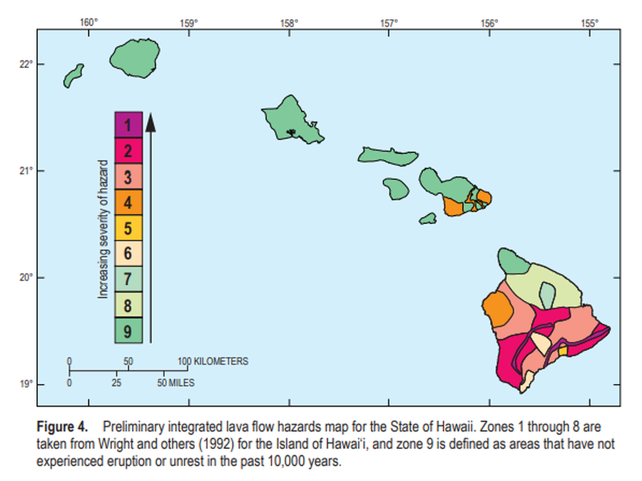
Official, Figure in a journal article
Preliminary integrated lava flow hazards map for the State of Hawaii
Figure 4 in: Kauahikaua, J.P. & Tilling, R.I. (2014). Natural hazards and risk reduction in Hawai‘i. In: Poland, M.P., Takahashi, T.J., & Landowski, C.M. (eds.) Characteristics of Hawaiian Volcanoes. US Geological Survey Professional Paper 1801, p. 397-427. https://doi.org/10.3133/pp180110