
Advanced Search for Maps
Showing 1-10 of 28
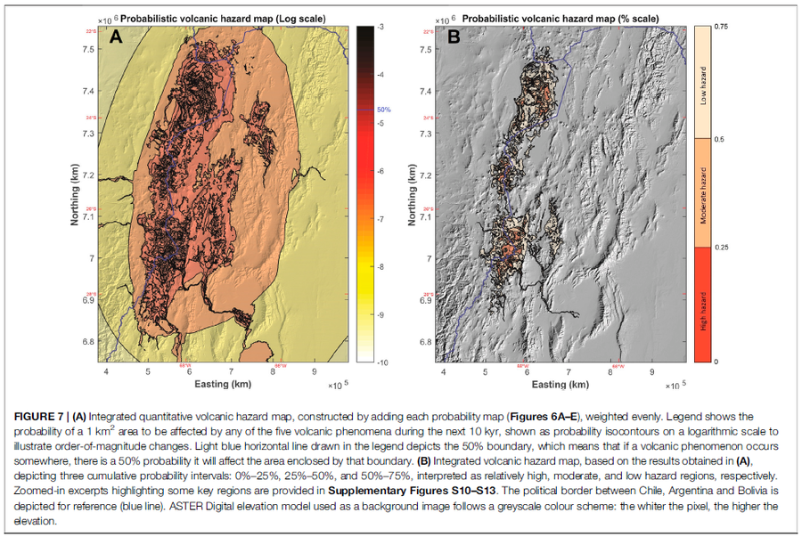
Figure in a journal article
Integrated quantitative volcanic hazard map, constructed by adding each probability map (Figures 6A–E), weighted evenly
Figure 7 in: Bertin, D., Lindsay, J.M., Cronin, S.J., de Silva, S.L., Connor, C.B., Caffe, P.J., Grosse, P., Báez, W., Bustos, E., & Constantinescu, R. (2022). Probabilistic Volcanic Hazard Assessment of the 22.5–28° S Segment of the Central Volcanic Zone of the Andes. Frontiers in Earth Science, 10. https://doi.org/10.3389/feart.2022.875439
Official, Figure in hazard assessment
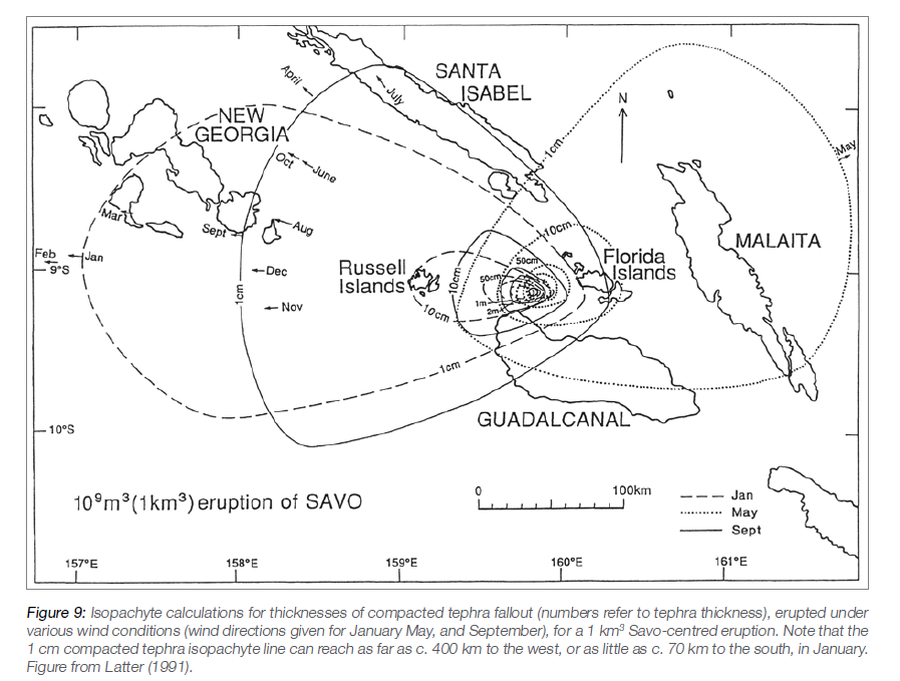
Isopachyte calculations for thicknesses of compacted tephra fallout, erupted under various wind conditions, for a 1 km³ Savo-centred eruption
Figure 9 in: Petterson, M.G., Tolia, D., Papabatu, A., Toba, T., & Qoptoto, C. (2016). Volcanic Hazard assessment of Savo Volcano, Solomon Islands, SW Pacific. In: Taylor, P.W. (Ed.) Volcanic Hazards and Emergency Management in the Southwest Pacific, SPC Technical Bulletin, SPC00017, p. 151-169
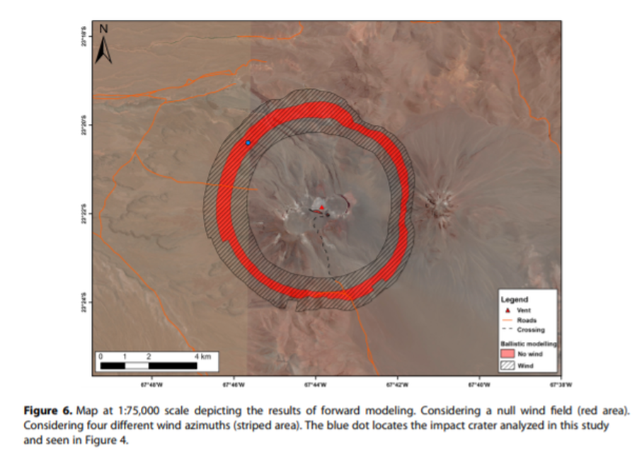
Figure in a journal article
Map at 1:75,000 scale depicting the results of forward modeling
Figure 6 in: Bertin, D. (2017). 3‐D ballistic transport of ellipsoidal volcanic projectiles considering horizontal wind field and variable shape‐dependent drag coefficients. Journal of Geophysical Research: Solid Earth, 122(2), p. 1126-1151. https://doi.org/10.1002/2016JB013320
Official, Map sheet or poster
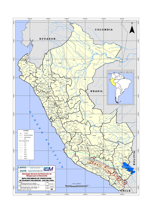
Mapa Preliminar de Zonificación de Peligros Volcanicos - Sur del Perú
(Preliminary Map of Volcanic Hazards Zoning - Southern Peru)
Comisión Multisectorial de Reducción de Riesgos en el Desarrollo (CMRRD) & Dirección General de Programación Multianual del Sector Público - MEF (DGPM) (2003). Mapa preliminar de zonificación de peligros volcánicos - Sur del Perú. Estrategía Nacional de Reducción de Riesgos para el Desarrollo. Escala 1:3000000
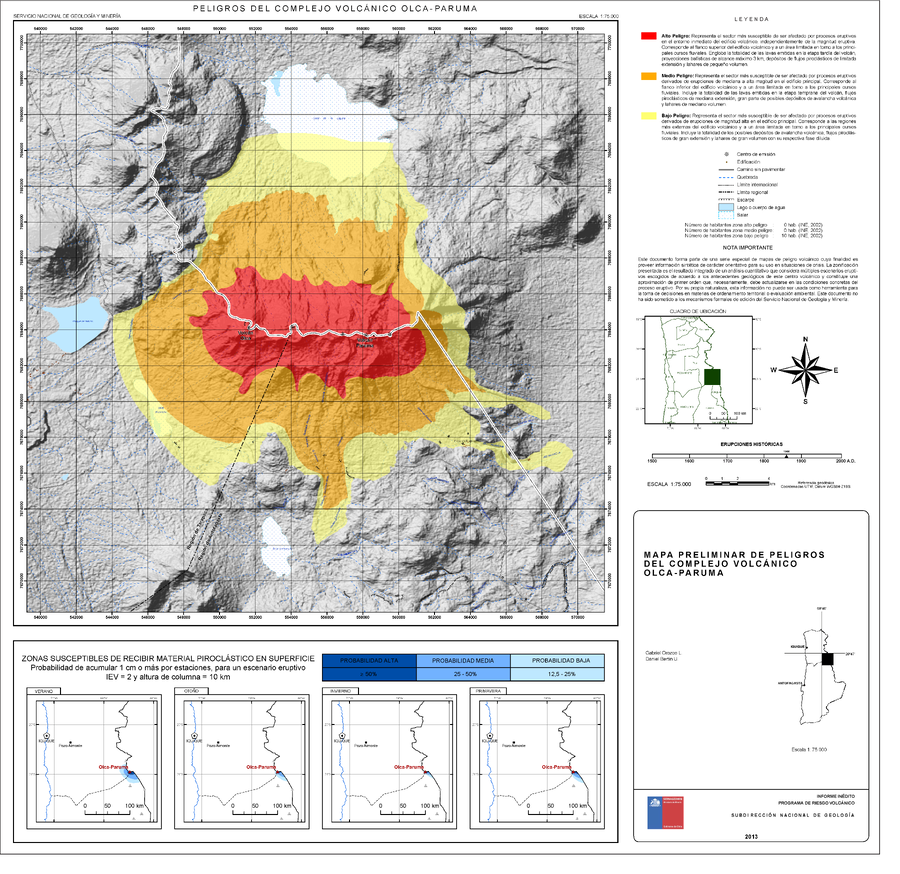
Official, Map sheet or poster
Peligros del Complejo Volcánico Olca-Paruma
(Hazards of the Olca-Paruma Volcanic Complex)
Orozco, G.; Bertin, D. (2013). Mapa Preliminar de peligros del Complejo volcánico Olca-Paruma, Regiones de Tarapacá y Antofagasta. Informe inédito, Subdirección Nacional de Geología, Programa de Riesgo Volcánico, Escala 1:75.000. Santiago.
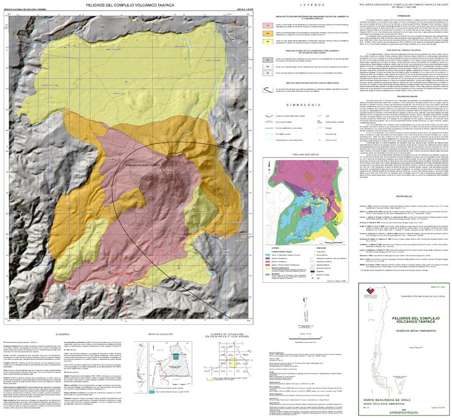
Official, Map sheet or poster
Peligros del Complejo Volcánico Taapaca
(Hazards of the Taapaca Volcanic Complex)
Clavero, J.E. (2007). Peligros del Complejo Volcánico Taapaca, Región de Arica y Parinacota. Servicio Nacional de Geología y Minería (SERNAGEOMIN), Carta Geológica de Chile, Serie Geología Ambiental No. 10, mapa escala 1:50.000. Santiago.
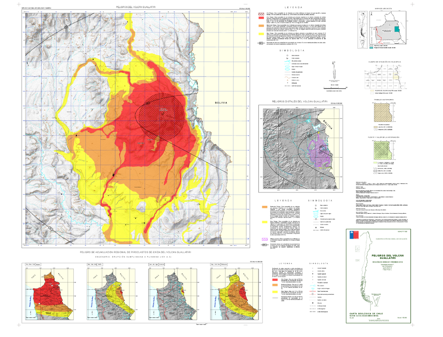
Official, Insert/poster-size map with accompanying report
Peligros del Volcán Guallatiri, región de Arica y Parinacota
(Hazards of the Guallatiri Volcano, Arica and Parinacota Region)
Jorquera, C., Rodríguez, I., Bertin, L., & Flores, F. (2019). Peligros del Volcán Guallatiri, región de Arica y Parinacota. Servicio Nacional de Geología y Minería (SERNAGEOMIN), Carta Geológica de Chile, Serie Geología Ambiental 35, 45 p., 1 mapa escala 1:50.000. Santiago.
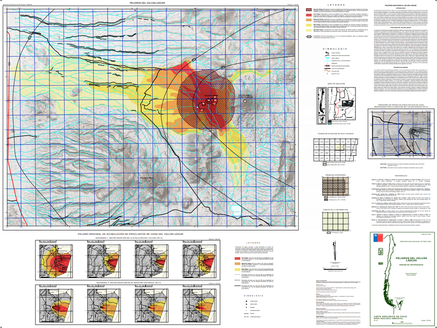
Official, Map sheet or poster
Peligros del Volcán Láscar
(Hazards of Lascar Volcano)
Gardeweg, M.C. & Amigo, A. (2015). Peligros del volcán Láscar, Región de Antofagasta. Servicio Nacional de Geología y Minería (SERNAGEOMIN), Carta Geológica de Chile, Serie Geología Ambiental 22, 1 mapa escala 1:50.000. Santiago.
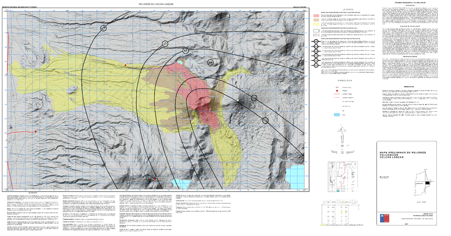
Official, Map sheet or poster
Peligros del Volcán Lascar
(Hazards of Lascar Volcano)
Gardeweg, M. & Amigo, A. (2011). Mapa Preliminar de Peligros Volcánicos Volcán Láscar. Servicio Nacional de Geología y Minería (SERNAGEOMIN), mapa escala 1:50,000. Santiago.
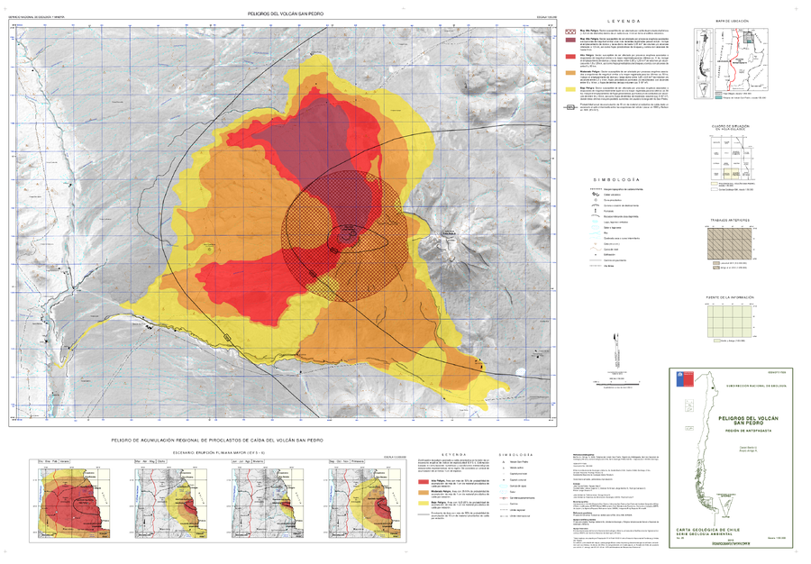
Official, Map sheet or poster
Peligros del Volcán San Pedro
(San Pedro Volcano Hazards)
Bertin, D. & Amigo, A. (2015). Peligros del volcán San Pedro, Región de Antofagasta. Servicio Nacional de Geología y Minería, Carta Geológica de Chile, Serie Geología Ambiente, No., p., 1, mapa escala 1:50.000. Santiago.