
Advanced Search for Maps
Showing 111-120 of 726

Official, Sign or billboard
Eruption Hazards at Mt. Ruapehu
GNS Science (compiler). (2007). Eruption Hazards at Mt. Ruapehu. 8 October 2007.
Official, Figure in hazard assessment
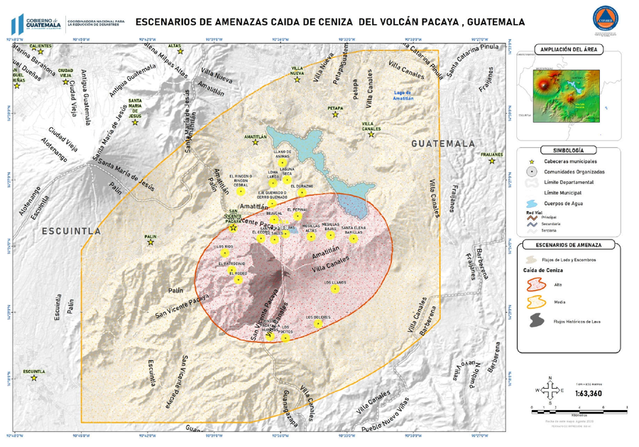
Escenarios de amenazas caída de ceniza del Volcán Pacaya, Guatemala
(Hazard scenarios of ash fall from the Pacaya Volcano, Guatemala)
3.2.2 in: Coordinadora Nacional para la Reducción de Desastres (CONRED). (2021). Protocolo Operativo por Actividad Efusiva del Volcán Pacaya. https://conred.gob.gt/documentos/planes/DRE_20210211_01_PROTOCOLO_OPERATIVO_POR_ACTIVIDAD_EFUSIVA_VOLCAN_PACAYA.pdf
Official, Figure in hazard assessment
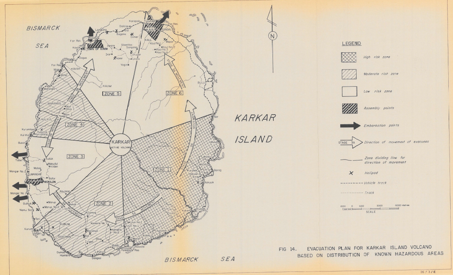
Evacuation Plan for Karkar Island Volcano Based on Distribution of Known Hazardous Areas
Figure 14 in: Lowenstein, P.L. (1982). Problems of volcanic hazards in Papua New Guinea. Geological Survey of Papua New Guinea, Report 82/7, 62 p.
Official, Figure in hazard assessment
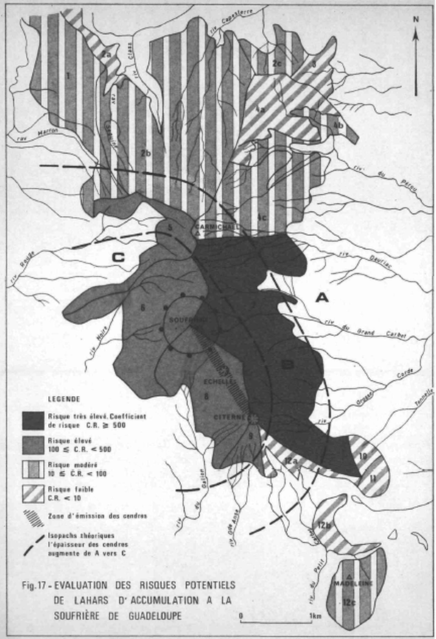
Evaluation des Risques Potentiels de Lahars d'Accumulation a la Soufrière de Guadeloupe
(Assessment of the Potential Risks of Lahars of Accumulation at the Soufriere of Guadeloupe)
Figure 17 in: Westercamp, D. (1977) Levés géologiques, évaluation et zonation des risques volcaniques à la Soufrière de Guadeloupe F. W. I. (Rapport de mission) Mai-Juin 1977. Délégation Générale a la Recherche Scientifique et Technique. 77 Ant 29
Official, Figure in a journal article
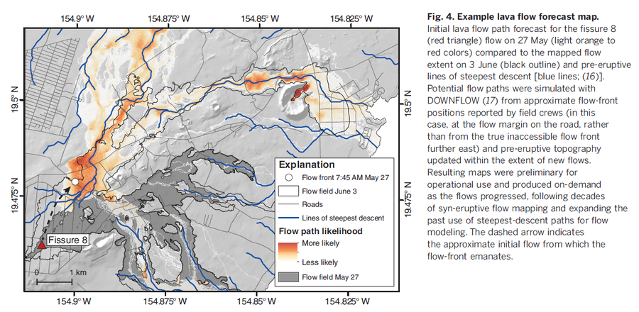
Example lava flow forecast map
Figure 4 in: Neal, C. A., Brantley, S. R., Antolik, L., Babb, J. L., Burgess, M., Calles, K., ... & Damby, D. (2019). The 2018 rift eruption and summit collapse of Kīlauea Volcano. Science, 363(6425), 367-374.

Official, Figure on website
Fancy Community Multi-Hazard Map
The University of the West Indies Seismic Research Centre (UWI-SRC) and National Emergency Management Organization (NEMO). (2021). Fancy Community Multi-Hazard Map. https://uwiseismic.com/wp-content/uploads/2021/10/Fancy-Hazard-Map-scaled.jpg
Official, Figure in hazard assessment
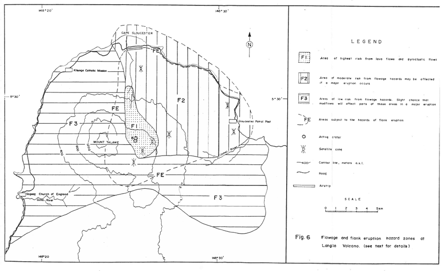
Flowage and flank eruption hazard zones at Langila Volcano
Figure 6 in: Talai, B. (1987). Volcanic hazards at Langila volcano. Geological Survey of Papua New Guinea, Report 87/25
Official, Figure in hazard assessment
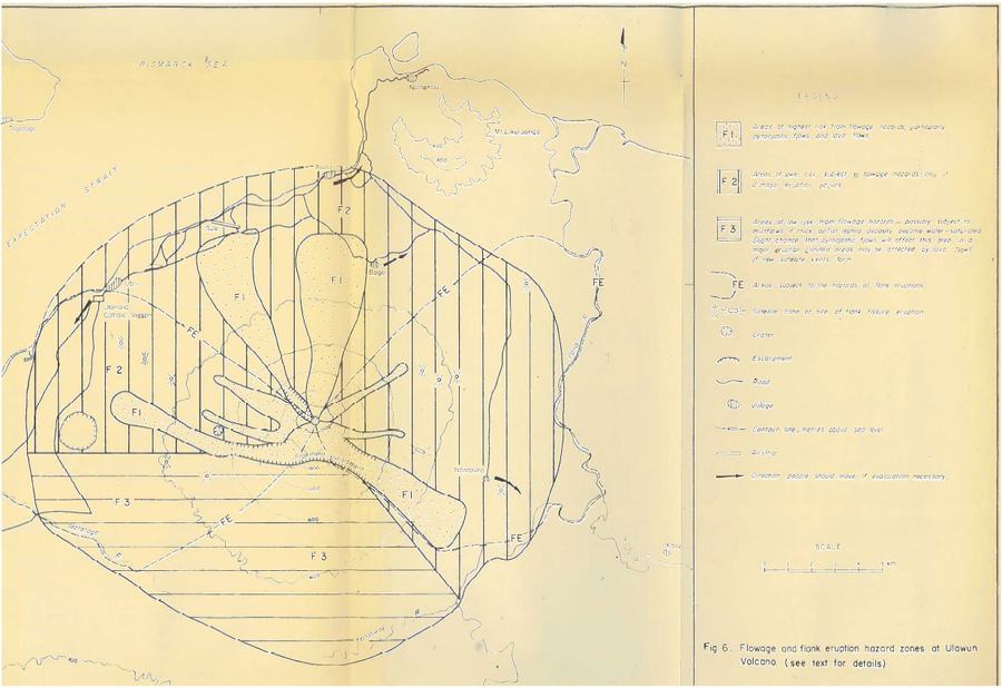
Flowage and flank eruption hazard zones at Ulawun Volcano
Figure 6 in: McKee, C.O. (1983). Volcanic hazards at Uluwan volcano. Geological Survey of Papua New Guinea, Report 83/13, 1:100,000
Official, Figure in hazard assessment
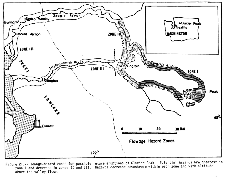
Flowage Hazard Zones
Figure 21 in: Beget, J.E. (1982). Postglacial Volcanic Deposits at Glacier Peak, Washington, and Potential Hazards from Future Eruptions. U.S. Geological Survey, Open-File Report 82-830, 81 p. https://doi.org/10.3133/ofr82830
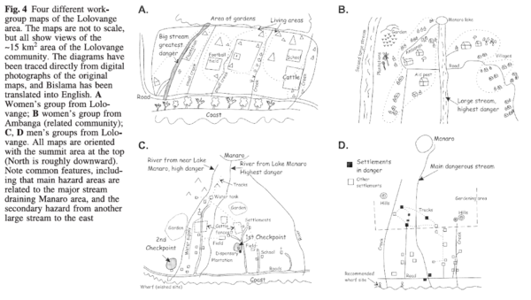
Figure in a journal article
Four different workgroup maps of the Lolovange area
Figure 4 in: Cronin, S.J., Gaylord, D.R., Charley, D., Alloway, B.V., Wallez, S., & Esau, J.W. (2004). Participatory methods of incorporating scientific with traditional knowledge for volcanic hazard management on Ambae Island, Vanuatu. Bulletin of volcanology, 66(7), p. 652-668. https://doi.org/10.1007/s00445-004-0347-9