
Advanced Search for Maps
Showing 531-540 of 726

Official, Figure in hazard assessment
Tephra-hazard zones for future tephra eruptions of Glacier Peak.
Figure 20 in: Beget, J.E. (1982). Postglacial Volcanic Deposits at Glacier Peak, Washington, and Potential Hazards from Future Eruptions. U.S. Geological Survey, Open-File Report 82-830, 81 p. https://doi.org/10.3133/ofr82830
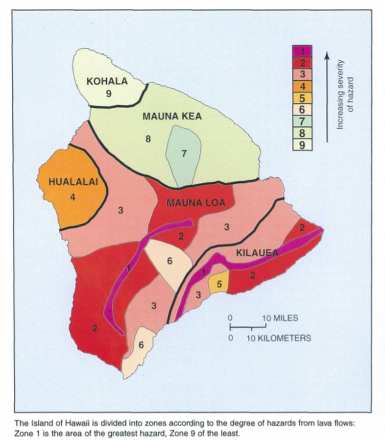
Official, Map in a booklet, long fact-sheet, or handbook
The Island of Hawaii is divided into zones according to the degree of hazards from lava flows
Page 22 in: U.S. Geological Survey (USGS). (1997). Volcanic and Seismic Hazards on the Island of Hawaii. U.S. Geological Survey, Unumbered Series, 48 p. https://doi.org/10.3133/7000036 (Simplified from: Wright 1992)
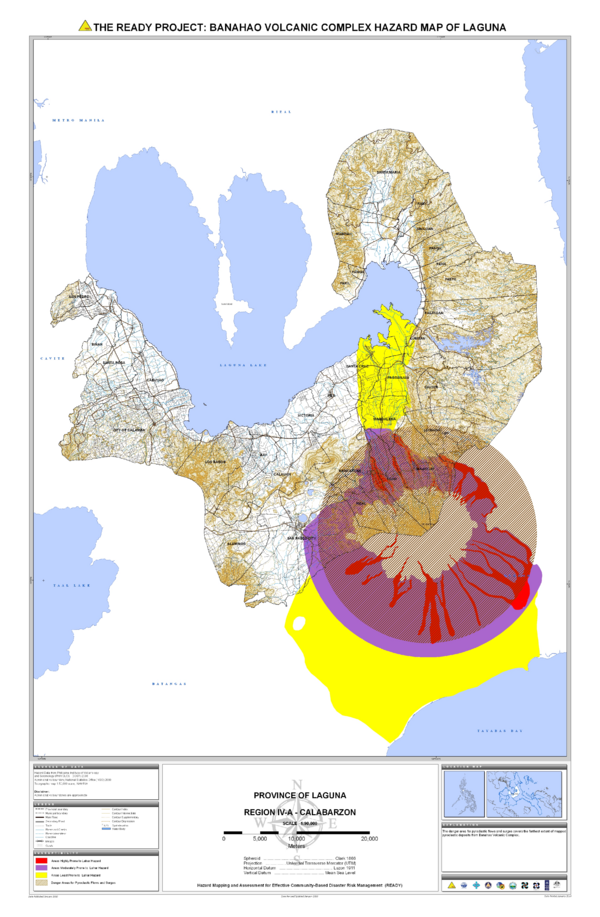
Official, Map sheet or poster
The Ready Project: Banahao Volcanic Complex Hazard Map of Laguna
Philippine Institute of Volcanology and Seismology – Department of Science and Technology (PHIVOLCS-DOST). 2010. The Ready Project: Banahao Volcanic Complex Hazard Map of Laguna. Province of Laguna, Region IV-A-Calabarzon. Hazards Mapping and Assessment for Effective Community-Based Disaster Risk Management (READY) Project

Official, Map sheet or poster
The Ready Project: Volcanic Hazard Map of Mahagnao Volcano
Philippine Institute of Volcanology and Seismology – Department of Science and Technology (PHIVOLCS-DOST). (2007). The Ready Project: Volcanic Hazard Map of Mahagnao Volcano. Province of Leyte, Region VIII-Eastern Visayas. Hazards Mapping and Assessment for Effective Community-Based Disaster Risk Management (READY) Project
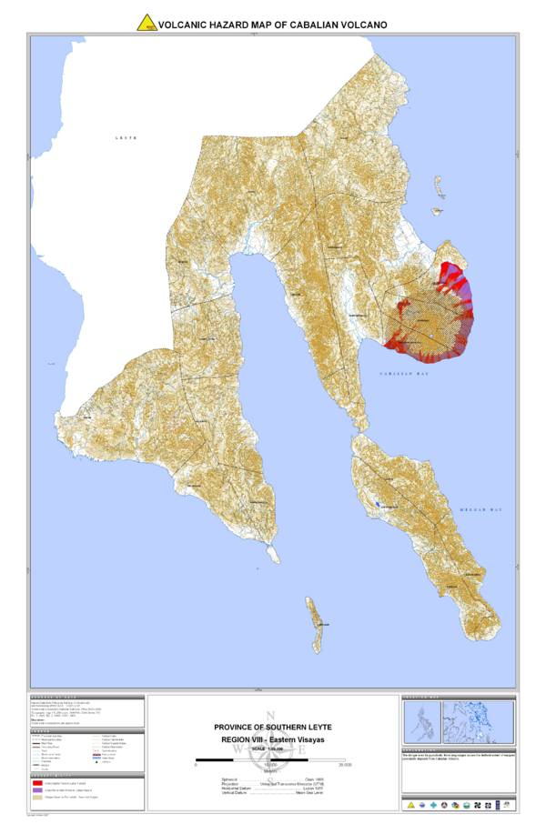
Official, Map sheet or poster
The Ready Project: Volcanic Hazard Map of Mt. Cabalian
Philippine Institute of Volcanology and Seismology – Department of Science and Technology (PHIVOLCS-DOST). (2007). The Ready Project: Volcanic Hazard Map of Cabalian Volcano. Province of Southern Leyte, Region VIII-Eastern Visayas. Hazards Mapping and Assessment for Effective Community-Based Disaster Risk Management (READY) Project
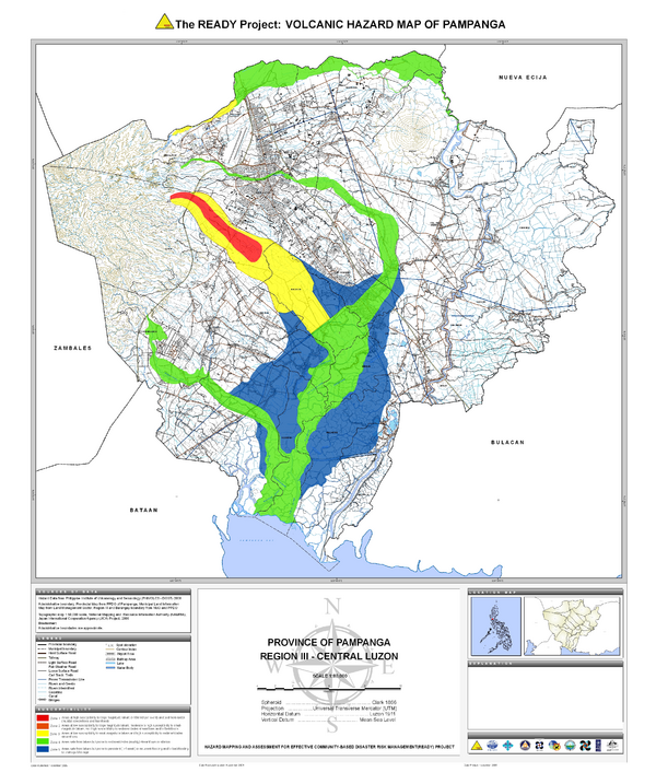
Official, Map sheet or poster
The READY Project: Volcanic Hazard Map of Pampanga
Philippine Institute of Volcanology and Seismology – Department of Science and Technology (PHIVOLCS-DOST). (2009). The Ready Project: Volcanic Hazard Map of Pampanga. Province of Pampanga, Region III-Central Luzon. Hazards Mapping and Assessment for Effective Community-Based Disaster Risk Management (READY) Project
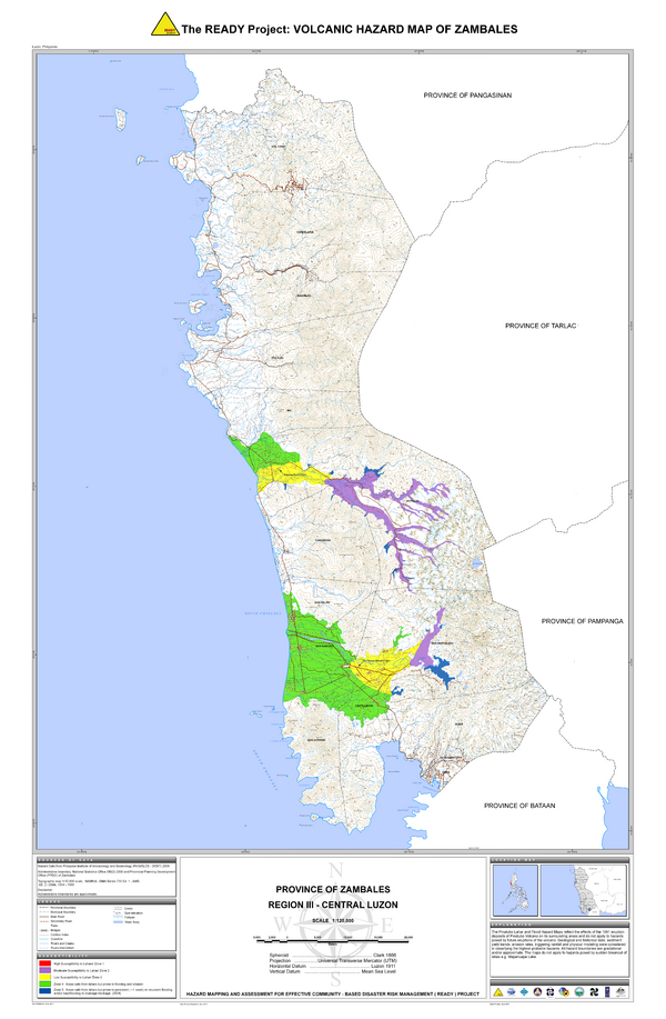
Official, Map sheet or poster
The READY Project: Volcanic Hazard Map of Zambales
Philippine Institute of Volcanology and Seismology – Department of Science and Technology (PHIVOLCS-DOST). (2011). The Ready Project: Volcanic Hazard Map of Zambales. Province of Zambales, Region III-Central Luzon. Hazards Mapping and Assessment for Effective Community-Based Disaster Risk Management (READY) Project
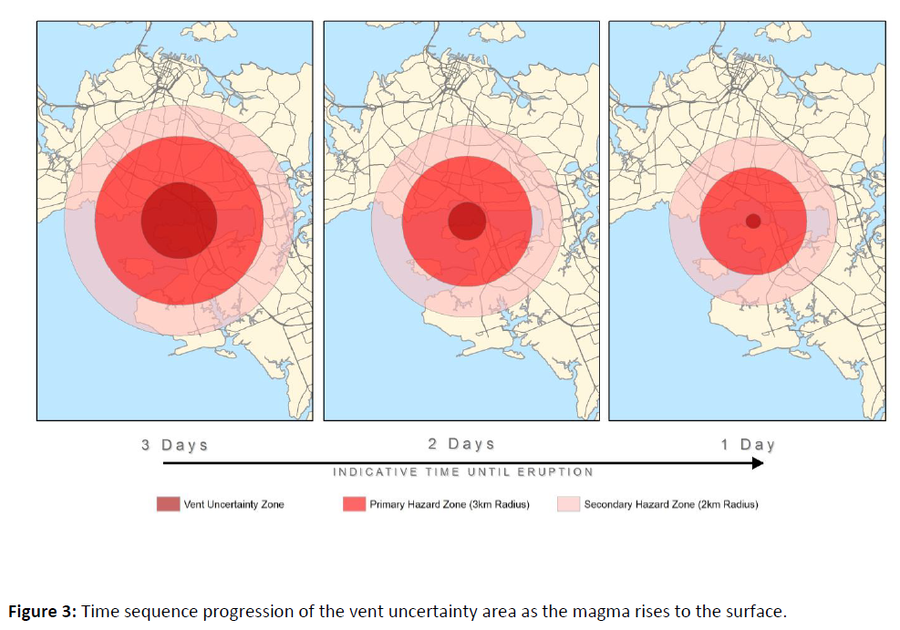
Official, Figure in hazard assessment
Time sequence progression of the vent uncertainty area as the magma rises to the surface
Figure 3 in: Auckland Council (2015). Auckland Volcanic Field Contingency Plan March 2015. Civil Defence and Emergency Management. Auckland. 50 p.
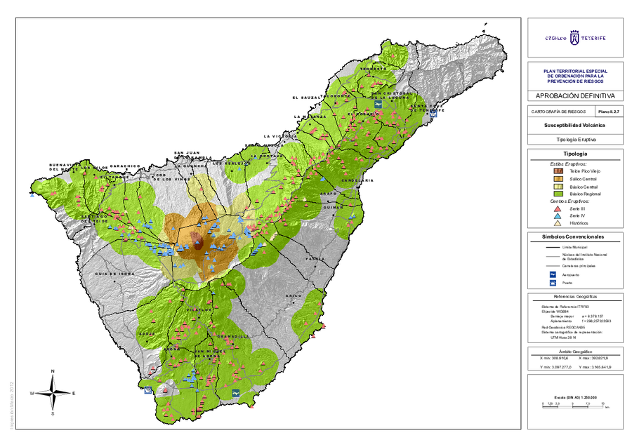
Official, Insert/poster-size map with accompanying report
Tipología Eruptiva
(Eruptive Type)
Map II.2.7 in: Cabildo Tenerife. (2012). Plan Territorial Especial de Ordenación para la Prevención de Riesgos. Documento Cartográfico (Planos de Información).
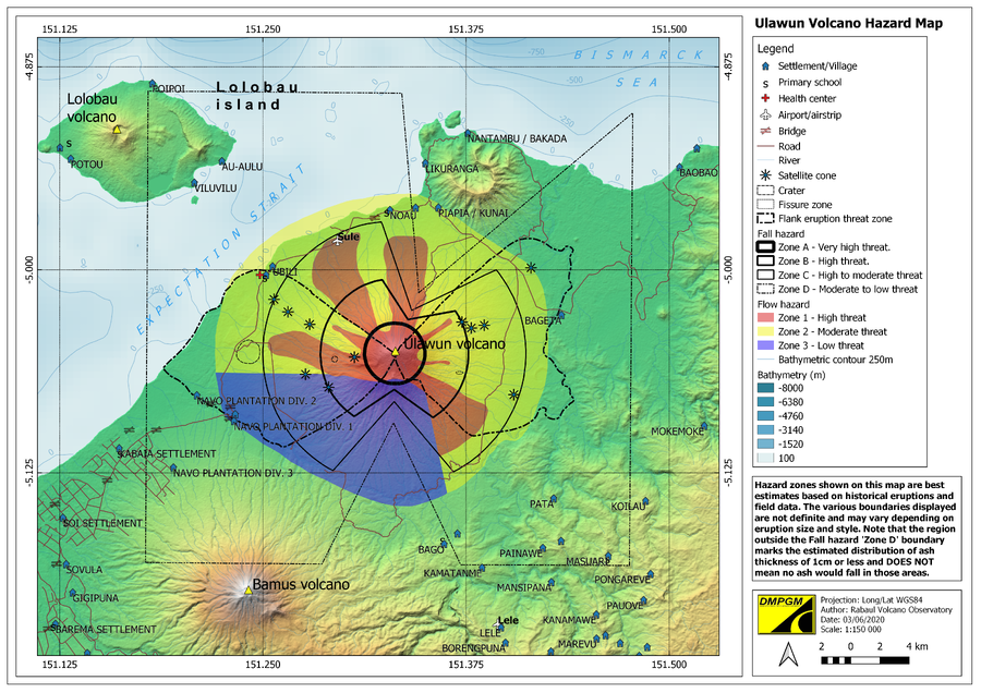
Official, Figure on website
Ulawun Volcano Hazard Map
Rabaul Volcano Observatory (RVO). (2020). Ulawun Volcanic Hazard Map. Department of Mineral Policy and Geohazards Management (DMPGM).