
Advanced Search for Maps
Showing 31-36 of 36
Official, Unknown format
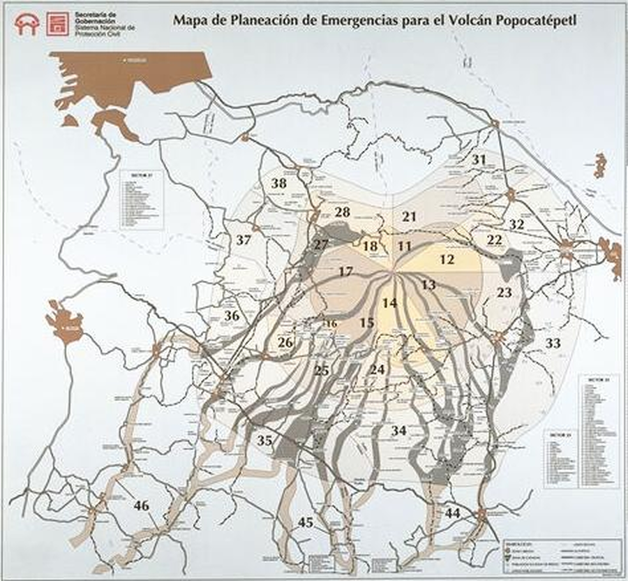
Mapa de Planeación de Emergencias para el Volcán Popocatépetl
(Emergency Planning Map for the Popocatépetl Volcano)
Sistema Nacional de Protección Civil de la Secretaría de Gobernación. (1995). Mapa de planeación de emergencias del volcán Popocatépetl.
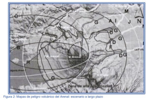
Figure in a journal article
Mapas de peligro volcánico del Arenal: escenario a largo plazo
(Arenal volcanic hazard maps: long-term scenario)
Figure 2 in: Soto, G.J. & Sjöbohm, L. (2007). Los Peligros volcánicos del Arenal. En torno a la Prevencion. Revista No. 4, Junio 2007. Comisión Nacional de Prevención de Riesgos y Atención de Emergencias (CNE).
Official, Figure in hazard assessment
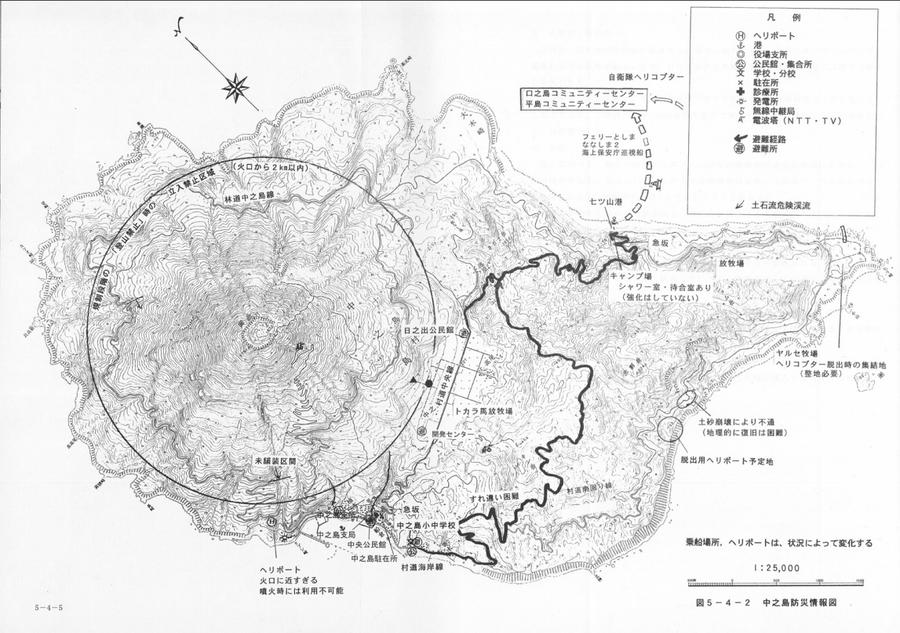
Nakanoshima disaster prevention information map
Figure 5-4-2 (pg. 5-4-5) in: Kagoshima Prefecture. (1996). Kagoshima Prefecture regional plan for disaster prevention.

Figure in a journal article
Risk zones for future ground-hugging volcanic hazards at Mt. Egmont.
Figure 11 in: Dibble, R.R., Nairn, I.A., & Neall, V.E. (1985). Volcanic hazards of North Island, New Zealand--Overview. Journal of Geodynamics, 3, p. 369-396. https://doi.org/10.1016/0264-3707(85)90043-2
Official, Figure in hazard assessment
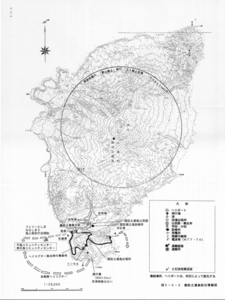
Suwanosejima disaster prevention information map
Figure 5-5-2 in: Kagoshima Prefecture. (1996). Kagoshima Prefecture regional plan for disaster prevention.
Official, Figure in hazard assessment
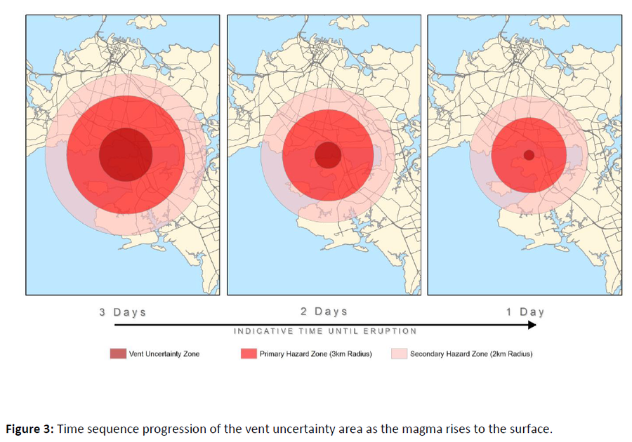
Time sequence progression of the vent uncertainty area as the magma rises to the surface
Figure 3 in: Auckland Council (2015). Auckland Volcanic Field Contingency Plan March 2015. Civil Defence and Emergency Management. Auckland. 50 p.