
Advanced Search for Maps
Showing 51-60 of 728
Official, Map in a booklet, long fact-sheet, or handbook
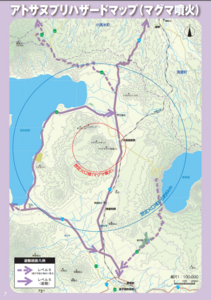
Atosanupuri Hazard map (magma eruption)
Page 7 in: Teshikaga Town Office. (2018). Teshikaga Town Disaster Prevention Guidebook.
Official, Map in a booklet, long fact-sheet, or handbook
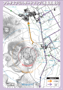
Atosanupuri Hazard Map (steam eruption)
Page 6 in: Teshikaga Town Office. (2018). Teshikaga Town Disaster Prevention Guidebook.
Official, Flyer, brochure, short fact-sheet, or handout
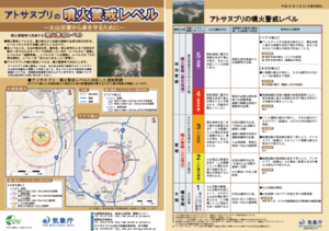
Atosanupuri Volcanic Alert Levels
Japan Meteorological Agency. (2018). Atosanupuri Volcanic Alert Levels. Volcano Monitoring and Warning Center, Volcano Division, Earthquake and Volcano Department.
Official, Flyer, brochure, short fact-sheet, or handout
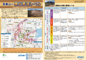
Azumayama Volcanic Alert Levels
Japan Meteorological Agency. (2019). Azumayama Volcanic Alert Levels. Volcano Monitoring and Warning Center, Volcano Division, Earthquake and Volcano Department.
Official, Flyer, brochure, short fact-sheet, or handout
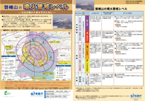
Bandaisan Volcanic Alert Levels
Japan Meteorological Agency. (2019). Bandaisan Volcanic Alert Levels. Volcano Monitoring and Warning Center, Volcano Division, Earthquake and Volcano Department.
Official, Map sheet or poster
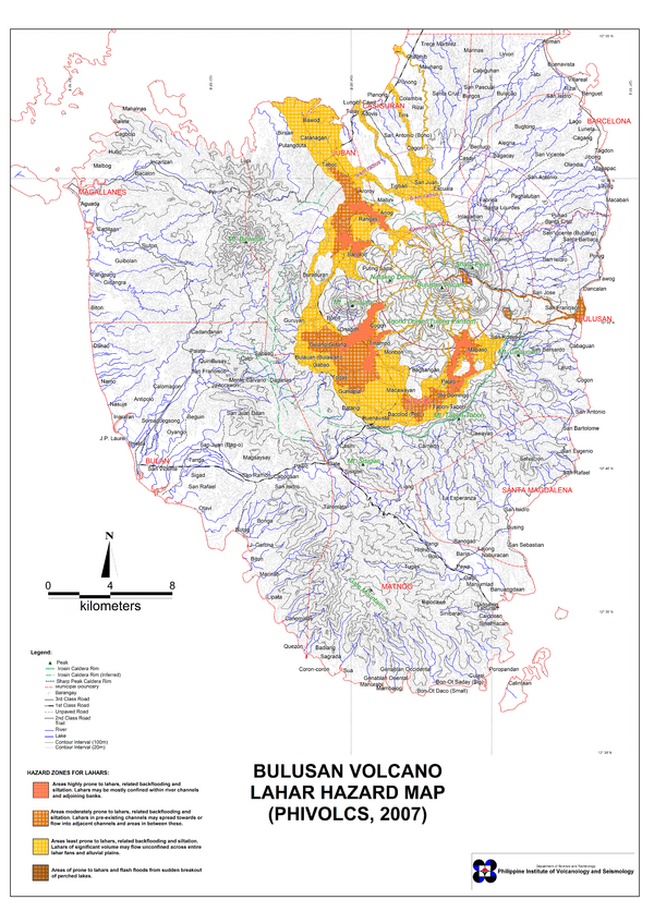
Bulusan Volcano Lahar Hazard Map
Philippine Institute of Volcanology and Seismology (PHIVOLCS). (2007). Bulusan Volcano Lahar Hazard Map.

Official, Map sheet or poster
Bulusan Volcano Lava Hazard Map
Philippine Institute of Volcanology and Seismology (PHIVOLCS). (2000). Bulusan Volcano Lava Hazard Map.

Official, Map sheet or poster
Bulusan Volcano Pyroclastic Flow Hazard Map
Philippine Institute of Volcanology and Seismology (PHIVOLCS). (2000). Bulusan Volcano Pyroclastic Flow Hazard Map.
Official, Insert/poster-size map with accompanying report
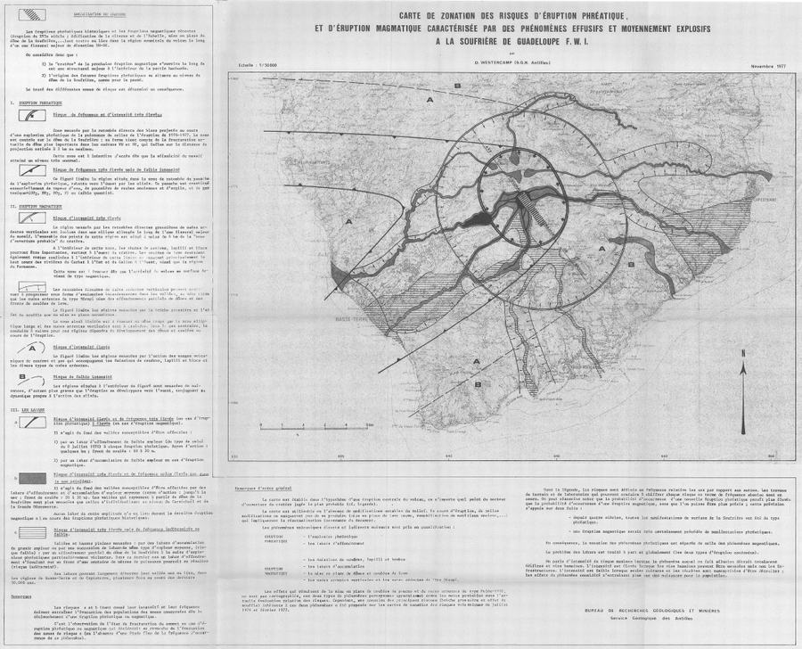
Carte de Zonation des Risques d'Éruption Phréatique, et d'Éruption Magmatique Caractérisée par des Phénomènes Effusifs et Moyennement Explosifs à la Soufrière de Guadeloupe F.W.I.
(Map of Risk of Phreatic Eruption, and Magmatic Eruption Characterized by Effusive and Moderately Explosive Phenomena at Soufrière de Guadeloupe F.W.I.)
Insert in: Westercamp, D. (1977) Levés géologiques, évaluation et zonation des risques volcaniques à la Soufrière de Guadeloupe F. W. I. (Rapport de mission) Mai-Juin 1977. Délégation Générale a la Recherche Scientifique et Technique. 77 Ant 29
Official, Map in a booklet, long fact-sheet, or handbook
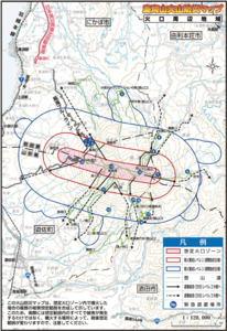
Chokaisan Hazard Map - Area around Chokaisan
Page 15 in: Volcano Disaster Management Councils of Chokaisan. (2019). Chokaisan Volcanic Disaster Prevention Map.