
Advanced Search for Maps
Showing 41-50 of 256
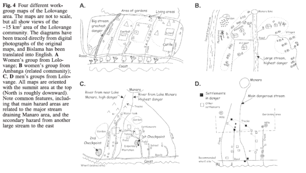
Figure in a journal article
Four different workgroup maps of the Lolovange area
Figure 4 in: Cronin, S.J., Gaylord, D.R., Charley, D., Alloway, B.V., Wallez, S., & Esau, J.W. (2004). Participatory methods of incorporating scientific with traditional knowledge for volcanic hazard management on Ambae Island, Vanuatu. Bulletin of volcanology, 66(7), p. 652-668. https://doi.org/10.1007/s00445-004-0347-9
Official, Figure in hazard assessment
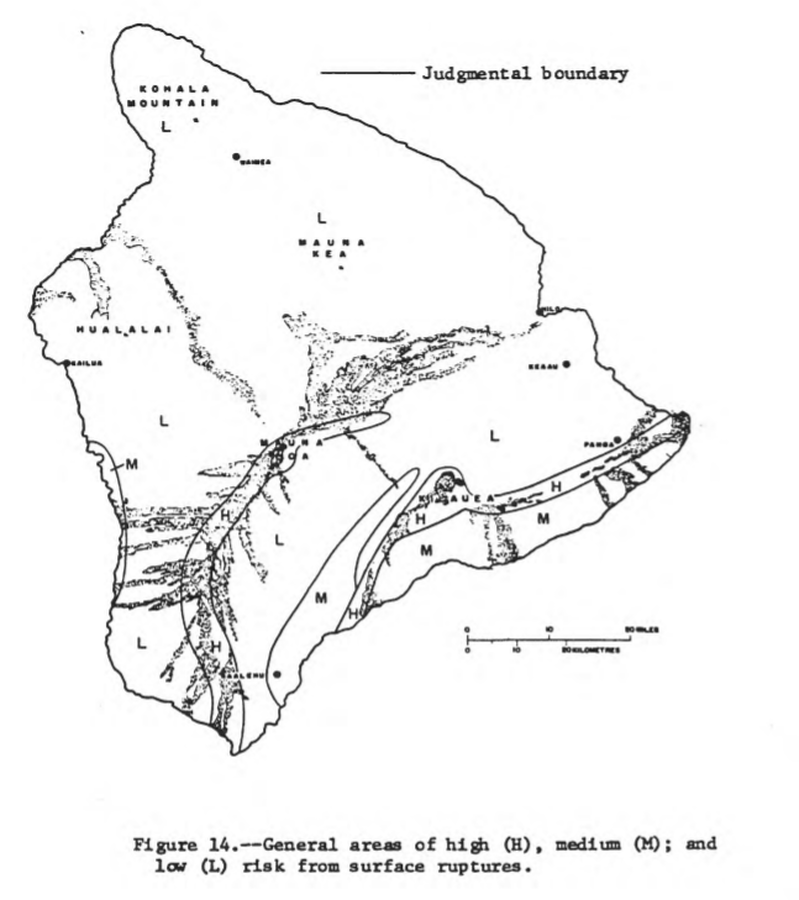
General areas of high (H), medium (M), and low (L) risk from surface ruptures
Figure 14 in: Mullineaux, D.R. & Peterson, D.W. (1974). Volcanic hazards on the Island of Hawaii. U.S. Geological Survey, Open-File Report 74-239. https://doi.org/10.3133/ofr74239
Official, Insert/poster-size map with accompanying report
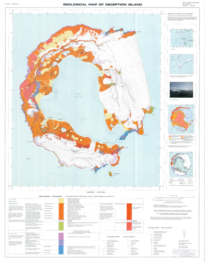
Geologic Map of Deception Island
Sheet 6-A in: Smellie, J.L., López-Martínez, J., Headland, R.K., Hernández-Cifuentes, F., Maestro, A., Millar, I.L., Rey, J., Serrano, E., Somoza, L., & Thomson, J.W. (2002). Geology and geomorphology of Deception Island. Cambridge, British Antarctic Survey, 77 p. (BAS Geomap Series, Sheets 6A and 6B).
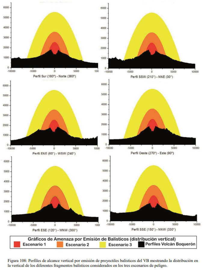
Figure in a thesis or dissertation
Gráficos de Amenaza por Emisión de Balísticos (distribución vertical)
(Ballistic Emission Threat Charts (vertical distribution))
Figure 108 in: Ferrés López, M.D. (2014). Estratigrafía, Geología y Evaluación de Peligros Volcánicos del Complejo Volcánico de San Salvador (El Salvador). Doctoral Thesis, Universidad Autónoma de México, México.
Official, Unknown format
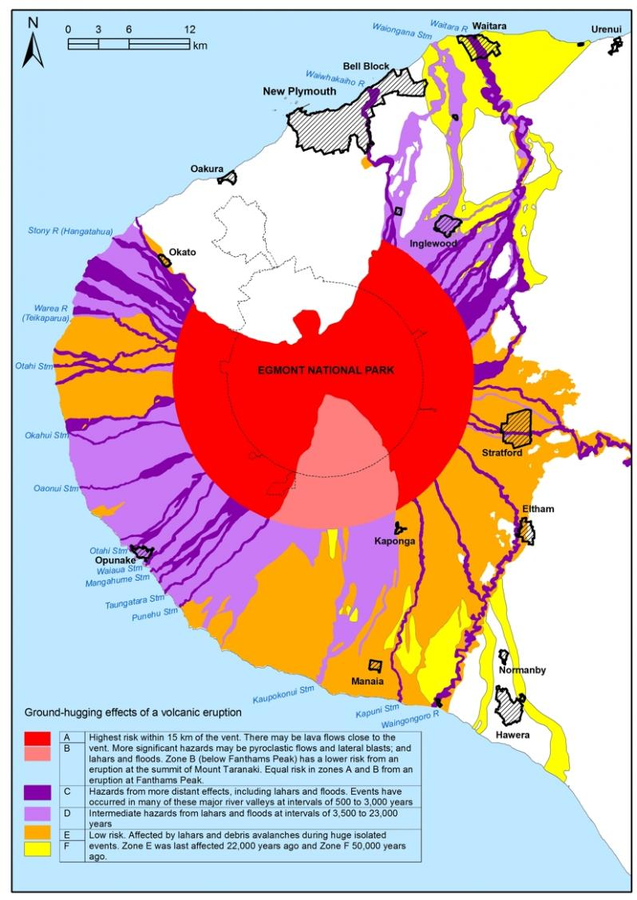
Ground hugging effects of a volcanic eruption
Taranaki Regional Council. (2004). Civil Defence Emergency Management, Group Plan for Taranaki. Stratford.

Official, Insert/poster-size map with accompanying report
Guadeloupe - Integrated Volcanic Hazard Zones for the areas most likely to be affected in the five eruptive scenarios defined for an eruption from a vent on or within 1 km the Soufrière dome and within the S-SW oriented most-recent edifice collapse depression and with the assumption of the presence of easterly trade winds between 0 and 5-8 km altitude
Pocket insert in: Komorowski, J.-C., Boudon, G., Michel-Semet, Beauducel, F., Anténor-Habazac, C., Bazin, S., & Hammouya, G. (2005). Guadeloupe. In: Lindsay, J.M., Shepherd, J.B., Robertson, R.E.A., & Ali, S. (Eds) Volcanic hazard atlas of the Lesser Antilles. Seismic Research Unit, The University of the West Indies, Trinidad and Tobago, W.I., p. 68-106.
Official, Figure on website
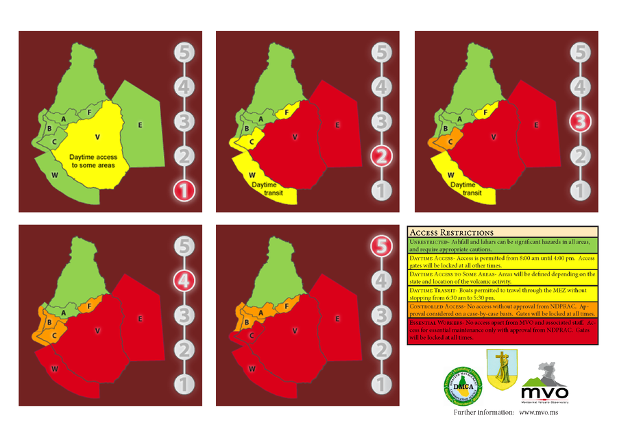
Hazard Level System
Montserrat Volcano Observatory (MVO). (Year Unknown). Hazard Level System. Soufrière Hills Volcano, Monsterrat, Hazards Level System.

Official, Figure on website
Hazard Level: 1
Montserrat Volcano Observatory (MVO). (Year Unknown). Hazard Level. Retrieved 29 March, 2022, from http://www.mvo.ms/
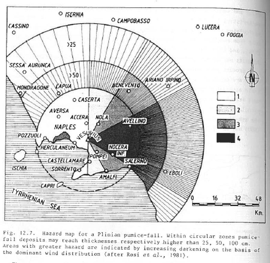
Figure in a journal article
Hazard map for a Plinian pumice-fall
Figure 12.7 in: Barberi, F., Rosi, M., Santacroce, R., & Sheridan, M.F. (1983). Volcanic hazard zonation: Mt. Vesuvius. In: Tazieff, H. & Sabroux, J.-C. (Eds.) Forecasting Volcanic Events, Elsevier, Amsterdam, p. 149-161.
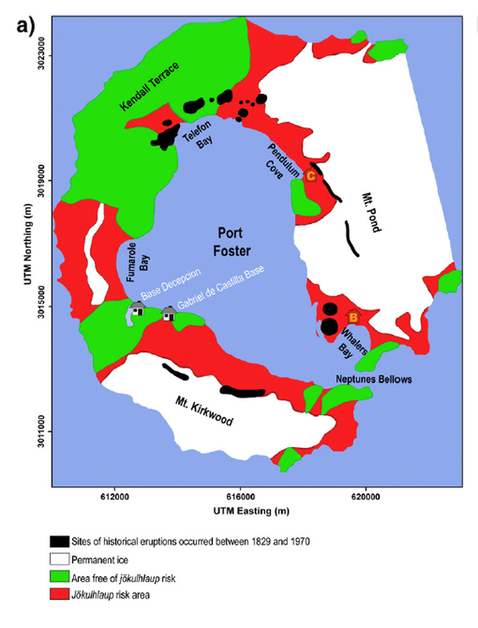
Figure in a journal article
Hazard map presented by Roobol (1982)
Figure 5 (in reprint) in: Roobol, M.J. (1982). The volcanic hazard at Deception Island, South Shetland Islands. British Antarctic Survey. 51, 237-245. (Reprinted in: Bartolini, S., Geyer, A., Martí, J., Pedrazzi, D., & Aguirre-Díaz, G. (2014). Volcanic hazard on Deception Island (South Shetland Islands, Antarctica). Journal of Volcanology and Geothermal Research, 285, p. 150-168. https://doi.org/10.1016/j.jvolgeores.2014.08.009)