
Advanced Search for Maps
Showing 41-50 of 153
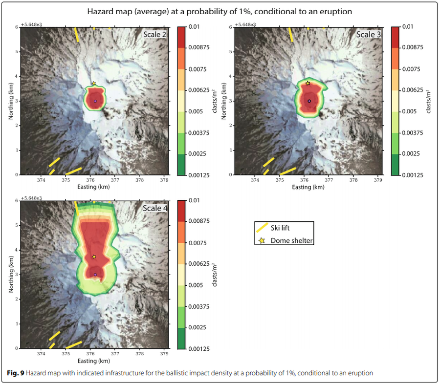
Figure in a journal article
Hazard map (average) at a probability of 1% conditional to an eruption
Figure 9 in: Strehlow, K., Sandri, L., Gottsmann, J. H., Kilgour, G., Rust, A. C., & Tonini, R. (2017). Phreatic eruptions at crater lakes: occurrence statistics and probabilistic hazard forecast. Journal of Applied Volcanology, 6(1), 4. https://doi.org/10.1186/s13617-016-0053-2
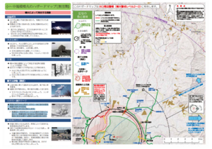
Official, Map in a booklet, long fact-sheet, or handbook
Hazard map of small to medium-scale eruptions (snowless period)
Asamayama Volcanic Disaster Prevention Committee. (2019). Asamayama Volcanic Disaster Prevention Map. Tsumagoi Village.
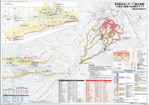
Official, Map sheet or poster
Higashikawa Town Flood Hazard (largest scale) and Daisetsu-san (Asahi-dake) Volcano Disaster Prevention Map
Higashikawa Town. (2020). Higashikawa Town Flood Hazard (largest scale) and Daisetsu-san (Asahi-dake) Volcano Disaster Prevention Map. Hokkaido Map Co., Ltd. Asahikawa Branch.
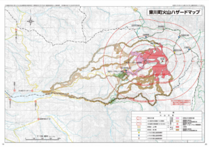
Official, Map in a booklet, long fact-sheet, or handbook
Higashikawa Town Volcano Hazard Map
Higashikawa Town Hall. (2020). Higashikawa Town Disaster Prevention Hazard Map. Hokkaido Map Co., Ltd. 30 p.
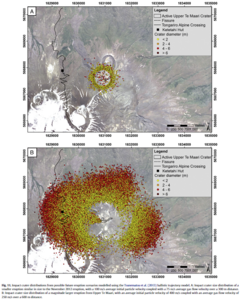
Figure in a journal article
Impact crater distributions from possible future eruption scenarios modelled using the Tsunematsu et al. (2013) ballistic trajectory model
Figure 11 in: Fitzgerald, R. H., Tsunematsu, K., Kennedy, B. M., Breard, E. C. P., Lube, G., Wilson, T. M., Jolly, A.D., Pawson, J., Rosenburg, M.D., & Cronin, S. J. (2014). The application of a calibrated 3D ballistic trajectory model to ballistic hazard assessments at Upper Te Maari, Tongariro. Journal of volcanology and geothermal research, 286, p. 248-262. https://doi.org/10.1016/j.jvolgeores.2014.04.006
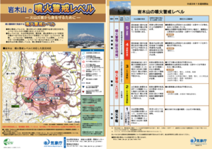
Official, Flyer, brochure, short fact-sheet, or handout
Iwakiyama Volcanic Alert Levels
Japan Meteorological Agency. (2016). Iwakiyama Volcanic Alert Levels. Volcano Monitoring and Warning Center, Volcano Division, Earthquake and Volcano Department.
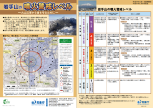
Official, Flyer, brochure, short fact-sheet, or handout
Iwatesan Volcanic Alert Levels
Japan Meteorological Agency. (2019). Iwatesan Volcanic Alert Levels. Volcano Monitoring and Warning Center, Volcano Division, Earthquake and Volcano Department.
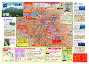
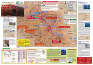
Official, Hiking or trail map
Kirishima Trekking Map
Kirishimashi. (2020). Kirishima Trekking Map. 2020.03
Official, Hiking or trail map
Kirishima Trekking Map
Kirishimashi. (2014). Kirishima Trekking Map. 2014.11
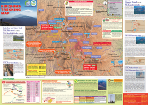
Official, Hiking or trail map
Kirishima Trekking Map
Kirishimashi. (2015). Kirishima Trekking Map.